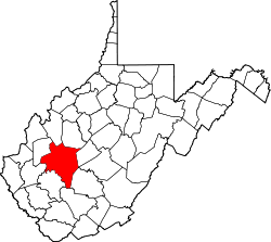
Bream, West Virginia | |
|---|---|
| Coordinates: 38°24′12″N81°31′44″W / 38.40333°N 81.52889°W | |
| Country | United States |
| State | West Virginia |
| County | Kanawha |
| Time zone | UTC-5 (Eastern (EST)) |
| • Summer (DST) | UTC-4 (EDT) |
| GNIS ID | 1553968 [1] |
Bream is an unincorporated community along Indian Creek Rd (County Route 49) in Kanawha County, West Virginia, United States. It is the first community after State Route 114 turns across the Elk River to Big Chimney. Bream is located between Milliken and Pinch, and is usually omitted from the map, because of its size.
The community was named after Bream Graham, the son of the proprietor of a local mine. [2]


