
Schuyler is a census-designated place (CDP) in Nelson County, Virginia, United States, close to Scottsville. The population as of the 2010 Census was 298.

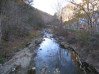
The Pin Oak Fountain was built in the U.S. state of West Virginia by the West Virginia State Road Commission and local artisans in 1932 on land given by H.R. Edeburn. The crystal quartz used in construction was quarried from behind nearby Bloomery Iron Furnace on Diamond Ridge, and the stone from the hillside behind the fountain. The fountain's spring water is gravity fed from the hill above and continues to supply area residents and travelers. The fountain is a popular site for picnics, dances, courting, and auctions. Pin Oak Fountain was restored in 1988 and is maintained by the Pin Oak Extension Homemakers Club.

Grove Park is a northwest Atlanta, inside-the-perimeter neighborhood bounded by:

Gerrardstown is an unincorporated community village located along W.Va. Route 51 in Berkeley County in West Virginia's Eastern Panhandle region in the lower Shenandoah Valley.

The Tri-Cities of Virginia is an area in the Greater Richmond Region which includes the three independent cities of Petersburg, Colonial Heights, and Hopewell and portions of the adjoining counties of Chesterfield, Dinwiddie, and Prince George in south-central Virginia. Other unincorporated communities located in the Tri-Cities area include Ettrick, Fort Lee, and City Point, the latter formerly a historic incorporated town which was annexed to become part of the City of Hopewell.
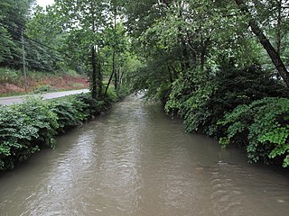
Falling Waters is a census-designated place (CDP) on the Potomac River in Berkeley County, West Virginia. It is located along Williamsport Pike north of Martinsburg. According to the 2010 census, Falling Waters has a population of 876. An 1887 Scientific American article claimed that the first U.S. railroad was built in Falling Waters in 1814.

Rennerdale is an unincorporated community and census-designated place in Collier Township, Allegheny County, Pennsylvania, United States, about 9 miles (14 km) southwest of Pittsburgh. As of the 2010 census it had a population of 1,150.
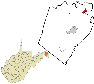
Scherr is an unincorporated community in Grant County, West Virginia, United States. The community's name is pronounced like "sheer." Scherr lies to the west of the community of Greenland at the crossroads of West Virginia Route 42, West Virginia Route 93, and U.S. Route 48. Scherr is home to a rock quarry, asphalt plant, and a small country store.
Mechanicsburg Gap is a water gap through Mill Creek Mountain in Hampshire County in the U.S. state of West Virginia.
Germany Valley is a scenic upland valley high in the Allegheny Mountains of eastern West Virginia originally settled by German farmers in the mid-18th Century. It is today a part of the Spruce Knob-Seneca Rocks National Recreation Area of the Monongahela National Forest, although much ownership of the Valley remains in private hands.

Sandstone is an unincorporated community in Summers County, West Virginia, United States. It lies along West Virginia Route 20 and the New River to the north of the city of Hinton, the county seat of Summers County. Its elevation is 1,352 feet. It has a post office, with the ZIP code of 25985.
Belva is an unincorporated community and census-designated place in west Nicholas County and north Fayette County, West Virginia, United States; while the CDP only includes the Nicholas County portion, the Fayette County portion is considered part of the community. The town is situated at the bottomland surrounding the convergence of Bells Creek with Twentymile Creek and, subsequently, Twenty Mile Creek with the Gauley River. Belva is also the location of the convergence of two state highways: West Virginia Route 16 and West Virginia Route 39.

The Greenbrier Limestone, also known locally as the "Big Lime", is an extensive limestone unit deposited during the Middle Mississippian Epoch, part of the Carboniferous Period. This rock stratum is present below ground in much of West Virginia and neighboring Kentucky, and extends somewhat into adjacent western Maryland and southwestern Virginia. The name derives from the Greenbrier River in West Virginia.

Eagle Rock is an unincorporated community in Botetourt County, Virginia, United States, located along the James River between Iron Gate and Buchanan.
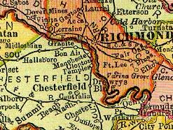
Granite was an unincorporated community in Chesterfield County, Virginia. It was originally located along the Richmond and Danville Railroad five miles west of Manchester and about a mile south of the rapids of the James River along Powhite Creek. Most of the Granite area of Chesterfield County was annexed by the independent city of Richmond on January 1, 1970.
Esmont is a census-designated place (CDP) in Albemarle County, Virginia, United States. The population as of the 2010 Census was 528.
Fort Spring is an unincorporated community and town in Greenbrier County, West Virginia, USA. It is situated along the Greenbrier River within the Greenbrier River Watershed. It was once a substantial portion of the Chesapeake and Ohio railway by way of the Gravel Girtie route from Hinton in Summers County, West Virginia to Clifton Forge in Virginia. The name comes from its main export; Mississippian limestone from Snowflake Quarry sent to Clifton Forge, Virginia The main road going through the small town was once the original rail line, but was moved.
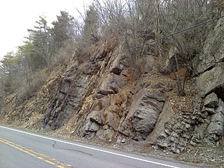
The Late Silurian to Early Devonian Keyser Formation is a mapped limestone bedrock unit in Pennsylvania, Maryland, Virginia, and West Virginia.
Cabin Creek is a tributary of the Kanawha River, 22.7 miles (36.5 km) long, in West Virginia in the United States. Via the Kanawha and Ohio rivers, it is part of the watershed of the Mississippi River, draining an area of 72.6 square miles (188 km2) in a coal mining region on the unglaciated portion of the Allegheny Plateau.
Quarry is a town in Monroe County, Ohio, United States that no longer exists. If Quarry still existed today, it would be located in today's Wayne National Forest.


