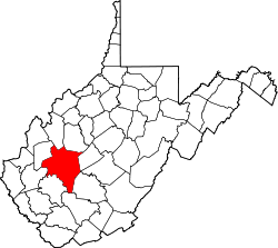
Elk Forest, West Virginia

Last updated
Elk Forest, West Virginia
USA West Virginia location map.svg
Red pog.svg
Elk Forest
Location in West Virginia and the United States
Usa edcp location map.svg
Red pog.svg
Elk Forest
Elk Forest (the United States)
Coordinates: 38°23′22″N81°35′35″W / 38.38944°N 81.59306°W / 38.38944; -81.59306 Coordinates: 38°23′22″N81°35′35″W / 38.38944°N 81.59306°W / 38.38944; -81.59306
Country United States
State West Virginia
County Kanawha
Time zone UTC-5 (Eastern (EST))
  Summer (DST) UTC-4 (EDT)

Elk Forest is a residential community out Elk Forest Road, which turns off U.S. Route 119 in Kanawha County, West Virginia, United States. Originally built in the late 1950s-early 1960s, it is a part of Mink Shoals, originally willed for development by Amanda Pitzer at her death, now buried at a small cemetery across the road from Elk Forest along Ventura Acres Road. It is directly opposite Dutch Road, which is a part of the Old German Settlement at Mink Shoals. [1]

Related Research Articles

Hiiumaa Second largest island in Estonia

Hiiumaa is the second largest island in Estonia and is part of the West Estonian archipelago, in the Baltic Sea. It has an area of 989 km2 and is 22 km from the Estonian mainland. Its largest town is Kärdla. It is located within Hiiu County.

Nez Perce National Forest

The Nez Perce National Forest is a 2,224,091-acre (9,000.58 km2) United States National Forest located in west-central Idaho. The forest is bounded on the east by the state of Montana, on the north by the Clearwater National Forest, on the west by a portion of the Wallowa–Whitman National Forest and on the south by the Payette National Forest.

Elk River (West Virginia)

The Elk River is a tributary of the Kanawha River, 172 miles (277 km) long, in central West Virginia in the United States. Via the Kanawha and Ohio rivers, it is part of the watershed of the Mississippi River.

Teton Wilderness

Teton Wilderness is located in Wyoming, United States. Created in 1964, the Teton Wilderness is located within Bridger-Teton National Forest and consists of 585,238 acres (2,370 km2). The wilderness is bordered on the north by Yellowstone National Park and to the west by Grand Teton National Park and the John D. Rockefeller Jr. Memorial Parkway. The Washakie Wilderness is to the east and the remainder of Bridger-Teton National Forest is to the south. The Teton Wilderness is a part of the 20 million acre (81,000 km2) Greater Yellowstone Ecosystem. Among many other features, Teton Wilderness is notable for having the most remote location of any place in the contiguous 48 states of the US. This location occurs very close to Bridger Lake, near the confluence of the Thorofare and Yellowstone Rivers, not far from the USFS Hawk's Rest Ranger Station.

St. Joe National Forest

The St. Joe National Forest is a U.S. National Forest located in the Idaho panhandle and is one of three forests that are aggregated into the Idaho Panhandle National Forests. In descending order of land area St. Joe National Forest is located in parts of Shoshone, Latah, Clearwater, and Benewah counties. It has a total area of 867,882 acres (3,512 km2).\

Welcome Creek Wilderness

The Welcome Creek Wilderness is located in the U.S. state of Montana. Created by an act of Congress in 1978, the wilderness is within Lolo National Forest, and protects the northern portion of the Sapphire Mountains.

U.S. Route 16A

U.S. Route 16A is a 36.971-mile-long (59.499 km) scenic United States highway. It is an alternate route for US 16. It splits from US 16 in the Black Hills of the southwestern part of the U.S. state of South Dakota. The highway's western terminus is an intersection with US 16, US 385, and South Dakota Highway 89 (SD 89) in Custer, South Dakota. The eastern terminus is at an interchange with US 16 called the Keystone Wye south of Rapid City, South Dakota. Portions of US 16A are known as the Iron Mountain Road.

Mackinaw State Forest State forest in Michigan

The Mackinaw State Forest is a 717,500-acre (2,904 km2) forested area owned by the U.S. state of Michigan and operated by the Michigan Department of Natural Resources. It is located in the northern area of the Lower Peninsula within the eight counties of Alpena, Antrim, Charlevoix, Cheboygan, Emmet, Montmorency, Otsego, and Presque Isle. The forest is served by Interstate 75, U.S. Highway 23 (US 23), and US 131.

White Clay Creek Preserve

White Clay Creek Preserve is a 1,255-acre (508 ha) Pennsylvania state park along the valley of White Clay Creek in London Britain Township in Chester County, Pennsylvania in the United States. The park was donated by the DuPont Company in 1984 for the purpose of "preserving the diverse and unique plant and animal species, and the rich cultural heritage of the area". Dupont also donated an additional 528 acres (214 ha) for the adjoining White Clay Creek State Park to the state of Delaware. White Clay Creek Preserve is 3 miles (4.8 km) north of Newark, Delaware on Pennsylvania Route 896.

Bucktail State Park Natural Area

Bucktail State Park Natural Area is a 16,433-acre (6,650 ha) Pennsylvania state park in Cameron and Clinton Counties in Pennsylvania in the United States. The park follows Pennsylvania Route 120 for 75 miles (121 km) between Emporium and Lock Haven. Bucktail State Park Natural Area park runs along Sinnemahoning Creek and the West Branch Susquehanna River and also passes through Renovo. The park is named for the Civil War Pennsylvania Bucktails Regiment and is primarily dedicated to wildlife viewing, especially elk.

Wallowa–Whitman National Forest

The Wallowa–Whitman National Forest is a United States National Forest in the U.S. states of Oregon and Idaho. Formed upon the merger of the Wallowa and Whitman national forests in 1954, it is located in the northeastern corner of the state, in Wallowa, Baker, Union, Grant, and Umatilla counties in Oregon, and includes small areas in Nez Perce and Idaho counties in Idaho. The forest is named for the Wallowa band of the Nez Perce people, who originally lived in the area, and Marcus and Narcissa Whitman, Presbyterian missionaries who settled just to the north in 1836. Forest headquarters are located in Baker City, Oregon with ranger districts in La Grande, Joseph and Baker City.

Sycamore Shoals State Historic Area

Sycamore Shoals State Historic Area is a state park located in Elizabethton, in the U.S. state of Tennessee. The park consists of 70 acres (28.3 ha) situated along the Sycamore Shoals of the Watauga River, a National Historic Landmark where a series of events critical to the establishment of the states of Tennessee and Kentucky, and the settlement of the Trans-Appalachian frontier in general, took place. Along with the historic shoals, the park includes a visitor center and museum, the reconstructed Fort Watauga, the Carter Mansion and Sabine Hill . For over a thousand years before the arrival of European explorers, Sycamore Shoals and adjacent lands had been inhabited by Native Americans. The first permanent European settlers arrived in 1770, and established the Watauga Association—one of the first written constitutional governments west of the Appalachian Mountains—in 1772. Richard Henderson and Daniel Boone negotiated the Treaty of Sycamore Shoals in 1775, which saw the sale of millions of acres of Cherokee lands in Kentucky and Tennessee and led to the building of the Wilderness Road. During the American Revolution, Sycamore Shoals was both the site of Fort Watauga, where part of a Cherokee invasion was thwarted in 1776, and the mustering ground for the Overmountain Men in 1780.

Mink Shoals, West Virginia Unincorporated community in West Virginia, United States

Mink Shoals is an unincorporated community along U.S. Route 119 in Kanawha County, West Virginia, United States and can be accessed by Interstate 79, Exit 1. It is located on the Elk River and has a public access site of the Elk River. Its rural-like feel attracts many residents, although it is only slightly over two miles from the Charleston city limits. It is located at an altitude of 571 feet (174 m). It also has an elementary school, Shoals Elementary.

Elk Hills, West Virginia Unincorporated community in West Virginia, United States

Elk Hills is an unincorporated community in central Kanawha County, West Virginia, United States. It lies on U.S. Route 119 along the Elk River, between the communities of Mink Shoals and Crede.

Elk Neck State Forest

Elk Neck State Forest belongs to the Maryland Department of Natural Resources and is managed by the Maryland Forest Service, and is adjacent to the town of North East, in Cecil County. It is often confused with Elk Neck State Park, which lies further south, near the end of the same peninsula.

Quehanna Wild Area State-owned wildlife area in Pennsylvania, US

Quehanna Wild Area is a wildlife area within parts of Cameron, Clearfield and Elk counties in the U.S. state of Pennsylvania; with a total area of 48,186 acres, it covers parts of Elk and Moshannon State Forests. Founded in the 1950s as a nuclear research center, Quehanna has a legacy of radioactive and toxic waste contamination, while also being the largest state forest wild area in Pennsylvania, with herds of elk. The wild area is bisected by the Quehanna Highway and is home to second growth forest with mixed hardwoods and evergreens. Quehanna has two state forest natural areas: the 1,215-acre (492 ha) Wykoff Run Natural Area, and the 917-acre (371 ha) Marion Brooks Natural Area. The latter has the largest stand of white birch in Pennsylvania and the eastern United States.

Morris Creek Wildlife Management Area

Morris Creek Wildlife Management Area is located near Clendenin, West Virginia in Clay and Kanawha counties. Located on 9,874 acres (3,996 ha) of steeply forested woodlands, the Morris Creek WMA can be accessed from Morris Creek Road north of Clendenin, or from Leatherwood Creek Road south of Clendenin.

Land Between the Lakes National Recreation Area Protected area in Kentucky and Tennessee, U.S.

Land Between the Lakes National Recreation Area is a United States national recreation area in Kentucky and Tennessee between Lake Barkley and Kentucky Lake. It was designated as a national recreation area in 1963 by President John F. Kennedy.

Elk Lake (Oregon)

Elk Lake is a natural body of water in the central Cascade Range in the U.S. state of Oregon. Nearly 4,900 feet (1,500 m) above sea level, the lake is part of a volcanic landscape about 25 miles (40 km) west-southwest of Bend along the Cascade Lakes Scenic Byway.

Upper Taz Nature Reserve

Upper Taz Nature Reserve is a Russian 'zapovednik' at the geographic center of the Russia Empire. It is on the upper reaches of the Taz River, on the east-central edge of the West Siberian Plain, about 700 km north of the city of Tomsk. The reserve is one of the largest in Russia, and is an important spawning ground for fish such as salmon and trout, and also protects fur-bearing animals such as the sable and ermine. It is divided into two forests - Pokolskoe and Taz, protecting the left bank of the Ratta River. The reserve is situated in the Krasnoselkupsky District of Yamalo-Nenets Autonomous Okrug.

References

  1. Coleman's Atlas and Gazeteer