East Side, West Virginia

Last updated
East Side, West Virginia
USA West Virginia location map.svg
Red pog.svg
East Side
Location in West Virginia and the United States
Usa edcp location map.svg
Red pog.svg
East Side
East Side (the United States)
Coordinates: 38°21′15″N81°38′26″W / 38.35417°N 81.64056°W / 38.35417; -81.64056 Coordinates: 38°21′15″N81°38′26″W / 38.35417°N 81.64056°W / 38.35417; -81.64056
Country United States
State West Virginia
County Kanawha
Elevation
591 ft (180 m)
Time zone UTC-5 (Eastern (EST))
  Summer (DST) UTC-4 (EDT)
GNIS ID 1554356 [1]

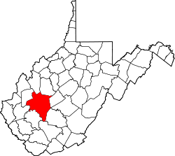
East Side is an unincorporated community in Kanawha County, West Virginia, United States.

Related Research Articles

West Virginia State of the United States of America

West Virginia is a state in the Appalachian, Mid-Atlantic and Southeastern regions of the United States. It is bordered by Pennsylvania to the northeast, Maryland to the east and northeast, Virginia to the southeast, Kentucky to the southwest, and Ohio to the northwest. West Virginia is the 41st-largest state by area and ranks 38th in population, with a population of 1,795,045 residents. The capital and largest city is Charleston.

Charleston, West Virginia Capital of West Virginia

Charleston is the capital and most populous city of the U.S. state of West Virginia. Located at the confluence of the Elk and Kanawha rivers, the city had a population of 51,400 at the 2010 census and an estimated population of 46,536 in 2019. The Charleston metropolitan area as a whole had an estimated 208,089 residents in 2019. Charleston is the center of government, commerce, and industry for Kanawha County, of which it is the county seat.

Shenandoah Valley

The Shenandoah Valley is a geographic valley and cultural region of western Virginia and the Eastern Panhandle of West Virginia in the United States. The valley is bounded to the east by the Blue Ridge Mountains, to the west by the eastern front of the Ridge-and-Valley Appalachians, to the north by the Potomac River and to the south by the James River. The cultural region covers a larger area that includes all of the valley plus the Virginia highlands to the west, and the Roanoke Valley to the south. It is physiographically located within the Ridge and Valley province and is a portion of the Great Appalachian Valley.

Great Appalachian Valley

The Great Valley, also called the Great Appalachian Valley or Great Valley Region, is one of the major landform features of eastern North America. It is a gigantic trough—a chain of valley lowlands—and the central feature of the Appalachian Mountain system. The trough stretches about 1,200 miles (1,900 km) from Quebec to Alabama and has been an important north-south route of travel since prehistoric times.

U.S. 60 is a major east–west United States highway, traveling 2,655 miles from southwestern Arizona to the Atlantic Ocean coast in Virginia. The highway's eastern terminus is in Virginia Beach, Virginia, where it is known as Pacific Avenue, in the city's Oceanfront resort district at the intersection of 5th Street and Winston-Salem Avenue. Its original western terminus was in Springfield, Missouri; it was then extended to Los Angeles, California; but in 1964 it was truncated to end southwest of Brenda, Arizona at an interchange with Interstate 10 (I-10) after the US 60 highway designation was removed from California. Some US 60 signs can be seen at this interchange about 5 mi (8.0 km) southwest of Brenda. I-10 replaced US 60 from Beaumont, California to Arizona, and California State Route 60 (SR 60) replaced US 60 from Los Angeles to Beaumont.

Ridge-and-Valley Appalachians Physiographic province of the larger Appalachian division

The Ridge-and-Valley Appalachians, also called the Ridge and Valley Province or the Valley and Ridge Appalachians, are a physiographic province of the larger Appalachian division and are also a belt within the Appalachian Mountains extending from southeastern New York through northwestern New Jersey, westward into Pennsylvania and southward into Maryland, West Virginia, Virginia, Kentucky, Tennessee, Georgia and Alabama. They form a broad arc between the Blue Ridge Mountains and the Appalachian Plateau physiographic province. They are characterized by long, even ridges, with long, continuous valleys in between.

U.S. Route 33

U.S. Route 33 (US 33) is a United States Numbered Highway that runs northwest–southeast for 709 miles (1,141 km) from northern Indiana to Richmond, Virginia, passing through Ohio and West Virginia en route. Although most odd-numbered U.S. routes are north–south, US 33 is labeled east–west throughout its route, except in Indiana where it is labeled north–south. It roughly follows a historic trail used by Native Americans from Chesapeake Bay to Lake Michigan.

U.S. Route 211 is a spur of US 11 in the U.S. state of Virginia. Known for most of its length as Lee Highway, the U.S. Highway runs 59.09 miles (95.10 km) from Interstate 81 (I-81) and Virginia State Route 211 in New Market east to US 15 Business, US 29 Business, and US 211 Business in Warrenton. US 211 connects the Shenandoah Valley with the Piedmont town of Warrenton via Luray and Sperryville, where the highway runs concurrently with US 340 and US 522, respectively.

South Branch Potomac River River in United States

The South Branch Potomac River has its headwaters in northwestern Highland County, Virginia near Hightown along the eastern edge of the Allegheny Front. After a river distance of 139 miles (224 km), the mouth of the South Branch lies east of Green Spring in Hampshire County, West Virginia where it meets the North Branch Potomac River to form the Potomac.

Fort Mill Ridge Wildlife Management Area

The Fort Mill Ridge Wildlife Management Area is located on 217 acres (0.88 km2) two miles (3 km) southwest of Romney in Hampshire County, West Virginia. Fort Mill Ridge WMA is owned by the West Virginia Division of Natural Resources. The Fort Mill Ridge Civil War Trenches are located at the top of the Fort Mill Ridge access road.

Pittsburgh and West Virginia Railway

The Pittsburgh and West Virginia Railway was a railroad in the Pittsburgh, Pennsylvania and Wheeling, West Virginia, areas. Originally built as the Wabash Pittsburgh Terminal Railway, a Pittsburgh extension of George J. Gould's Wabash Railroad, the venture entered receivership in 1908 and the line was cut loose. An extension completed in 1931 connected it to the Western Maryland Railway at Connellsville, Pennsylvania, forming part of the Alphabet Route, a coalition of independent lines between the Northeastern United States and the Midwest. It was leased by the Norfolk and Western Railway in 1964 in conjunction with the N&W acquiring several other sections of the former Alphabet Route, but was leased to the new spinoff Wheeling and Lake Erie Railway in 1990, just months before the N&W was merged into the Norfolk Southern Railway.

West Virginia Mountaineers

The West Virginia Mountaineers are the athletic teams that represent West Virginia University, an American university located in Morgantown, West Virginia. The school is a member of National Collegiate Athletic Association Division I. The Mountaineers have been a member of the Big 12 Conference since 2012. At that time, the Mountaineers joined the Mid-American Conference as an affiliate member for men's soccer. The two major sports at the university are football and basketball, although many of the other sports have large followings as well.

U.S. Route 50 is a transcontinental highway which stretches from Ocean City, Maryland to West Sacramento, California. In the U.S. state of Virginia, US 50 extends 86 miles (138 km) from the border with Washington, D.C. at a Potomac River crossing at Rosslyn in Arlington County to the West Virginia state line near Gore in Frederick County.

U.S. Route 460 in Virginia

U.S. Route 460 (US 460) in Virginia runs west-east through the southern part of the Commonwealth. The road has two separate pieces in Virginia, joined by a relatively short section in West Virginia. Most of US 460 is a four-lane divided highway and is a major artery in the southern third of the state. From Petersburg to Suffolk, US 460 is a four-lane non-divided highway. It is a popular alternative to Interstate 64 (I-64) when going from Richmond and other points in central Virginia to the Currituck Sound and Outer Banks of North Carolina, avoiding the congestion and tunnels of the more northerly I-64 corridor. The road passes through several small towns that built up at stops along the railroad line. Two of these, Windsor and Waverly, have earned reputations for being speed traps.

Virginia State Route 40 State highway in Virginia, United States

State Route 40 is a primary state highway in the southern part of the U.S. state of Virginia. It runs from SR 8 at Woolwine east to SR 10 at Spring Grove, about half the width of Virginia. It is the longest state-numbered route in Virginia.

U.S. Route 33 in Virginia

U.S. Route 33 is a part of the U.S. Highway System that runs from Elkhart, Indiana to Richmond, Virginia. In Virginia, the U.S. Highway runs 135.60 miles (218.23 km) from the West Virginia state line near Rawley Springs east to its eastern terminus at SR 33 in Richmond. US 33 is the primary east–west highway of Rockingham County, which lies in the Shenandoah Valley. The highway connects the independent city of Harrisonburg, the town of Elkton, and an entrance to Shenandoah National Park. East of the Blue Ridge Mountains, US 33 connects the Piedmont communities of Stanardsville, Gordonsville, and Louisa. The U.S. Highway is a major suburban and urban route in the Richmond metropolitan area. Within Richmond, US 33 runs concurrently with US 250. SR 33 continues from US 33's eastern terminus as a state-numbered extension of the U.S. Highway that connects Richmond with Virginia's Middle Peninsula.

Earling, West Virginia Census-designated place in West Virginia, United States

Earling is an unincorporated community and census-designated place (CDP) in Logan County, West Virginia, United States. It was first listed as a CDP prior to the 2020 census. The Earling post office closed on July 1, 1989. The town now shares ZIP Code 25632 with Lyburn and Taplin.

<i>East Side, West Side</i> (1927 film) 1927 film by Allan Dwan

East Side, West Side is a 1927 American drama film directed by Allan Dwan and starring George O'Brien, Virginia Valli, and June Collyer. The supporting cast includes J. Farrell MacDonald and Holmes Herbert. The epic film was shot extensively on various locations in New York City and includes a sinking ship loosely based upon the RMS Titanic.

A total of at least sixteen special routes of U.S. Route 460 exist and at least six have been deleted.

References