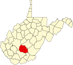
Alaska, West Virginia

Last updated

Alaska, West Virginia
USA West Virginia location map.svg
Red pog.svg
Alaska
Usa edcp location map.svg
Red pog.svg
Alaska
Coordinates: 37°54′52″N81°2′21″W / 37.91444°N 81.03917°W / 37.91444; -81.03917
Country United States
State West Virginia
County Fayette
Elevation
1,112 ft (339 m)
Time zone UTC-5 (Eastern (EST))
  Summer (DST) UTC-4 (EDT)
GNIS ID 1556047 [1]

Alaska was an unincorporated community in Fayette County, West Virginia.

The community was named after the Alaska Territory. [2]

Related Research Articles

<span class="mw-page-title-main">Alaska</span> U.S. state

Alaska is a non-contiguous U.S. state on the northwest extremity of North America. It borders British Columbia and Yukon in Canada to the east and it shares a western maritime border in the Bering Strait with Russia's Chukotka Autonomous Okrug. The Chukchi and Beaufort Seas of the Arctic Ocean lie to the north and the Pacific Ocean lies to the south. Technically a semi-exclave of the U.S., Alaska is the largest exclave in the world.

Indian or Indians may refer to something or someone of, from, or associated with the nation of India or with the indigenous people of the Americas.

<span class="mw-page-title-main">Aleutians West Census Area, Alaska</span> Census area in Alaska, United States

Aleutians West Census Area is a census area located in the U.S. state of Alaska. As of the 2020 census, the population was 5,232, down from 5,561 in 2010.

<span class="mw-page-title-main">Juneau, Alaska</span> Capital city of Alaska, United States

The City and Borough of Juneau, more commonly known simply as Juneau, is the capital city of the U.S. state of Alaska. Located in the Gastineau Channel and the Alaskan panhandle, it is a consolidated city-borough and the second-largest city in the United States by area. Juneau was named the capital of Alaska in 1906, when the government of what was then the District of Alaska was moved from Sitka as dictated by the U.S. Congress in 1900. The municipality unified on July 1, 1970; the city of Juneau merged with the city of Douglas and the surrounding Greater Juneau Borough to form the current municipality, which is larger by area than both Rhode Island and Delaware.

<span class="mw-page-title-main">Matanuska-Susitna Borough, Alaska</span> Borough in Alaska, United States

Matanuska-Susitna Borough is a borough located in the U.S. state of Alaska. Its borough seat is Palmer, and the largest community is the census-designated place of Knik-Fairview. As of the 2020 census, the borough's population was 107,801.

<span class="mw-page-title-main">Sitka, Alaska</span> Consolidated city-borough in southeastern Alaska, United States

Sitka is a unified city-borough in the southeast portion of the U.S. state of Alaska. It was under Russian rule from 1799 to 1867. The city is situated on the west side of Baranof Island and the south half of Chichagof Island in the Alexander Archipelago of the Pacific Ocean. As of the 2020 census, Sitka had a population of 8,458, the fifth-most populated city in the state.

<span class="mw-page-title-main">Counties of the United States</span> Subdivision used by most states in the United States

In the United States, a county or county equivalent is an administrative or political subdivision of a state which consists of a geographic region with specific boundaries and usually some level of governmental authority. The term "county" is used in 48 states, while Louisiana and Alaska have functionally equivalent subdivisions called parishes and boroughs, respectively. The specific governmental powers of counties vary widely between the states, with many providing some level of services to civil townships, municipalities, and unincorporated areas. Certain municipalities are in multiple counties; New York City is uniquely partitioned into five counties, referred to at the city government level as boroughs. Some municipalities have been consolidated with their county government to form consolidated city-counties, or have been legally separated from counties altogether to form independent cities. Conversely, those counties in Connecticut, Rhode Island, eight of Massachusetts's 14 counties, and Alaska's Unorganized Borough have no government power, existing only as geographic distinctions.

Norton may refer to:

<span class="mw-page-title-main">Tornado, West Virginia</span> Census-designated place in West Virginia, United States

Tornado, also called Upper Falls, is a census-designated place (CDP) in Kanawha County, West Virginia, United States.

<span class="mw-page-title-main">Historical regions of the United States</span>

The territory of the United States and its overseas possessions has evolved over time, from the colonial era to the present day. It includes formally organized territories, proposed and failed states, unrecognized breakaway states, international and interstate purchases, cessions, and land grants, and historical military departments and administrative districts. The last section lists informal regions from American vernacular geography known by popular nicknames and linked by geographical, cultural, or economic similarities, some of which are still in use today.

The West Coast Hockey League was a professional minor ice hockey league active in the western United States from 1995 to 2003. The number of teams ranged from six to nine. The teams were located in Alaska, Arizona, California, Colorado, Idaho, Nevada and Washington.

Sunrise is the instant at which the upper edge of the Sun appears above the horizon in the east.

Alexander is a male given name.

The following is a set–index article, providing a list of lists, for the cities, towns and villages within the jurisdictional United States. It is divided, alphabetically, according to the state, territory, or district name in which they are located.

<span class="mw-page-title-main">Village (United States)</span> Administrative division at the local government level in the United States

In the United States, the meaning of village varies by geographic area and legal jurisdiction. In many areas, "village" is a term, sometimes informal, for a type of administrative division at the local government level. Since the Tenth Amendment to the United States Constitution prohibits the federal government from legislating on local government, the states are free to have political subdivisions called "villages" or not to and to define the word in many ways. Typically, a village is a type of municipality, although it can also be a special district or an unincorporated area. It may or may not be recognized for governmental purposes.

<span class="mw-page-title-main">Mount Clifton, Virginia</span> CDP in Virginia, United States

Mount Clifton is a Census-designated place in Shenandoah County, in the U.S. state of Virginia. As of the 2020 decennial census the village was noted as having 110 residents with 6 being Native American or Alaska Native, 1 being Asian, 0 Black or African American individuals, 7 of Hispanic or Latino descent, 0 Native Hawaiian and Pacific Islanders, 4 of Some Other Race, 8 of Two or More Races, and 91 White. It was also noted as having 54 housing units, 3 of which are noted as being vacant.

In the United States, an independent city is a city that is not in the territory of any county or counties and is considered a primary administrative division of its state. Independent cities are classified by the United States Census Bureau as "county equivalents" and may also have similar governmental powers to a consolidated city-county. However, in the case of a consolidated city-county, a city and a county were merged into a unified jurisdiction in which the county at least nominally exists to this day, whereas an independent city was legally separated from any county or merged with a county that simultaneously ceased to exist even in name.

References

  1. U.S. Geological Survey Geographic Names Information System: Alaska, West Virginia
  2. "Towns named after states". Reading Eagle. July 2, 1897. p. 3. Retrieved October 14, 2015.