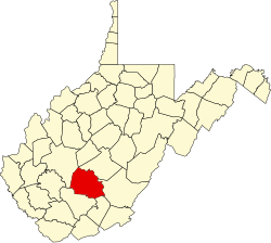
Beury, West Virginia

Last updated

Beury, West Virginia
USA West Virginia location map.svg
Red pog.svg
Beury
Usa edcp location map.svg
Red pog.svg
Beury
Coordinates: 37°57′34″N81°2′26″W / 37.95944°N 81.04056°W / 37.95944; -81.04056
Country United States
State West Virginia
County Fayette
Elevation
1,066 ft (325 m)
Time zone UTC-5 (Eastern (EST))
  Summer (DST) UTC-4 (EDT)
GNIS ID 1549592 [1]

Beury is an unincorporated community and coal town in Fayette County, West Virginia, United States.

The community has the name of J. L. Beury, the proprietor of a mine. [2]

See also

Related Research Articles

<span class="mw-page-title-main">Beurys Lake, Pennsylvania</span> CDP in Pennsylvania, United States

Beurys Lake is a census-designated place in Schuylkill County, Pennsylvania, United States. The population was 133 at the 2000 census.

<span class="mw-page-title-main">Bluefield, Virginia</span> Town in Virginia, United States

Bluefield is a town in Tazewell County, Virginia, United States, located along the Bluestone River. The population was 5,096 at the 2020 census. It is part of the Bluefield WV-VA micropolitan area which has a population of 106,363 in 2020.

The following is a set–index article, providing a list of lists, for the cities, towns and villages within the jurisdictional United States. It is divided, alphabetically, according to the state, territory, or district name in which they are located.

Beury may refer to:

<span class="mw-page-title-main">Beury Mountain Wildlife Management Area</span> State Wildlife Management Area in Fayette County, West Virginia

Beury Mountain Wildlife Management Area is located on 9,232 acres (3,736 ha) near Babcock State Park and New River Gorge National River in Fayette County, West Virginia. Beury Mountain's sloping terrain is covered with mixed hardwoods and oak-hickory second growth woodlands overlooking New River Gorge. Camping is not allowed at Beury Mountain WMA, but is available at nearby Babcock State Park.

Belva is an unincorporated community and census-designated place in west Nicholas County and north Fayette County, West Virginia, United States; while the CDP only includes the Nicholas County portion, the Fayette County portion is considered part of the community. The town is situated at the bottomland surrounding the convergence of Bells Creek with Twentymile Creek and, subsequently, Twenty Mile Creek with the Gauley River. Belva is also the location of the convergence of two state highways: West Virginia Route 16 and West Virginia Route 39.

Maybeury is a census-designated place (CDP) in McDowell County, West Virginia, United States, located on U.S. Route 52 between Northfork and Bramwell. As of the 2010 census, its population was 234.

The coal towns, or "coal camps" of Fayette County, West Virginia were situated to exploit the area's rich coal seams. Many of these towns were located in deep ravines that afforded direct access to the coal through the hillsides, allowing mined coal to be dropped or conveyed downhill to railway lines at the valley floor. Many of these encampments were set up as company towns, and when their mines closed, the towns vanished. A few, like Thurmond, West Virginia, have survived in a reduced state. Fayette County covers portions of three coalfields: the New River Coalfield, the Kanawha Coalfield and the Greenbrier Coalfield. Below is a partial list of known coal towns within the three coalfields: the New River Coalfield, the Kanawha Coalfield and the Greenbrier Coalfield. More may be found here

Ingram Branch is an unincorporated community located in Fayette County, West Virginia, United States.

Gamoca is an unincorporated community and coal town in Fayette County, West Virginia, United States.

Carbondale is an unincorporated community and coal town in Fayette County, West Virginia, United States.

Rush Run was an unincorporated community and coal town in Fayette County, West Virginia, United States.

Dimmock is an unincorporated community and coal town in Fayette County, West Virginia, United States.

Caperton is an unincorporated community and coal town in Fayette County, West Virginia, United States. It was also known as Elen.

Milburn is an unincorporated community and coal town in Fayette County, West Virginia, United States.

Dunloup or Dunloop is an unincorporated community and coal town in Fayette County, West Virginia, United States.

Boone was an unincorporated community in Fayette County, West Virginia, United States.

Glade is an unincorporated community in Fayette County, West Virginia, United States. It was also known as Paw Paw.

References

  1. U.S. Geological Survey Geographic Names Information System: Beury, West Virginia
  2. Kenny, Hamill (1945). West Virginia Place Names: Their Origin and Meaning, Including the Nomenclature of the Streams and Mountains. Piedmont, WV: The Place Name Press. p. 110.