Belva, West Virginia

Last updated

Belva
USA West Virginia location map.svg
Red pog.svg
Belva
Location within the state of West Virginia
Usa edcp location map.svg
Red pog.svg
Belva
Belva (the United States)
Coordinates: 38°13′50″N81°11′37″W / 38.23056°N 81.19361°W / 38.23056; -81.19361
Country United States
State West Virginia
Counties Nicholas and Fayette
Area
[1]
  Total0.162 sq mi (0.42 km2)
  Land0.137 sq mi (0.35 km2)
  Water0.025 sq mi (0.06 km2)
Population
 (2010) [2]
  Total95
  Density590/sq mi (230/km2)
Time zone UTC-5 (Eastern (EST))
  Summer (DST) UTC-4 (EDT)
GNIS feature ID1535619 [3]

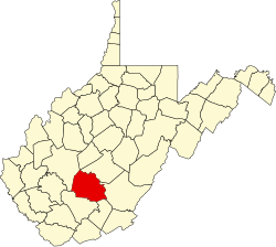
Belva is an unincorporated community and census-designated place in west Nicholas County and north Fayette County, West Virginia, United States; while the CDP only includes the Nicholas County portion, the Fayette County portion is considered part of the community. [3] [4] [5] The town is situated at the bottomland surrounding the convergence of Bells Creek with Twentymile Creek and, subsequently, Twenty Mile Creek with the Gauley River. Belva is also the location of the convergence of two state highways: West Virginia Route 16 and West Virginia Route 39.

Contents

History

The community is named in honor of Belva Ann Lockwood, a presidential candidate and early feminist. [6]

The Belva post office was established in 1885. [7]

Climate

The climate in this area is characterized by hot, humid summers and generally mild to cool winters. According to the Köppen Climate Classification system, Belva has a humid subtropical climate, abbreviated "Cfa" on climate maps. [8]

See also

Related Research Articles

<span class="mw-page-title-main">Gauley River</span> River in West Virginia, United States

The Gauley River is a 105-mile-long (169 km) river in West Virginia. It merges with the New River to form the Kanawha River, a tributary of the Ohio River. The river features numerous recreational whitewater areas, including those in Gauley River National Recreation Area downstream of the Summersville Dam.

Lockwood is an unincorporated community in western Nicholas County, West Virginia, United States. The town is situated along Otter Creek and West Virginia Route 39.

<span class="mw-page-title-main">Ivy, Virginia</span> Census-designated place in Virginia, United States

Ivy is a census-designated place (CDP) in Albemarle County, Virginia, United States. The population as of the 2010 Census was 905. It is a small unincorporated community located on U.S. Route 250, just west of Charlottesville.

Hico is a census-designated place (CDP) in Fayette County, West Virginia, United States. Hico is located at the junction of U.S. routes 19 and 60, 7 miles (11 km) northeast of Fayetteville. Hico has a post office with ZIP code 25854. As of the 2010 census, its population was 272.

Coffee Creek is an unincorporated community in Fergus County, Montana, United States. It is located along Montana Highway 81 in west central Fergus County, several miles northwest of Denton. Coffee Creek has a post office with the ZIP code 59424.

Gillman Bottom is an unincorporated community in Logan County, West Virginia, United States. Gillman Bottom is located along Huff Creek and West Virginia Route 10, 4.7 miles (7.6 km) east-southeast of Man. It is part of the Mallory census-designated place.

Claypool is an unincorporated community in Logan County, West Virginia, United States. Claypool is located along West Virginia Route 10 and Huff Creek, 3.5 miles (5.6 km) east of Man. It is part of the Mallory census-designated place.

Mineral City is an unincorporated community in Logan County, West Virginia, United States. Mineral City is located along Huff Creek and West Virginia Route 10, 3 miles (4.8 km) east of Man. It is part of the Mallory census-designated place.

Combs Addition is an unincorporated community in Logan County, West Virginia, United States. Combs Addition is located along Huff Creek and West Virginia Route 10, 4.3 miles (6.9 km) east-southeast of Man. It is part of the Mallory census-designated place.

Crystal Block is an unincorporated community in Logan County, West Virginia, United States. Crystal Block is located along Island Creek and West Virginia Route 44, 9.7 miles (15.6 km) south of Logan. It is part of the Sarah Ann census-designated place.

<span class="mw-page-title-main">Stirrat, West Virginia</span> Unincorporated community in West Virginia, United States

Stirrat is an unincorporated community in Logan County, West Virginia, United States. Stirrat is located along Island Creek and West Virginia Route 44, 8.4 miles (13.5 km) south of Logan. The southern part of the community is within the Sarah Ann census-designated place.

Micco is an unincorporated community in Logan County, West Virginia, United States. Micco is located along Island Creek and West Virginia Route 44, 4.5 miles (7.2 km) south of Logan. It is included in the Switzer census-designated place.

Whites Addition is an unincorporated community in Logan County, West Virginia, United States. Whites Addition is located along Island Creek and West Virginia Route 44, 1 mile (1.6 km) southwest of Logan. It is part of the Mount Gay-Shamrock census-designated place.

Earling is an unincorporated community and census-designated place (CDP) in Logan County, West Virginia, United States. It was first listed as a CDP prior to the 2020 census. The Earling post office closed on July 1, 1989. The town now shares ZIP Code 25632 with Lyburn and Taplin.

Beckwith is an unincorporated community in Fayette County, West Virginia, United States. Beckwith is located on West Virginia Route 16 and Laurel Creek, 4.1 miles (6.6 km) northwest of Fayetteville. Beckwith had a post office, which closed on October 3, 1998. The community has the name of P. D. Beckwith.

Harvey is an unincorporated community in Fayette County, West Virginia, United States. Harvey is located on County Route 25, 2.8 miles (4.5 km) south-southeast of Oak Hill.

Long Branch is an unincorporated community in Fayette County, West Virginia, United States. Long Branch is located near the West Virginia Turnpike, 1.1 miles (1.8 km) northwest of Pax. Long Branch had a post office, which closed on October 3, 1998.

<span class="mw-page-title-main">Delta, Alabama</span> Census-designated place in Alabama, United States

Delta is a census-designated place and unincorporated community in Clay County, Alabama, United States. Its population was 260 as of the 2020 census.

<span class="mw-page-title-main">Paint Creek (West Virginia)</span> River in West Virginia, United States

Paint Creek is a 42.1-mile (67.8 km) tributary of the Kanawha River in southern West Virginia. Paint Creek is part of the Mississippi River watershed via the Kanawha and Ohio Rivers and drains an area of 123 square miles (320 km2).

<span class="mw-page-title-main">Sumneytown, Pennsylvania</span> Unincorporated community in Pennsylvania, United States

Sumneytown is an unincorporated community that is situated on Route 63 in Marlborough Township, Montgomery County, Pennsylvania, United States.

References

  1. "US Gazetteer files: 2010, 2000, and 1990". United States Census Bureau. February 12, 2011. Retrieved April 23, 2011.
  2. "U.S. Census website". United States Census Bureau . Retrieved May 14, 2011.
  3. 1 2 "Belva". Geographic Names Information System . United States Geological Survey, United States Department of the Interior.
  4. "Belva Census Designated Place". Geographic Names Information System . United States Geological Survey, United States Department of the Interior.
  5. Fayette County, West Virginia General Highway Map (PDF) (Map). West Virginia Department of Transportation. 2011. § 1. Retrieved June 24, 2011.[ dead link ]
  6. Kenny, Hamill (1945). West Virginia Place Names: Their Origin and Meaning, Including the Nomenclature of the Streams and Mountains. Piedmont, WV: The Place Name Press. p. 105.
  7. Helbock, Richard W. (2004) United States Post Offices, Volume VI - The Mid-Atlantic, p. 33 Scappoose, Oregon: La Posta Publications
  8. Climate Summary for Belva, West Virginia