Lexington, consolidated with Fayette County and often denoted as Lexington-Fayette, is the second-largest city in Kentucky and the 60th-largest city in the United States. By land area, Lexington is the 28th largest city in the United States. Known as the "Horse Capital of the World," it is the heart of the state's Bluegrass region. It has a nonpartisan mayor-council form of government, with 12 council districts and three members elected at large, with the highest vote-getter designated vice mayor. In the 2018 U.S. Census Estimate, the city's population was 323,780 anchoring a metropolitan area of 516,697 people and a combined statistical area of 746,330 people.

Frankfort is the capital city of the Commonwealth of Kentucky and the seat of Franklin County. It is a home rule-class city in Kentucky; the population was 25,527 at the 2010 census. Located along the Kentucky River, Frankfort is the principal city of the Frankfort, Kentucky Micropolitan Statistical Area, which includes all of Franklin and Anderson counties.

Todd County is a county located in the U.S. state of Kentucky. As of the 2010 census, the population was 12,460. Its county seat is Elkton. The county is named for Colonel John Todd, who was killed at the Battle of Blue Licks in 1782 during the American Revolution.

Indian Hills is a home rule-class city along the Ohio River in Jefferson County, Kentucky, United States. The population was 2,868 as of the 2010 census. Indian Hills and the nearby cities of Mockingbird Valley, Glenview, and Anchorage have been cited as the most prosperous suburbs of Louisville since the mid-20th century. It was among the highest-income places in the United States as of the 2000 U.S. census.

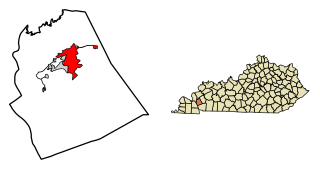
Eddyville is a home rule-class city in and the county seat of Lyon County, Kentucky, United States. The population was 2,554 at the 2010 census, up from 2,350 in 2000. The Kentucky State Penitentiary is located at Eddyville.

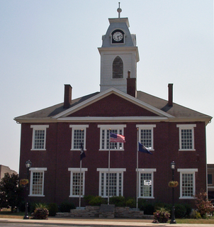
Mount Sterling – often written as Mt. Sterling – is a home rule-class city in Montgomery County, Kentucky, in the United States. The population was 6,895 at the 2010 U.S. census. It is the county seat of Montgomery County and the principal city of the Mount Sterling micropolitan area.

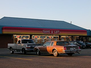
Save-A-Lot Food Stores Ltd. is an American discount supermarket chain headquartered within Greater St. Louis in the inner ring suburb of St. Ann, Missouri. The subsidiary of Onex Corporation comprises more than 1,300 stores across 36 states in the United States with over $4 billion in annual sales.

Transylvania University is a private university in Lexington, Kentucky, United States. Transylvania was founded in 1780, making it the first university in Kentucky. It offers 36 major programs, as well as dual-degree engineering programs, and is accredited by the Southern Association of Colleges and Schools. Transylvania's name, meaning "across the woods" in Latin, stems from the university's founding in the heavily forested region of western Virginia known as the Transylvania Colony, which became most of Kentucky in 1792. Transylvania is the alma mater of two U.S. vice presidents, two U.S. Supreme Court justices, 50 U.S. senators, 101 U.S. representatives, 36 U.S. governors, the one Confederate President, and 34 U.S. ambassadors, making it a large producer of U.S. statesmen. Its medical program graduated 8,000 physicians by 1859. Its enduring footprint, both in national and Southern academia, makes it among the most prolific cultural establishments and the most storied institutions in the South.

Houchens Industries is an American employee-owned company, in business since 1918 when it began as a small grocery operated by founder Ervin Houchens in rural Barren County, Kentucky. The company is headquartered in Bowling Green, Kentucky. The company runs about 425 grocery and convenience stores. Sales in 2006 were just under $2 billion, with approximately 10,500 employees.

James Turner Morehead was a United States Senator and the 12th Governor of Kentucky. He was the first native-born Kentuckian to hold the governorship of the state. A member of Henry Clay's National Republican Party, Morehead entered politics just as his party was beginning to challenge the Democratic Party's dominance in the state.
U.S. Route 31E (US 31E) is the easternmost of two parallel routes for U.S. Highway 31 from Nashville, Tennessee, to Louisville, Kentucky.

Harrods Creek is a neighborhood of Louisville, Kentucky centered near Harrods Creek at the intersection of River Road and Wolf Pen Branch Road. It is roughly bordered by the Ohio River to the west and US 42 to the east. Its ZIP code is 40027. Formerly an unincorporated community, it was designated a neighborhood of Louisville when the city merged with Jefferson County in 2003.
Lake Dreamland is a neighborhood of Louisville, Kentucky located along Campground Road and the Ohio River.

Old Fort Harrod State Park is a park located in Harrodsburg, Kentucky in the United States. The park encompasses 15 acres (6.1 ha) and features a reconstruction of Fort Harrod, the first permanent American settlement in the state of Kentucky. The fort was named after James Harrod, who led an early party of settlers into Kentucky.

The Old Bank of Louisville is a National Historic Landmark in Louisville, Kentucky. Completed in 1837, it was made of brick and limestone. Of United States small-scale commercial architecture, it is considered one of the most sophisticated. The narrow downtown lot saw classical idioms adapted to it. Its monumental distyle-in-antis doorway is particularly notable. It was originally thought to be designed by Gideon Shryock, but instead was designed by James H. Dakin. Shryock was construction superintendent for the project.

In the Bible, Lot's wife is a figure first mentioned in Genesis 19. The Book of Genesis describes how she became a pillar of salt after she looked back at Sodom. She is not named in the Bible but is called "Ado" or "Edith" in some Jewish traditions. She is also referred to in the deuterocanonical books at Wisdom 10:7 and the New Testament at Luke 17:32. Islamic accounts also talk about the wife of Prophet Lut (Lot) when mentioning 'People of Lut'.

The Cherokee Triangle is a historic neighborhood in Louisville, Kentucky, USA, known for its large homes displaying an eclectic mix of architectural styles. Its boundaries are Bardstown Road to the southwest, Cherokee Park and Eastern Parkway to the southeast, and Cave Hill Cemetery to the north, and is considered a part of a larger area of Louisville called The Highlands. It is named for nearby Cherokee Park, a 409 acres (1.7 km2) park designed by Frederick Law Olmsted, the designer of New York's Central Park.

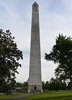
Fairview is a small census-designated place on the boundary between Christian and Todd counties in the western part of the U.S. state of Kentucky. As of the 2010 census, it had a population of 286, with 186 living in Christian County and 100 living in Todd County. It is chiefly notable as the birthplace of Jefferson Davis, later President of the Confederate States of America, and as the location of the Jefferson Davis State Historic Site.

The Cincinnati metropolitan area, informally known as Greater Cincinnati or the Greater Cincinnati Tri-State Area, is a metropolitan area that includes counties in the U.S. states of Ohio, Kentucky, and Indiana around the Ohio city of Cincinnati. The United States Census Bureau's formal name for the area is the Cincinnati–Middletown, OH–KY–IN Metropolitan Statistical Area. As of the 2010 U.S. Census, this MSA had a population of 2,114,580, making Greater Cincinnati the 29th most populous metropolitan area in the United States, the first largest metro area entirely in Ohio, followed by Cleveland (2nd) and Columbus (3rd).


