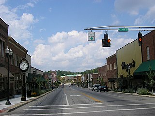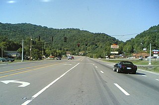
London is a home rule-class city in Laurel County, Kentucky, in the United States. It is the seat of its county. The population was 8,053 at the time of the 2020 census. It is the second-largest city named "London" in the United States and the fourth-largest in the world. It is part of the London, Kentucky micropolitan area. Of the seventeen micropolitan areas in Kentucky, London is the largest; the London micropolitan area's 2010 Census population was 126,368. London is also home to the annual World Chicken Festival that celebrates the life of Colonel Sanders and features the world's largest skillet.

Deale is a census-designated place (CDP) in Anne Arundel County, Maryland, United States. The population was 4,945 at the 2010 census. It has a scenic view of Chesapeake Bay and is popular with boaters. Sudley was listed on the National Register of Historic Places in 1973.

Prospect is a home rule-class city in Jefferson and Oldham counties in the U.S. state of Kentucky. The Jefferson County portion is a part of the Louisville Metro government. The population was 4,698 at the time 2010 census. It is one of the wealthiest communities in Kentucky.

Oneida is an unincorporated community and census-designated place (CDP) in Clay County, Kentucky, United States. Its population was 410 at the 2010 census. It is the home of Oneida Baptist Institute. Goose Creek, the Red Bird River, and Bullskin Creek confluence to form the South Fork of the Kentucky River a few hundred yards from the center of the town.
Hardyville is a small unincorporated community and census-designated place (CDP) in Hart County, Kentucky, United States, located east of Munfordville on U.S. Route 31E. As of the 2010 census it had a population of 156. In the 2020 United States Census the population was 180.
Jeff is a census-designated place and coal town in Perry County, Kentucky, United States. Its population was 323 as of the 2010 census.
West Van Lear is an unincorporated community in Johnson County, Kentucky, United States. Even though it is unincorporated, it has a post office and its own ZIP code (41268). It has a small grocery store, a volunteer fire department, and a community center.

Rineyville is an unincorporated community and census-designated place (CDP) in Hardin County, Kentucky, United States. It is located 7 miles (11 km) northwest of Elizabethtown. The Paducah and Louisville Railway runs north and south through the community.

Pathfork is an unincorporated community and census-designated place (CDP) in Harlan County, Kentucky, United States, located to the south bank of Wallins Creek. Its population was 379 as of the 2010 census. The community's main roads are East Hwy 72, which connects from US 119, and travels to an end at Old RB Mines, however, 72 runs to Harlan via gravel road, and Ky 2005 an old gravel road that leads to Smith/Brownies Creek, south of Harlan, Kentucky.

Betsy Layne is a census-designated place (CDP) and coal town in Floyd County, Kentucky, United States. It was established in 1875 along the Levisa Fork. The post office opened on May 1, 1908, with Clayton S. Hitchins as postmaster. Its ZIP code is 41605. The 2010 census reported the population to be 688. Stage actress Bette Henritze was a native of Betsy Layne.
Pryorsburg is an unincorporated community and census-designated place (CDP) in Graves County, Kentucky, United States. As of the 2010 census the population was 311.
Auxier is an unincorporated community and census-designated place (CDP) in Floyd County, Kentucky, United States. The 2010 United States Census reported that Auxier's population was 669, of which 661 persons were white and 2 persons were black.
Dwale is an unincorporated community and census-designated place in Floyd County, Kentucky, United States. The 2010 United States Census reported that Dwale's population was 329, of which 312 persons were white and 9 persons were Asian.
McDowell is an unincorporated community and census-designated place (CDP) in Floyd County, Kentucky, United States.
Diablock is a census-designated place, unincorporated community and coal town in Perry County, Kentucky, United States. Its population was 453 as of the 2010 census. The town's post office has closed.

Freeburn is a census-designated place, unincorporated community and coal town in Pike County, Kentucky, United States.

Belfry is an unincorporated community in Pike County, Kentucky. Belfry is located on U.S. Route 119, 16.8 miles (27.0 km) northeast of Pikeville. Belfry has a post office with ZIP code 41514, which opened on February 26, 1921. The origin of the name "Belfry" is obscure.
Ages is an unincorporated coal town and census-designated place (CDP) in Harlan County, Kentucky, United States.
Dunmor is an unincorporated community and census-designated place (CDP) in Muhlenberg and Logan counties, Kentucky, United States. As of the 2020 census it had a population of 322.
Garrison is an unincorporated community and census-designated place in Lewis County, Kentucky, United States. Its population was 866 as of the 2010 census. Garrison has a post office with ZIP code 41141, which opened on February 26, 1886. The community is located along the Ohio River and Kentucky Route 8.


