Yangtze or Yangzi is the longest river in Eurasia, the third-longest in the world. It rises at Jari Hill in the Tanggula Mountains of the Tibetan Plateau and flows 6,300 km (3,915 mi) in a generally easterly direction to the East China Sea. It is the fifth-largest primary river by discharge volume in the world. Its drainage basin comprises one-fifth of the land area of China, and is home to nearly one-third of the country's population.
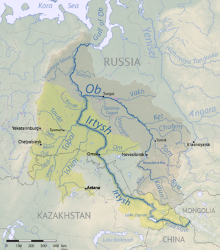
The Irtysh is a river in Russia, China, and Kazakhstan. It is the chief tributary of the Ob and is also the longest tributary river in the world.

Aksai Chin is a region administered by the People's Republic of China (PRC) partly in Hotan County, Hotan Prefecture, Xinjiang and partly in Rutog County, Ngari Prefecture, Tibet and constituting the easternmost portion of the larger Kashmir region that has been the subject of a dispute between India and the PRC as well as the Republic of China (ROC) on Taiwan since 1959. It is claimed by India as part of its Leh District, Ladakh Union Territory and by the ROC as part of the Mainland area.

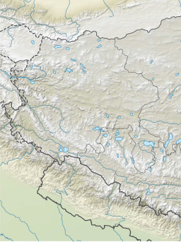
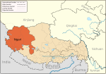
The geography of Tibet consists of the high mountains, lakes and rivers lying between Central, East and South Asia. Traditionally, Western sources have regarded Tibet as being in Central Asia, though today's maps show a trend toward considering all of modern China, including Tibet, to be part of East Asia. Tibet is often called "the roof of the world," comprising tablelands averaging over 4,950 metres above the sea with peaks at 6,000 to 7,500 m, including Mount Everest, on the border with Nepal.
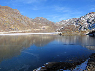
Gangtok District is an administrative district of the Indian state of Sikkim. It was renamed in 2021 as a result of administrative reorganisation of the state, which also saw three subdivisions of the East Sikkim district spawned off as a separate Pakyong district.

Huizhou is a city in central-east Guangdong Province, China, forty-three miles north of Hong Kong. Huizhou borders the provincial capital of Guangzhou to the west, Shenzhen and Dongguan to the southwest, Shaoguan to the north, Heyuan to the northeast, Shanwei to the east, and Daya Bay of the South China Sea to the south. As of the 2020 census, the city has about 6,042,852 inhabitants and is administered as a prefecture-level city. Huizhou's core metropolitan area, which is within Huicheng and Huiyang Districts, is home to around 2,090,578 inhabitants.

Lake Khanka or Lake Xingkai, is a freshwater lake on the border between Primorsky Krai, Russia and Heilongjiang province, Northeast China.
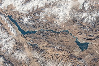
Pangong Tso or Pangong Lake is an endorheic lake spanning eastern Ladakh and West Tibet situated at an elevation of 4,225 m (13,862 ft). It is 134 km (83 mi) long and divided into five sublakes, called Pangong Tso, Tso Nyak, Rum Tso and Nyak Tso. Approximately 50% of the length of the overall lake lies within Tibet administered by China, 40% in Indian-administered Ladakh, and the remaining 10% is disputed and is a de facto buffer zone between India and China. The lake is 5 km (3.1 mi) wide at its broadest point. All together it covers almost 700 km2. During winter the lake freezes completely, despite being saline water. It has a land-locked basin separated from the Indus River basin by a small elevated ridge, but is believed to have been part of the latter in prehistoric times.

The bagua (Chinese: 八卦; pinyin: bāguà; lit. 'eight trigrams') is a set of symbols from China intended to illustrate the nature of reality as being composed of mutually opposing forces reinforcing one another. Bagua is a group of trigrams—composed of three lines, each either "broken" or "unbroken", which represent yin and yang, respectively. Each line having two possible states allows for a total of 23 = 8 trigrams, whose early enumeration and characterization in China has had an effect on the history of Chinese philosophy and cosmology.
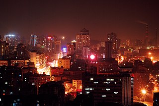
Huangshi, alternatively romanized as Hwangshih, is a prefecture-level city in southeastern Hubei province, People's Republic of China. Its population was 2,469,079 inhabitants at the 2020 census; 1,567,108 of whom lived in the built-up area made up of 4 urban districts plus the city of Daye, now being part of the agglomeration.

Xainza County, also Shantsa, Shentsa, is a county within Nagqu of the Tibet Autonomous Region of China. In 1999 the county had a population of 16,190.

Shuanghu County, also transliterated from Tibetan as Tsonyi County or Co Nyi County, is a county under the jurisdiction of the prefecture-level city of Nagqu, in the northernmost part of the Tibet Autonomous Region, China. It was formed in 2012, combining the territory of the former Shuanghu Special District with the eastern half of Nyima County. Much of the county is within the Changtang area.

Saga County is a county of the prefecture-level city of Xigazê in the Tibet Autonomous Region, China, bordering Nepal to the west and southwest.

Siling Lake, is a salt lake in the Tibet Autonomous Region, China to the north of Xainza. Doijiang is located near the lake. Administratively it belongs to Xainza County and Baingoin County of the Nagqu.
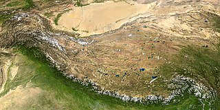
The following outline is provided as an overview of and topical guide to Tibet:
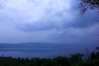
Yangzonghai Lake is located between Yiliang County, Chenggong District and Chengjiang County, 45 kilometers east of Kunming City in Yunnan Province, China. About 30,000 people rely on the Lake as their drinking water. Yangzonghai Lake is noted for its underwater springs and is one of several scenic areas in Yunnan province, which is known for its biodiversity. The lake is a popular resort destination for people living in the nearby provincial capital of Kunming, which itself borders Dianchi Lake, one of China's biggest freshwater lakes but also one of its most polluted.
The Kongka Pass or Kongka La is a low mountain pass on the Line of Actual Control between India and China in eastern Ladakh. It lies on a spur of the Karakoram range that intrudes into the Chang Chenmo Valley adjacent to the disputed Aksai Chin region. China claimed the location as its border in a 1956 map, and attacked an Indian patrol party in 1959 killing ten policemen and apprehending ten others. Known as the Kongka Pass incident, the event was a milestone in the escalation of the border dispute between the two countries.

Bangda Lake, formerly called Yeshil Kul, is a glacial lake in Ngari Prefecture in the northwest of the Tibet Autonomous Region of China. It lies south of the western Kunlun Mountains, only a few kilometres to the southeast of Guozha Lake . Located at an altitude of 4902 metres, it covers an area of 106 square kilometres with a maximum depth of 21.6 metres and has a drainage basin containing 90 glaciers.

Kotra Tso, or Guozha Lake , previously called Lake Lighten, is a glacial lake in Rutog County in the Ngari Prefecture in the northwest of the Tibet Autonomous Region of China. It lies in the western Kunlun Mountains to the northwest of Bangda Lake, not far from the regional border with Xinjiang. Located at an altitude of 5080 metres, it covers an area of 244 square kilometres with a maximum depth of 81.9 metres and has a drainage basin containing 62 glaciers.

The Khurnak Fort is a ruined fort on the northern shore of Pangong Lake, which spans eastern Ladakh in India and Rutog County in the Tibet region of China. The area of the Khurnak Fort is disputed by India and China, and has been under Chinese administration since 1958.


