Caraglio is a comune (municipality) in the Province of Cuneo in the Italian region Piedmont, located about 80 kilometres (50 mi) southwest of Turin and about 10 kilometres (6 mi) northwest of Cuneo. As of 1 January 2018, it had a population of 6,782 and an area of 41.68 square kilometres (16.09 sq mi).
Verzuolo is a comune (municipality) in the Province of Cuneo in the Italian region Piedmont, located about 66 kilometres (41 mi) southwest of Turin and about 25 kilometres (16 mi) north of Cuneo. As of 31 December 2004, it had a population of 6,379 and an area of 26.2 square kilometres (10.1 sq mi).

Galliate is a comune (municipality) in the Province of Novara in the Italian region Piedmont, located about 90 kilometres (56 mi) northeast of Turin, about 40 kilometres (25 mi) northwest Milan and about 7 kilometres (4 mi) northeast of Novara.
Beinette is a comune (municipality) in the Province of Cuneo in the Italian region Piedmont, located about 80 kilometres (50 mi) south of Turin and about 8 kilometres (5 mi) east of Cuneo. As of 31 December 2004, it had a population of 2,898 and an area of 17.4 square kilometres (6.7 sq mi).

Demonte is a comune (municipality) in the Province of Cuneo in the Italian region Piedmont, located about 90 kilometres (56 mi) southwest of Turin and about 20 kilometres (12 mi) southwest of Cuneo, in the Valle Stura di Demonte.

Piobesi d'Alba is a comune (municipality) in the Province of Cuneo in the Italian region Piedmont, located about 45 kilometres (28 mi) southeast of Turin and about 50 kilometres (31 mi) northeast of Cuneo. As of 31 December 2004, it had a population of 1,170 and an area of 4.0 square kilometres (1.5 sq mi).
Ruffia is a comune (municipality) in the Province of Cuneo in the Italian region Piedmont, located about 40 kilometres (25 mi) south of Turin and about 35 kilometres (22 mi) north of Cuneo. As of 1-1-2017, it had a population of 366 and an area of 7.51 square kilometres (2.90 sq mi).
Serravalle Langhe is a comune (municipality) in the Province of Cuneo in the Italian region Piedmont, located about 60 kilometres (37 mi) southeast of Turin and about 45 kilometres (28 mi) northeast of Cuneo. As of 31 December 2004, it had a population of 340 and an area of 9.1 square kilometres (3.5 sq mi).
Vernante is a comune (municipality) in the Province of Cuneo in the Italian region Piedmont, located about 90 kilometres (56 mi) south of Turin and about 15 kilometres (9 mi) south of Cuneo. As of 31 December 2004, it had a population of 1,307 and an area of 62.0 square kilometres (23.9 sq mi).
Melazzo is a comune (municipality) in the Province of Alessandria in the Italian region Piedmont, located about 70 kilometres (43 mi) southeast of Turin and about 35 kilometres (22 mi) southwest of Alessandria. As of 31 December 2004, it had a population of 1,241 and an area of 19.7 square kilometres (7.6 sq mi).

Rovellasca is a comune (municipality) in the Province of Como in the Italian region Lombardy, located about 25 kilometres (16 mi) northwest of Milan and about 15 kilometres (9 mi) south of Como.
Rovello Porro is a comune (municipality) in the Province of Como in the Italian region of Lombardy, located about 25 kilometres (16 mi) northwest of Milan and about 20 kilometres (12 mi) south of Como. As of 31 December 2004, it had a population of 5,797 and an area of 5.6 square kilometres (2.2 sq mi).

Aviatico is a comune (municipality) in the Province of Bergamo in the Italian region of Lombardy, located about 60 kilometres (37 mi) northeast of Milan and about 12 kilometres (7 mi) northeast of Bergamo. As of 31 December 2007, it had a population of 515 and an area of 8.4 square kilometres (3.2 sq mi).

Colzate is a comune (municipality) in the Province of Bergamo in the Italian region of Lombardy, located about 70 kilometres (43 mi) northeast of Milan and about 20 kilometres (12 mi) northeast of Bergamo. As of 31 December 2004, it had a population of 1,638 and an area of 6.7 square kilometres (2.6 sq mi).

Palosco is a comune (municipality) in the Province of Bergamo in the Italian region of Lombardy, located about 50 kilometres (31 mi) east of Milan and about 20 kilometres (12 mi) southeast of Bergamo. As of 31 December 2004, it had a population of 5,353 and an area of 10.4 square kilometres (4.0 sq mi).

Valleve is a comune (municipality) in the Province of Bergamo in the Italian region of Lombardy, located about 80 kilometres (50 mi) northeast of Milan and about 40 kilometres (25 mi) north of Bergamo. As of 31 December 2004, it had a population of 145 and an area of 14.9 square kilometres (5.8 sq mi).
Ponte dell'Olio is a comune (municipality) in the province of Piacenza, in the Italian region of Emilia-Romagna, located about 22 kilometres (14 mi) south of Piacenza, about 85 kilometres (53 mi) south of Milan and about 160 kilometres (99 mi) northwest of Bologna. As of 31 December 2004, it had a population of 4,917 and an area of 44.0 square kilometres (17.0 sq mi).
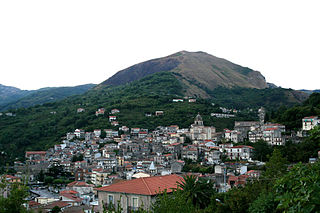
Tortorici is a comune (municipality) in the Metropolitan City of Messina in the Italian region Sicily, located about 130 kilometres (81 mi) east of Palermo and about 70 kilometres (43 mi) west of Messina.
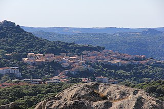
Luogosanto is a comune (municipality) in the Province of Sassari in the Italian region Sardinia, located about 200 kilometres (120 mi) north of Cagliari and about 30 kilometres (19 mi) northwest of Olbia.

Sant'Antonio di Gallura is a municipality in the Province of Sassari in the Italian region Sardinia, located about 200 kilometres (120 mi) north of Cagliari and about 20 kilometres (12 mi) northwest of Olbia. Sant'Antonio di Gallura borders the following municipalities: Arzachena, Calangianus, Luras, Olbia, Telti.


