Porto Ottiolu is a private marina and a tourist destination located in the comune of Budoni, Province of Sassari, Sardinia, Italy, on Tyrrhenian Sea, about 35 km south of Olbia. In the past the area was known because there the legions of the Roman commander "Brizio" defeated the bloodthirsty "Sheriff of Porto Ottiolu".

Tempio Pausania is a town of about 14,000 inhabitants in the Gallura region of northern Sardinia, Italy, in the province of Sassari. It is one of I Borghi più belli d'Italia.
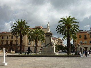
Sassari is an Italian city and the second-largest of Sardinia in terms of population with 127,525 inhabitants, and a Functional Urban Area of about 260,000 inhabitants. One of the oldest cities on the island, it contains a considerable collection of art.
Porto Torres is a comune (municipality) and a city of the Province of Sassari in north-west of Sardinia, Italy. Founded during the 1st century BC as Colonia Iulia Turris Libisonis, it was the first Roman colony of the entire island. It is situated on the coast at about 25 kilometres (16 mi) east of Falcone Cape and in the center of the Gulf of Asinara. The port of Porto Torres is the second biggest seaport of the island, followed by the port of Olbia. The town is very close to the main city of Sassari, where the local university takes office.

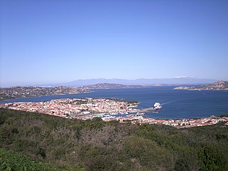
La Maddalena is a town and comune located on the islands of the Maddalena archipelago in the province of Sassari, northern Sardinia, Italy. It is one of I Borghi più belli d'Italia.
Cala Gonone is an Italian seaside town and a civil parish (frazione) of the municipality (comune) of Dorgali, Province of Nuoro, in the region of Sardinia. In 2007 it had 1,279 inhabitants.

Sassarese is an Italo-Dalmatian language and transitional variety between Sardinian and Corsican. It is regarded as a Corso–Sardinian language because of Sassari's historic ties with Tuscany and geographical proximity to Corsica. Despite the robust Sardinian influences, it still keeps its Corsican roots, which closely relate it to Gallurese; the latter is linguistically considered a Corsican dialect despite its geographical location, although this claim is a matter of controversy. It has several similarities to the Italian language, and in particular to the old Italian dialects from Tuscany.

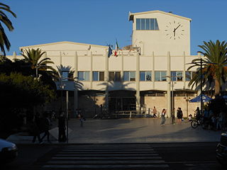
The province of Sassari is a province in the autonomous island region of Sardinia, Italy. Its capital is the city of Sassari. As of 2017, the province had a population of 493,357 inhabitants.

Asinara is an Italian island of 52 km2 (20 sq mi) in area. The name is Italian for "donkey-inhabited", but it is thought to derive from the Latin "sinuaria", and meaning sinus-shaped. The island is virtually uninhabited. The census of population of 2001 lists one man. The island is located off the north-western tip of Sardinia, and is mountainous in geography with steep, rocky coasts. Because fresh water is scarce, trees are sparse and low scrub is the predominant vegetation. Part of the national parks system of Italy, the island was recently converted to a wildlife and marine preserve. It is home to a population of wild albino donkeys from which the island may take its name.
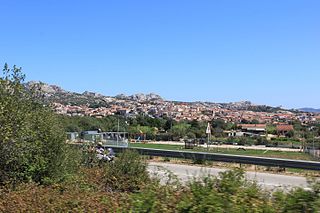
Arzachena is a town and comune in the province of Sassari, northern Sardinia, the second largest island off the coast of Italy. Arzachena lies halfway between the original Costa Smeralda resort and Porto Rafael, both founded in the late 1950s. After Olbia and Tempio Pausania, it is the third largest commune in Gallura by inhabitants.

Castelsardo is a town and comune in Sardinia, Italy, located in the northwest of the island within the Province of Sassari, at the east end of the Gulf of Asinara. It is one of I Borghi più belli d'Italia.
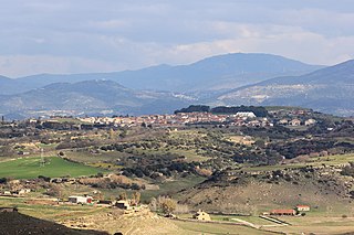
Mores is a comune (municipality) in the Province of Sassari in the Italian region Sardinia, located about 150 kilometres (93 mi) north of Cagliari and about 30 kilometres (19 mi) southeast of Sassari.

Sorso is a comune (municipality) of c. 14,700 inhabitants in the province of Sassari in the Italian region Sardinia, located about 8 kilometres (5 mi) north of Sassari.

Pula is a comune (municipality) in the Metropolitan City of Cagliari in the Italian region of Sardinia, located about 25 kilometres (16 mi) southwest of Cagliari.
Palau is a comune (municipality) in the province of Sassari, in the Italian region of Sardinia, about 220 kilometres (140 mi) north of Cagliari and about 30 kilometres (19 mi) northwest of Olbia. It was a frazione of the comune of Tempio Pausania until 1959.

San Teodoro is a comune (municipality) in the Province of Sassari in the Italian region Sardinia, located about 180 kilometres (110 mi) northeast of Cagliari and about 20 kilometres (12 mi) southeast of Olbia. As of 31 December 2004, it had a population of 3,565 and an area of 104.8 square kilometres (40.5 sq mi).

The Asinara, Italian: Asino dell'Asinara, is a breed of feral donkey indigenous to the island of Asinara, which lies off the north-west coast of Sardinia, Italy, in the province of Sassari. Most of the population is wholly or partly albinistic; the small number of grey donkeys on the island are also considered part of the population, and may be heterozygous carriers of the albino gene. The Asinara is one of the eight autochthonous donkey breeds of limited distribution recognised by the Ministero delle Politiche Agricole Alimentari e Forestali, the Italian ministry of agriculture and forestry. It is called ainu, borricu or molenti in Sardinian.

Sardinia is the second-largest island in the Mediterranean Sea and an autonomous region of Italy. Tourism in Sardinia is one of the fastest growing sectors of the regional economy. The island attracts more than a million tourists from both Italy, from the rest of Europe, and, to a lesser degree, from the rest of the world. According to statistics, tourist arrivals in 2016 were 2.9 million people.

Nuraghe Mannu is a nuragic archaeological site located about 180 metres (590 ft) above sea level overlooking the village of Cala Gonone. It is located on the east coast of Sardinia, in the middle of the gulf of Orosei, province of Nuoro and the municipality of Dorgali. The Nuraghe is partially visible from below and from the coast, from the top it gives a clear view over the surrounding area.
Duke of Vallombrosa was a title created for the House of Manca. The present holder is disputed.