Zabłocie is a village in the administrative district of Gmina Kcynia, within Nakło County, Kuyavian-Pomeranian Voivodeship, in north-central Poland. It lies approximately 7 kilometres (4 mi) north-east of Kcynia, 13 km (8 mi) south of Nakło nad Notecią, and 32 km (20 mi) west of Bydgoszcz.
Zaradowiska is a village in the administrative district of Gmina Wąbrzeźno, within Wąbrzeźno County, Kuyavian-Pomeranian Voivodeship, in north-central Poland. It lies approximately 7 kilometres (4 mi) south of Wąbrzeźno and 33 km (21 mi) north-east of Toruń.
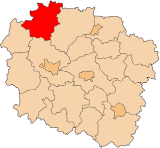
Antoniewo is a village in the administrative district of Gmina Łabiszyn, within Żnin County, Kuyavian-Pomeranian Voivodeship, in north-central Poland.
Pohulanka is a village in the administrative district of Gmina Wojsławice, within Chełm County, Lublin Voivodeship, in eastern Poland.
Sidra is a village in Sokółka County, Podlaskie Voivodeship, in north-eastern Poland. It is the seat of the gmina called Gmina Sidra. It lies approximately 18 kilometres (11 mi) north of Sokółka and 52 km (32 mi) north of the regional capital Białystok.
Wójcza is a village in the administrative district of Gmina Pacanów, within Busko County, Świętokrzyskie Voivodeship, in south-central Poland. It lies approximately 6 kilometres (4 mi) west of Pacanów, 21 km (13 mi) south-east of Busko-Zdrój, and 61 km (38 mi) south-east of the regional capital Kielce.
Cierchy is a village in the administrative district of Gmina Mniów, within Kielce County, Świętokrzyskie Voivodeship, in south-central Poland. It lies approximately 4 km (2 mi) south of Mniów and 15 km (9 mi) north-west of the regional capital Kielce.
Badowo-Mściska is a village in the administrative district of Gmina Mszczonów, within Żyrardów County, Masovian Voivodeship, in east-central Poland. It lies approximately 3 kilometres (2 mi) south-east of Mszczonów, 13 km (8 mi) south-east of Żyrardów, and 42 km (26 mi) south-west of Warsaw.
Marianka is a village in the administrative district of Gmina Mszczonów, within Żyrardów County, Masovian Voivodeship, in east-central Poland.
Kuźnica Żelichowska is a village in the administrative district of Gmina Krzyż Wielkopolski, within Czarnków-Trzcianka County, Greater Poland Voivodeship, in west-central Poland. It lies approximately 13 kilometres (8 mi) north-east of Krzyż Wielkopolski, 34 km (21 mi) west of Czarnków, and 86 km (53 mi) north-west of the regional capital Poznań.
Niedźwiady is a village in the administrative district of Gmina Jaraczewo, within Jarocin County, Greater Poland Voivodeship, in west-central Poland.
Czamża is a village in the administrative district of Gmina Sompolno, within Konin County, Greater Poland Voivodeship, in west-central Poland.
Kunowo is a settlement in the administrative district of Gmina Słupca, within Słupca County, Greater Poland Voivodeship, in west-central Poland.
Małe Osiedle is a village in the administrative district of Gmina Strzelce Krajeńskie, within Strzelce-Drezdenko County, Lubusz Voivodeship, in western Poland.
Zgojewko is a village in the administrative district of Gmina Główczyce, within Słupsk County, Pomeranian Voivodeship, in northern Poland. It lies approximately 12 kilometres (7 mi) south-west of Główczyce, 17 km (11 mi) north-east of Słupsk, and 94 km (58 mi) west of the regional capital Gdańsk.
Olszewnik is a village in the administrative district of Gmina Jeziorany, within Olsztyn County, Warmian-Masurian Voivodeship, in northern Poland. It lies approximately 4 kilometres (2 mi) east of Jeziorany and 29 km (18 mi) north-east of the regional capital Olsztyn.
Górzyca is a village in the administrative district of Gmina Gryfice, within Gryfice County, West Pomeranian Voivodeship, in north-western Poland. It lies approximately 8 kilometres (5 mi) north of Gryfice and 76 km (47 mi) north-east of the regional capital Szczecin.
Wirówek is a settlement in the administrative district of Gmina Gryfino, within Gryfino County, West Pomeranian Voivodeship, in north-western Poland, close to the German border.
Pąkowo is a settlement in the administrative district of Gmina Widuchowa, within Gryfino County, West Pomeranian Voivodeship, in north-western Poland, close to the border with Germany.
Ciemino Małe is a settlement in the administrative district of Gmina Borne Sulinowo, within Szczecinek County, West Pomeranian Voivodeship, in north-western Poland.