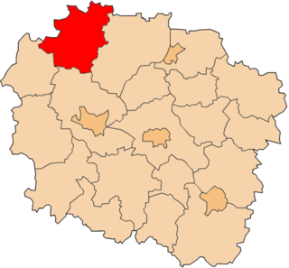
Ławy Drwęczne is a village in the administrative district of Gmina Zbiczno, within Brodnica County, Kuyavian-Pomeranian Voivodeship, in north-central Poland.

Mikaszówka is a village in the administrative district of Gmina Płaska, within Augustów County, Podlaskie Voivodeship, in north-eastern Poland, close to the border with Belarus. It lies approximately 10 kilometres (6 mi) east of Płaska, 29 km (18 mi) east of Augustów, and 88 km (55 mi) north of the regional capital Białystok.
Stary Dwór is a village in the administrative district of Gmina Narewka, within Hajnówka County, Podlaskie Voivodeship, in north-eastern Poland, close to the border with Belarus.

Konopki Leśne is a village in the administrative district of Gmina Rutki, within Zambrów County, Podlaskie Voivodeship, in north-eastern Poland. It lies approximately 24 kilometres (15 mi) north-east of Zambrów and 44 km (27 mi) west of the regional capital Białystok.

Xıdırlı is a village in the Agdam Rayon of Azerbaijan.

Rozpęd is a village in the administrative district of Gmina Kobiele Wielkie, within Radomsko County, Łódź Voivodeship, in central Poland. It lies approximately 8 kilometres (5 mi) west of Kobiele Wielkie, 8 km (5 mi) south-east of Radomsko, and 86 km (53 mi) south of the regional capital Łódź.

Sokoliki Górskie is a former village in the administrative district of Gmina Lutowiska, within Bieszczady County, Subcarpathian Voivodeship, in south-eastern Poland, close to the border with Ukraine. It lies approximately 23 kilometres (14 mi) south-east of Lutowiska, 44 km (27 mi) south-east of Ustrzyki Dolne, and 123 km (76 mi) south-east of the regional capital Rzeszów.
Mosaki-Rukle is a village in the administrative district of Gmina Krasne, within Przasnysz County, Masovian Voivodeship, in east-central Poland.
Bębnikąt is a village in the administrative district of Gmina Oborniki, within Oborniki County, Greater Poland Voivodeship, in west-central Poland.

Biała Góra is a village in the administrative district of Gmina Sztum, within Sztum County, Pomeranian Voivodeship, in northern Poland. It lies approximately 10 kilometres (6 mi) west of Sztum and 53 km (33 mi) south of the regional capital Gdańsk.

Tabory is a village in the administrative district of Gmina Stary Dzierzgoń, within Sztum County, Pomeranian Voivodeship, in northern Poland. It lies approximately 10 kilometres (6 mi) north-east of Stary Dzierzgoń, 33 km (21 mi) east of Sztum, and 79 km (49 mi) south-east of the regional capital Gdańsk.

Upałty Małe is a village in the administrative district of Gmina Giżycko, within Giżycko County, Warmian-Masurian Voivodeship, in northern Poland. It lies approximately 10 kilometres (6 mi) east of Giżycko and 95 km (59 mi) east of the regional capital Olsztyn.

Jora Mała is a village in the administrative district of Gmina Mikołajki, within Mrągowo County, Warmian-Masurian Voivodeship, in northern Poland. It lies approximately 8 kilometres (5 mi) north-west of Mikołajki, 15 km (9 mi) east of Mrągowo, and 68 km (42 mi) east of the regional capital Olsztyn.

Zajączki is a village in the administrative district of Gmina Ostróda, within Ostróda County, Warmian-Masurian Voivodeship, in northern Poland. It lies approximately 17 kilometres (11 mi) south of Ostróda and 48 km (30 mi) south-west of the regional capital Olsztyn.

Ganiec is a village in the administrative district of Gmina Kamień Pomorski, within Kamień County, West Pomeranian Voivodeship, in north-western Poland. It lies approximately 11 kilometres (7 mi) south-east of Kamień Pomorski and 56 km (35 mi) north of the regional capital Szczecin.
Mount Vernon is a hamlet in the town of Hamburg in Erie County, New York, United States. It is located within the Wanakah census-designated place and is part of the Frontier Central School District. The Hamlet is separate from the city of Mount Vernon, a city in Westchester County.
Nadorah is a town and commune in Tiaret Province, Algeria. According to the 1998 census it has a population of 7,030.
Waalhaven is a neighborhood of Rotterdam, Netherlands.
Ab Sila is a village in Darreh Kayad Rural District, Sardasht District, Dezful County, Khuzestan Province, Iran. At the 2006 census, its population was 50, in 9 families.
Decatur Rock is a small barren island located in Buzzards Bay in New Bedford, Massachusetts.


