Ma'an

Last updated • 10 min readFrom Wikipedia, The Free Encyclopedia
Ma'an
مدينة معان
City
Petra-Locomotive.jpg
A pre-1920 photograph of the train station in Ma'an. The Hejaz Railway is still operational today.
Nickname: 
Capital of the Great Arab Revolt
Reliefkarte Jordanien.png
Red pog.svg
Ma'an
Location in Jordan
Coordinates: 30°11.6′N35°44′E / 30.1933°N 35.733°E / 30.1933; 35.733
CountryFlag of Jordan.svg  Jordan
Governorate Ma'an Governorate
Municipality established1898
Government
  TypeMunicipality
   Mayor Akram Kreishan
Area
  City
7.5 km2 (2.9 sq mi)
  Metro
100 km2 (40 sq mi)
Population
 (2015) [1]
  City
41,055
Time zone GMT +2
  Summer (DST)+3
Area code +(962)3
Website http://www.maan.gov.jo

Ma'an (Arabic : مَعان, romanized: Maʿān) is a city in southern Jordan, 218 kilometres (135 mi) southwest of the capital Amman. It serves as the capital of the Ma'an Governorate. Its population was approximately 41,055 in 2015. Civilizations with the name of Ma'an have existed at least since the Nabatean period—the modern city is just northwest of the ancient town. The city is an important transport hub situated on the ancient King's Highway and also on the modern Desert Highway.

Contents

History

Ma'an was founded by the Minaeans (known as "Ma'in" in Arabic), an ancient Arab people based in Yemen, between the 2nd and 4th century BCE. [2] The site was located on a major trade route and was settled by Minaean traders and merchants. [3] Local tradition has it that the city was named after "Ma'an", the son of Lot. [4]

During the Byzantine era in Syria, Ma'an was part of the territory of the Arab Christian tribe of Banu Judham who served as vassals for the Byzantines in Transjordan. [4] In the early 7th century, the Christian governor of Ma'an, Farwa ibn Amr al-Judhami, converted to Islam and sent Muhammad a wide array of presents including a white mule and gold. When the Byzantine authorities learned of his conversion he was ordered to repent his new religion, but refused. [5] Consequently, the Byzantine emperor ordered his imprisonment and subsequent execution by crucifixion. [4] In retaliation the Muslim state in Medina, sent an army led by Usama ibn Zayd to conquer Ma'an.[ citation needed ]

Islamic era

When the Umayyads took control of the Caliphate, Ma'an entered a period of relative prosperity. In 951 the Persian geographer Istakhri described it as "a small town on the border of the desert." He claimed that most of its inhabitants belonged the Umayyad family or their clients even though by that time the Umayyads had been overthrown by the Abbasid Caliphate. Istakhri further noted that Ma'an served as a fortress in the Sharat district (today southern Jordan) and "travelers were well received." [6] A market was organized in the city where pilgrims could store their unessential possessions. [2]

When Syrian geographer Yaqut al-Hamawi visited in the early 13th century, during Ayyubid rule, Ma'an was a mostly ruined town in the Balqa district of Bilad al-Sham (Islamic province of Syria.) The Hajj pilgrimage route to Mecca still passed through the town which also contained a resting station. [7] By the end of the 13th-century Syria's new rulers, the Bahri Mamluks, designated Ma'an and its surroundings as one of four districts of the al-Karak province. [8] According to al-Dimashqi, during that time period, it grew to become a "small city", with a khan ("caravanserai") that included a "market for provisions" and a hostel. Muslim traveler Ibn Batutah noted Ma'an was "the last place in Syria" before reaching Aqaba as-Sawan in the Hejaz. [7]

Ottoman rule

Map of Ottoman Syria, showing Sanjak of Ma'an Ottoman levant.png
Map of Ottoman Syria, showing Sanjak of Ma'an

Because of its geographic isolation from the rest of Syria and a low frequency of travelers (with the exception of Mecca-bound pilgrims), the history of Ma'an was the least well-documented of the Transjordanian districts of Ottoman Syria—at least until direct rule was attempted in the late 19th century. [9] The Ottomans annexed Transjordan in 1517 and in 1559, during the tenure of Suleiman the Magnificent, the Ottomans built a fort in Ma'an to safeguard the pilgrimage route (see Qal'at al-Ma'an at "External links"). [10] The governor of Damascus put down a revolt by Ma'an and other cities in south Damascus Eyalet in 1656, although Ottoman troops were later routed as a result of a revolt by the Banu Tamim tribe. Since then, the Ottomans had struggled to maintain full control of the area. [11]

Ma'an was divided into two distinct quarters since the Umayyad period: [2] Ma'an al-Shamiyya and Ma'an al-Hijaziyya. The latter served as the main town, while the former was a small neighborhood inhabited by Syrians from the north. [9] The city continued to be a major town on the Hajj pilgrimage route and its economy was entirely dependent on it. [12] Its principal trade partner was the coastal city of Gaza in southern Palestine, from where supplies were brought to Ma'an for resale to pilgrims. [13] Provisions were also imported from Hebron. In addition to provisions, Ma'an's outward caravan was dominated by the sale of livestock, particularly camels for transport and sheep for ritual sacrifice. The incoming caravan was a buyer's market for goods coming from across the Muslim world. Ma'an's culture was highly influenced by its role on the Hajj route and unlike many other desert towns, most of its residents were literate and many served as imams or religious advisers for the Bedouin tribes in the area. Swiss traveler Johann Ludwig Burckhardt noted that the people of Ma'an "considered their town an advanced post to the sacred city of Medina." [12] The townspeople's relationship with Bedouin was also unique. While most Transjordanian towns had uneasy relationships with the nomadic tribes to whom they paid regular tribute (khuwwa), Ma'an's residents and the Bedouin enjoyed positive relations. Finnish explorer Georg August Wallin wrote the level of economic interdependence between the two groups was unlike anywhere else in Syria's desert regions. As a testament to their relationship of mutual trust, Ma'an's inhabitants were able to bargain down or withhold payment of the khuwwa during tough economic years. The major tribes around the city were the 'Anizzah and the Huwaytat. [13]

During the late 19th century, there were numerous attempts by the Ottoman authorities to elevate Ma'an's political status at over al-Karak, although most attempts failed or were short-lived. In 1868 the Ottoman governor of Syria, Rashid Pasha, succeeded in designating Ma'an as its own kaza (subdistrict) of the al-Balqa sanjak (district), part of Damascus Vilayet. Four years later, Governor Abdulletif Subhi Pasha proposed that Ma'an become a sanjak that would include al-Karak, as-Salt and al-Jawf. This proposal was popular with much of the Ottoman government in Istanbul, but was ultimately rejected after strong opposition from Midhat Pasha, a leading Tanzimat reformer, who argued the administrative expenses of having Ma'an as district capital would not be feasible. [14]

Following the British occupation of Egypt, Ottoman politicians began serious initiatives to form a new vilayet out of Damascus Vilayet that would combine the districts of Ma'an, al-Balqa and Jerusalem to serve as a buffer against a potential British invasion of Syria. This effort failed, although a new proposal in 1886 would see Ma'an serve as the capital of a district including the kazas of al-Karak and Tafilah and the nahiyas (subdistricts smaller than kazas) of Amman, Bani Hamida and Wadi Musa. [14] Governor Osman Nuri Pasha's goal in this respect was to establish a government center in southern Transjordan to "avoid the alienation of the people." [15] Sultan Abdulhamid II approved the plan in 1892. However, the establishment of the new sanjak was delayed and eventually scrapped after the leading sheikh of al-Karak offered the Ottoman authorities his full services. [14] Al-Karak was deemed more suitable as district capital due to its larger population, proximity to Palestine and the established relationships between the Majali notables of the city and the authorities in Damascus and Istanbul. [16]

Between 1897 and 1899, two primary schools for boys and a secondary school were founded by the Ottomans in Ma'an. [17] In 1902 the Ma'an train station connected the city to Damascus and Medina.

Modern era

Following the Battle of Aqaba during the Arab Revolt, the Turkish army fortified Maan with 6000 infantry, a regiment of cavalry and mounted infantry, and an aerodrome, all under the command of Behjet Pasha. This important Ottoman military base and communications hub was under 5-day siege by the Arab Northern Army during the Battle of Maan, 13–17 April 1918. Though failing to capture the city, the Hejaz railway southwards was wrecked. [18] [19]

In 1920, The Hashemite emir Abdullah I arrived in Ma'an in with several hundred fighters mostly from the 'Utaybah tribe [20] in an attempt to restore the Sharifian throne in Damascus following its overthrow by France. [21] He addressed the French colonization of Syria by stating to Ma'an's residents "The colonialist has come to you to rob you of the three graces: faith, freedom and masculinity." [22] Following the British capture of the area during World War I, the British Mandate of Palestine was established in 1922 and included Transjordan which was semi-autonomous from British administration in Palestine. Ma'an was annexed to the Transjordanian state in 1925. [23] The British Army had an armored car regiment based in the city. [24]

A railway building at Ma'an station was used by Abdullah I as the site of the first government of the Kingdom of Jordan. It is now called the Ma'an Palace and is depicted on the reverse of the 5 Jordanian dinar note. [25]

The 1989 Jordanian protests started in Ma'an, in protest against government cuts to food subsidies. The protests left eight dead and dozens injured, and spurred King Hussein to dismiss his prime minister, Zaid Al-Rifai. [26]

In 1998 a large demonstration in Ma'an protesting the threat of an American attack against Iraq turned into a miniature uprising. The flags of Saudi Arabia were flown by some protesters. Jordanian Special Forces and police attempted to quell the protests, resulting in the death of a demonstrator and the injury of 25 people, including police officers. King Hussein had the Jordanian Army deployed and Ma'an was placed under curfew and had its phone lines cut. Hussein arrived in the city afterward to meet with army units and local tribal leaders in order to placate the city. He stated the "riots" were an insult to the country, that foreign "infiltrators" provoked the protests and stressed Ma'an's importance in Jordanian history, referring to the city as "Ma'an the origin" and "Ma'an the history." [27]

Ma'an was the site of clashes between the Jordanian army and Islamist groups in 2002 after the death of a US diplomat.

The city has been described as a "hotbed of IS support" by The Economist . [28] A 2014 Al Jazeera article about IS sympathies in Ma'an stated that the governorate is "a reputed hotbed of unrest, known for high crime rates, low employment and anti-government sentiment," and noted the presence of pro-IS graffiti in the city. [29]

In December 2022, demonstrations against high fuel prices that broke out in Ma'an; one policeman was killed in the ensuing violence. [30]

Climate

Ma'an has a cold desert climate (Köppen climate classification BWk), with hot summers and mild to cold winters due to its high altitude (above 1000 meters). Rainfall is extremely rare with an average of 44 mm a year only.

Climate data for Ma'an, Jordan (1991–2020 normals, extremes 1923–1993)
MonthJanFebMarAprMayJunJulAugSepOctNovDecYear
Record high °C (°F)27.7
(81.9)
30.6
(87.1)
33.4
(92.1)
39.3
(102.7)
39.6
(103.3)
42.5
(108.5)
42.2
(108.0)
42.3
(108.1)
40.0
(104.0)
36.1
(97.0)
31.4
(88.5)
28.0
(82.4)
42.5
(108.5)
Mean daily maximum °C (°F)14.0
(57.2)
16.2
(61.2)
20.4
(68.7)
25.0
(77.0)
29.9
(85.8)
33.2
(91.8)
35.1
(95.2)
35.4
(95.7)
32.8
(91.0)
28.0
(82.4)
20.8
(69.4)
15.9
(60.6)
25.6
(78.0)
Daily mean °C (°F)8.1
(46.6)
9.8
(49.6)
13.4
(56.1)
17.5
(63.5)
22.1
(71.8)
25.1
(77.2)
27.0
(80.6)
27.2
(81.0)
24.7
(76.5)
20.5
(68.9)
14.2
(57.6)
9.7
(49.5)
18.3
(64.9)
Mean daily minimum °C (°F)2.1
(35.8)
3.4
(38.1)
6.4
(43.5)
10.0
(50.0)
14.2
(57.6)
17.0
(62.6)
18.9
(66.0)
18.9
(66.0)
16.6
(61.9)
13.0
(55.4)
7.5
(45.5)
3.5
(38.3)
11.0
(51.7)
Record low °C (°F)−6.6
(20.1)
−8.4
(16.9)
−5.6
(21.9)
−1.4
(29.5)
4.4
(39.9)
8.5
(47.3)
10.0
(50.0)
12.2
(54.0)
7.4
(45.3)
3.3
(37.9)
−3.0
(26.6)
−6.5
(20.3)
−8.4
(16.9)
Average precipitation mm (inches)8.6
(0.34)
7.5
(0.30)
6.9
(0.27)
5.1
(0.20)
4.6
(0.18)
1.0
(0.04)
0.1
(0.00)
0.0
(0.0)
0.3
(0.01)
6.8
(0.27)
2.9
(0.11)
3.0
(0.12)
46.8
(1.84)
Average precipitation days (≥ 1.0 mm)1.92.01.20.60.30.00.00.00.10.80.70.98.5
Average snowy days0.60.40.30.00.00.00.00.00.00.00.00.21.5
Average relative humidity (%)62595244393941424347556349
Mean monthly sunshine hours 229.4226.8263.5270.0322.4369.0384.4365.8318.0291.4246.0223.23,509.9
Percent possible sunshine 72747271778890908784787180
Source 1: NOAA (sun 1961–1990) [31]
Source 2: Deutscher Wetterdienst (extremes, humidity 1973-1993) [32] Starlings Roost Weather [33]

Demographics

In 1845 Ma'an al-Hijaziyya had a population of 200 households and Ma'an al-Shamiyya 20 families. [13] Karl Baedeker estimated its population to be around 3,000 in 1912 and the same number was recorded in Guide Bleu's survey in 1932. By 1956 Ma'an's population reached 4,500 and in 1973 it was 9,500. [4] Ma'an has now 75000 with 5 large tribes (Kreshan, Shamiah, Bazaia, Hararah, Fanatsah). In 1961, the population of Maan was 6,643 persons. [34]

The city had a population of 22,989 in the 1994 census. The gender makeup was 54.3% male 45.7% female. There were 4,871 housing units and 3,862 households. [35] According to Ma'an Municipality, Ma'an's population was estimated as being about 50,000 as of 2007. [36] The majority of the city's inhabitants are Sunni Muslims of the Hanafi school. [37]

Education

Al-Hussein Bin Talal University is the only university in Ma'an, it offers a range of 38 undergraduate degrees, these being across the disciplines of engineering, arts, science, business administration, archaeology, education and nursing. It also offers postgraduate diplomas in education and in higher administration.

Economy

Ma'an is home to the Ma'an Development Area (MDA), a special economic zone with reduced income taxes, no other taxes (including taxes on income from exports), and streamlined regulatory procedures. Construction of the MDA's industrial park began in 2008 and is set to be completed in 2030. [38] The Shams Ma'an Solar Power Plant is located in the MDA. [39]

Notable people

Related Research Articles

<span class="mw-page-title-main">History of Jordan</span>

The history of Jordan refers to the history of the Hashemite Kingdom of Jordan and the background period of the Emirate of Transjordan under British protectorate as well as the general history of the region of Transjordan.

<span class="mw-page-title-main">Emirate of Transjordan</span> British protectorate, 1921–1946; predecessor to the Hashemite Kingdom of Jordan

The Emirate of Transjordan, officially known as the Amirate of Trans-Jordan, was a British protectorate established on 11 April 1921, which remained as such until achieving formal independence as the Kingdom of Jordan in 1946.

<span class="mw-page-title-main">Al-Karak</span> City in Karak Governorate, Jordan

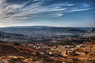
Al-Karak, in English sources often simply Karak, is a city in Jordan known for its medieval castle, the Kerak Castle. The castle is one of the three largest castles in the region, the other two being in Syria. Al-Karak is the capital city of the Karak Governorate.

<span class="mw-page-title-main">As-Salt</span> City in Balqa Governorate, Jordan

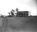
Al-Salt, also known as Salt, is an ancient trading city and administrative centre in west-central Jordan. It is on the old main highway leading from Amman to Jerusalem. Situated in the Balqa highland, about 790–1,100 metres above sea level, the city is built in the crook of three hills, close to the Jordan Valley. One of the three hills, Jabal al-Qal'a, is the site of a 13th-century ruined fortress. It is the capital of Balqa Governorate of Jordan.

<span class="mw-page-title-main">Al-Jizah, Jordan</span> District in Amman Governorate, Jordan

Al-Jizah, historically known as Ziza or Zizia, is a town in northwestern Jordan. It is the 22nd district of the Amman Governorate. During the medieval period it served as a waystation for pilgrims en route to the Hajj in Mecca. This function ceased in the 17th century, though a fort remained there, however was later reinstated when the Al-Fayez clan of the Bani Sakher gained the rights for Hajj protection in the 18th century. The region has been one of the Al-Fayez strongholds ever since.

The Tuqan clan is a prominent Palestinian and Jordanian political and business family. During the Ottoman era, they dominated the political and socio-economic spheres in Nablus and extended their influence to al-Salt. During that era, they were the only household that came close to establishing centralized rule over Jabal Nablus. Over the course of the 18th and 19th centuries the Tuqan family held the title of mutasallim of Nablus longer than any other local family.

Sheikh Attallah Suheimat or Attlallah Pasha Suheimat was a Jordanian leader, politician, and a statesperson. Born in the historic city of Al Karak, south of Jordan. He was the son of Sheikh Sulieman effendi Suheimat who was a national leader and a Member of the first municipal council of the city of Karak during the reign of the Ottoman Empire in the 1890s. Sheikh Attallah Suheimat was the head of the Ghassanids tribes in Jordan, and a famous leader during different time periods in the region: Ottoman Syria, Transjordan, and later the Hashemite Kingdom of Jordan. He held several senior positions including the President of the Al-Haqqania Court in the Ottoman Empire and President of the Court of First Instance in The "National Government of Moab". He participated in the development of the National Charter in 1928, and in 1929 was a member of the first Legislative Council in the Emirate of Transjordan representing Al Karak and Ma'an. Sheikh Suheimat was the Director of the General Intelligence in the government of King Faisal I of Syria.

<span class="mw-page-title-main">Hauran Druze Rebellion</span> Druze uprising against Ottoman authority in the Syrian province

The Hauran Druze Rebellion was a violent Druze uprising against Ottoman authority in the Syrian province, which erupted in 1909. The rebellion was led by the al-Atrash family, in an aim to gain independence, but ended in brutal suppression of the Druze, significant depopulation of the Hauran region and execution of the Druze leaders.

<span class="mw-page-title-main">Mustafa Wahbi Tal</span> Jordanian poet, teacher and civil servant (1899–1949)

Mustafa Wahbi Tal, also known by his pen name Arar, was a Jordanian poet, writer, teacher and civil servant, widely regarded as Jordan's most prominent poet and among the best-known Jordanian poets among Arab readers.

Husayn Pasha ibn Makki served as the Ottoman wali of Damascus (1757) and Marash (1762), and the sanjak-bey of his native Gaza (1763–1765).

The 1757 Hajj caravan raid was the plunder and massacre of the Hajj caravan of 1757 on its return to Damascus from Mecca by Bedouin tribesmen. The caravan was under the protection of an Ottoman force led by the Wali of Damascus, Husayn Pasha, and his deputy Musa Pasha, while the Bedouin were led by Qa'dan al-Fayez of the Bani Sakher tribe. An estimated 20,000 pilgrims were either killed or died of hunger or thirst as a result of the raid.

<span class="mw-page-title-main">Jordanian nationalism</span>

Jordanian nationalism is a nationalistic ideology that considers the Jordanian people a separate nation and strives to maintain Jordan as an independent nation-state. It emerged as one of three nationalist currents in the 1920s, and was opposed to both Palestinian nationalism present in the region, as well as the Hashemite Arab nationalism promoted by Abdullah I, the first ruler of the Emirate of Transjordan.

<span class="mw-page-title-main">Karak Sanjak</span> Subdivision in the Ottoman Empire

The Mutasarrifate of Karak, also known as the Sanjak of Karak, was an Ottoman district with special administrative status established in 1895, located in modern-day Jordan. The city of Karak was the district's capital. It had a population of 72,562 in 1914.

<span class="mw-page-title-main">Mehmed Rashid Pasha</span> Ottoman statesman (ca. 1825–1876)

Mehmed Rashid Pasha was an Ottoman statesman who served as the vali (governor) of Syria Vilayet in 1866–1871 and as minister of foreign affairs of the Ottoman government in 1873–1874 and 1875 until his death. Rashid Pasha was raised in Egypt where his father was an aide of the governor Muhammad Ali and was educated in Paris before joining government service in Istanbul in 1851. There he became a protege of the grand vizier Ali Pasha, a key figure in the empire-wide Tanzimat reforms. After the latter was reappointed grand vizier in 1866, Rashid Pasha was appointed governor of the Damascus-centered Syria Vilayet which extended from Tripoli and Hama in the north to Palestine and Transjordan in the south.

<span class="mw-page-title-main">Siege of Al-Karak (1834)</span>

Siege of Al-Karak was a 17-day siege imposed by Ibrahim Pasha of Egypt on the Transjordanian town of Al-Karak in 1834. The Pasha laid the siege on the town in pursuit of Qasim al-Ahmad, the leader of the Peasants' revolt in Palestine, who had fled from Nablus to take shelter in Al-Karak.

<span class="mw-page-title-main">Karak revolt</span>

The Karak revolt was an uprising against Ottoman authority in the Transjordanian town of Al-Karak, which erupted on 4 December 1910. The revolt came after Sami Pasha, the governor of Damascus, wanted to apply the same measures of conscription, taxation, and disarmament to the inhabitants of Al-Karak that previously provoked the Hauran Druze Rebellion.

<span class="mw-page-title-main">Al-Sharat</span> Highland region in modern southern Jordan and northwestern Saudi Arabia

Ash-Sharāt or Ash-Sharāh (Arabic: ٱلشَّرَاة, also known as Bilād ash-Sharāt or Jibāl ash-Sharāt, is a highland region in modern-day southern Jordan and northwestern Saudi Arabia. It was formerly a sub-district in Bilad al-Sham during the 7th–11th centuries CE.

<span class="mw-page-title-main">Balqa (region)</span>

The Balqa, known colloquially as the Balga, is a geographic region in central Jordan generally defined as the highlands east of the Jordan Valley in between the Zarqa River to the north and the Wadi Mujib gorge to the south.

<span class="mw-page-title-main">Establishment of the Emirate of Transjordan</span>

Establishment of the Emirate of Transjordan refers to the government that was set up in Transjordan on 11 April 1921, following a brief interregnum period.

<span class="mw-page-title-main">Circassians in Jordan</span> Branch of the Circassian diaspora in Jordan

Circassians in Jordan are descendants of Circassian refugees who arrived in Jordan in the late 19th century after the Circassian genocide in the 1860s and the Russo-Turkish War (1877–1878). They settled in Jordan, then a part of Ottoman Syria, in and around Amman and Jerash. Circassians are credited with founding modern Amman as the city had been previously abandoned.

References

  1. "The General Census - 2015" (PDF). Department of Population Statistics.
  2. 1 2 3 Museum With No Frontiers, p. 203.
  3. Bromiley, p. 362.
  4. 1 2 3 4 Gibb, p. 897.
  5. UNESCO, p. 184.
  6. Le Strange, 1890, p. 508
  7. 1 2 Le Strange (1890), p. 509
  8. Rogan and Tell, 1994, p. 17
  9. 1 2 Rogan, p. 33.
  10. Shoup, probably p. 16.
  11. Rogan and Tell, 1994, p. 26
  12. 1 2 Rogan, p. 34.
  13. 1 2 3 Rogan, p. 35.
  14. 1 2 3 Rogan and Tell, 1994, pp. 41-42
  15. Rogan, p. 190.
  16. Rogan and Tell, 1994, p. 43
  17. Rogan, p. 154.
  18. Lawrence, T.E. (1935). Seven Pillars of Wisdom . Garden City: Doubleday, Doran & Company, Inc. pp.  519-520.
  19. Faulkner, Neil (2016). Lawrence of Arabia's War: The Arabs, the British and the Remaking of the Middle East in WWI. New Haven: Yale University Press. pp. 389–593. ISBN   9780300226393.
  20. Porath, Y. (1984). "Abdallah's Greater Syria Programme". Middle Eastern Studies. 20 (2): 172–189. doi:10.1080/00263208408700579. JSTOR   4282995.
  21. Massad, p. 103.
  22. Massad, p. 89.
  23. Massad, p. 56.
  24. Massad, p. 186.
  25. "5 Jordanian Dinars banknote (Ma'an Palace)". Leftover Currency. Retrieved 2019-07-01.
  26. Cowell, Alan (April 21, 1989). "Jordan's Revolt Is Against Austerity". New York Times. Retrieved January 19, 2023.
  27. Massad, pp. 273-274.
  28. "Jihad and vandalism: Save our stones". The Economist . 13 June 2015. Retrieved 14 June 2015.
  29. Su, Alice (September 2, 2014). "Fade to black: Jordanian city Ma'an copes with Islamic State threat". Al Jazeera. Retrieved January 19, 2023.
  30. "Police officer killed in Jordan as anger over fuel prices spreads". Al Jazeera. December 16, 2022. Retrieved January 20, 2023.
  31. "Ma'an Airport Climate Normals 1961–1990". National Oceanic and Atmospheric Administration . Retrieved 14 February 2016.
  32. "Klimatafel von Ma'an / Jordanien" (PDF). Baseline climate means (1961-1990) from stations all over the world (in German). Deutscher Wetterdienst. Retrieved February 14, 2016.
  33. "MA'AN Climate: 1991–2020". Starlings Roost Weather. Retrieved 18 December 2024.
  34. Government of Jordan, Department of Statistics, 1964, pp. 6, 13
  35. Population (by Sex), Number of Households, Housing Units and Buildings by Locality Archived 2012-01-17 at the Wayback Machine . General Census of Population and Housing of Jordan 1994. Department of Statistics of Jordan. 1994-10-12. Retrieved on 2012-02-24.
  36. "Jordan: largest cities and towns and statistics of their population". Worldgazetteer. Archived from the original on 2007-10-01. Retrieved 2011-03-29.
  37. Rogan, p.37.
  38. Elias Farraj. Where to Invest? Jordan's Enabling Platforms (PDF) (Report). Jordan Investment Board. Retrieved May 4, 2018.
  39. "SHAMS MA'AN LAUNCHES PRODUCTION PHASE OF THE LARGEST ELECTRICITY GENERATION PROJECT USING PHOTOVOLTAIC CELLS IN JORDAN". Shams Ma'an. October 10, 2016. Archived from the original on 2017-02-06. Retrieved 4 May 2018.

Bibliography

30°11.6′N35°44′E / 30.1933°N 35.733°E / 30.1933; 35.733