Related Research Articles

The geography of Antarctica is dominated by its south polar location and, thus, by ice. The Antarctic continent, located in the Earth's southern hemisphere, is centered asymmetrically around the South Pole and largely south of the Antarctic Circle. It is washed by the Southern Ocean or, depending on definition, the southern Pacific, Atlantic, and Indian Oceans. It has an area of more than 14 million km2. Antarctica is the largest ice desert in the world.

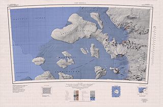
Marie Byrd Land (MBL) is an unclaimed region of Antarctica. With an area of 1,610,000 km2 (620,000 sq mi), it is the largest unclaimed territory on Earth. It was named after the wife of American naval officer Richard E. Byrd, who explored the region in the early 20th century.
Amundsen Glacier is a major Antarctic glacier, about 7 to 11 km wide and 150 km (80 nmi) long, originating on the polar plateau where it drains the area to the south and west of Nilsen Plateau, and descending through the Queen Maud Mountains to enter the Ross Ice Shelf just west of the MacDonald Nunataks. The tributary Blackwall Glacier flows northwest along the northeast side of Hansen Spur to join Amundsen Glacier.

Ellsworth Land is a portion of the Antarctic continent bounded on the west by Marie Byrd Land, on the north by Bellingshausen Sea, on the northeast by the base of Antarctic Peninsula, and on the east by the western margin of the Filchner–Ronne Ice Shelf. It extends between 103°24'W and 79°45'W. The area west of 90°W is unclaimed, the area between 84°W and 90°W is claimed by Chile only, and the remainder by Chile and the United Kingdom as a part of the British Antarctic Territory. Eights Coast stretches between 103°24'W and 89°35'W, and Bryan Coast between 89°35'W and 79°45'W.

Bear Peninsula is a peninsula about 80 km (50 mi) long and 40 km (25 mi) wide which is ice covered except for several isolated rock bluffs and outcrops along its margins, lying 48 km 30 mi) east of Martin Peninsula on Walgreen Coast, Marie Byrd Land, Antarctica.

West Antarctica, or Lesser Antarctica, one of the two major regions of Antarctica, is the part of that continent that lies within the Western Hemisphere, and includes the Antarctic Peninsula. It is separated from East Antarctica by the Transantarctic Mountains and is covered by the West Antarctic Ice Sheet. It lies between the Ross Sea, and the Weddell Sea. It may be considered a giant peninsula, stretching from the South Pole towards the tip of South America.
The Bakutis Coast is that part of the coast of Marie Byrd Land, West Antarctica, extending from a point opposite eastern Dean Island, at 74°42′S127°05′W, to Cape Herlacher, or between Hobbs Coast in the west and Walgreen Coast in the east. It stretches between 127°05'W and 114°12'W. The coast in this area is bounded by several large ice-covered islands and the very extensive Getz Ice Shelf. This coast was sighted by members of the US Antarctic Service, 1939–1941, and was charted in part from air photos taken by Operation Highjump, 1946–1947, both expeditions led by Admiral Richard E. Byrd. The United States Geological Survey completely mapped the coast from ground surveys and U.S. Navy air photos, 1959–1966.

Sulzberger Bay is a bay between Fisher Island and Vollmer Island, along the coast of King Edward VII Land. Discovered by the Byrd Antarctic Expedition on December 5, 1929, and named by Byrd for Arthur H. Sulzberger, publisher of The New York Times, a supporter of the Byrd expeditions in 1928–1930 and 1933–1935.
Guest Peninsula is a snow-covered peninsula about 45 miles (70 km) long between the Sulzberger Ice Shelf and Block Bay, on Saunders Coast in the northwest part of Marie Byrd Land, Antarctica. Mitchell Peak, located on the peninsula, was sighted by the first Byrd Antarctic Expedition in 1929. This feature was defined and mapped as "Guest Island" by the United States Antarctic Service Expedition in 1940. It was determined to be a peninsula by U.S. Geological Survey cartographers from air photos taken by the U.S. Navy, 1962–65. It is named for Amy Guest, a contributor to the Second Byrd Antarctic Expedition, 1933–35.
Zuniga Glacier is a glacier flowing west-northwest into Dotson Ice Shelf between Jeffrey Head and Mount Bodziony on the west side of Bear Peninsula, Walgreen Coast, Marie Byrd Land. Mapped by United States Geological Survey (USGS) from aerial photographs taken by U.S. Navy Operation Highjump in 1947 and U.S. Navy in 1966, it was named by Advisory Committee on Antarctic Names (US-ACAN) after Mike "Iron Mike" Zuniga, Chief Aviation Storekeeper, U.S. Navy, who made seven Deep Freeze deployments between 1960 and 1978.
Shabtaie Ice Ridge is an ice ridge between MacAyeal Ice Stream and Bindschadler Ice Stream at the junction of Shirase Coast and Siple Coast, Marie Byrd Land. Named by Advisory Committee on Antarctic Names (US-ACAN) after Sion Shabtaie, Geophysical and Polar Research Center, University of Wisconsin, Madison, WI, who, with Charles R. Bentley, 1982–84 and 1985–86, made a glaciogeophysical survey of the nearby Mercer, Whillans and Kamb Ice Streams and the intervening ice ridges.
Bindschadler Ice Stream is an ice stream between Siple Dome and MacAyeal Ice Stream. It is one of several major ice streams draining from Marie Byrd Land into the Ross Ice Shelf. The ice streams were investigated and mapped by U.S. Antarctic Research Program personnel in a number of field seasons from 1983 to 1984 and named Ice Stream A, B, C, etc., according to their position from south to north.
The Echelmeyer Ice Stream, formerly known as Ice Stream F, is a glaciological feature of the West Antarctic Ice Sheet. It is an ice stream flowing west to the Shirase Coast to the north of the MacAyeal Ice Stream, and is one of several major ice streams draining from Marie Byrd Land into the Ross Ice Shelf. The ice streams were investigated and mapped by U.S. Antarctic Research Program personnel in a number of field seasons from 1983–84 and originally named Ice Stream A, B, C, etc., according to their position from south to north.
Mercer Ice Stream, formerly Ice Stream A, flows west to Gould Coast to the south of Whillans Ice Stream, Antarctica. It is the southernmost of several major ice streams draining from Marie Byrd Land into the Ross Ice Shelf. The ice streams were investigated and mapped by U.S. Antarctic Research Program personnel in a number of field seasons from 1983–84 and named Ice Stream A, B, C, etc., according to their position from south to north. The name was changed by the Advisory Committee on Antarctic Names in 2002 to honor Quaternary geologist John H. Mercer (1922–87) of the Institute of Polar Studies, Ohio State University, who mapped the moraines above Reedy Glacier and in the Ohio Range at the head of Horlick Ice Stream, the major tributaries to Mercer Ice Stream.
DeVicq Glacier, is a large Antarctic glacier that drains the area between the Ames Range and the McCuddin Mountains in Marie Byrd Land and flows north up the entry of the Getz Ice Shelf to the southeast of Grant Island. It was mapped by the U.S. Geological Survey from surveys and U.S. Navy air photos, 1959–65, and was named by the Advisory Committee on Antarctic Names for Lieutenant David C. DeVicq, U.S. Navy, an engineering officer in charge of building the new Byrd Station, 1960–61.
Berry Glacier is an Antarctic glacier, about 25 miles (40 km) long and 5 miles (8 km) wide, draining north between Perry Range and Demas Range into the Getz Ice Shelf on the coast of Marie Byrd Land. This vicinity was first photographed and rudely charted from aircraft of the U.S. Antarctic Service in December 1940, and the glacier was mapped in detail by the U.S. Geological Survey from ground surveys and from U.S. Navy air photos, 1959–66. It was named by the Advisory Committee on Antarctic Names for Commander William H. Berry, U.S. Navy, Air Operations Officer for Task Force 43 during Operation Deep Freeze 1969–72; Operations Officer, 1973.
Crosson Ice Shelf is an Antarctic ice shelf, about 35 miles (56 km) wide, north and northeast of Mount Murphy along the Walgreen Coast of Marie Byrd Land. The ice shelf is nurtured by Smith, Pope, Vane, and Haynes Glaciers. It was mapped by the U.S. Geological Survey from surveys and from U.S. Navy air photos, 1959–66, and named by the Advisory Committee on Antarctic Names for Commander W.E. Crosson, U.S. Navy, Commanding Officer of the Antarctic Construction Group during Operation Deep Freeze 1973.
Harrison Ice Ridge is an ice ridge between Echelmeyer Ice Stream and MacAyeal Ice Stream on the Shirase Coast of Marie Byrd Land, Antarctica. It was named by the Advisory Committee on Antarctic Names after William D. Harrison of the Geophysics Institute at the University of Alaska, Fairbanks, a United States Antarctic Program investigator of ice flow dynamics in the margin of the nearby Whillans Ice Stream, 1992–93 and 1993–94, and at Siple Dome, 2001–02.
MacAyeal Peak is a peak about 1,100 metres (3,600 ft) high located 2 nautical miles (4 km) west-northwest of the Brandwein Nunataks in the north-central part of the Nebraska Peaks of Antarctica. It was named by the Advisory Committee on Antarctic Names after Douglas R. MacAyeal of the Institute of Quaternary Studies, University of Maine, Orono, a member of the United States Antarctic Research Program glaciological party during the Ross Ice Shelf Project in the 1976–77 austral summer; he was later affiliated with the University of Chicago.
Mackey Rock is an isolated rock on the east side of the Sulzberger Ice Shelf, 8 nautical miles (15 km) southwest of Mount Iphigene, Fosdick Mountains, on the coast of Marie Byrd Land, Antarctica. It was mapped by the United States Geological Survey from surveys and U.S. Navy air photos (1959–65), and was named by the Advisory Committee on Antarctic Names for Steven Mackey, a field assistant with the United States Antarctic Research Program Marie Byrd Land Survey II, summer 1967–68.
References
- ↑ "MacAyeal Ice Stream". Geographic Names Information System . United States Geological Survey . Retrieved 2009-11-06.
![]() This article incorporates public domain material from "MacAyeal Ice Stream". Geographic Names Information System . United States Geological Survey.
This article incorporates public domain material from "MacAyeal Ice Stream". Geographic Names Information System . United States Geological Survey.
| | This Marie Byrd Land location article is a stub. You can help Wikipedia by expanding it. |