
The Lewis and Clark Expedition, also known as the Corps of Discovery Expedition, was the United States expedition to cross the newly acquired western portion of the country after the Louisiana Purchase. The Corps of Discovery was a select group of U.S. Army and civilian volunteers under the command of Captain Meriwether Lewis and his close friend Second Lieutenant William Clark. Clark and 30 members set out from Camp Dubois, Illinois, on May 14, 1804, met Lewis and ten other members of the group in St. Charles, Missouri, then went up the Missouri River. The expedition crossed the Continental Divide of the Americas near the Lemhi Pass, eventually coming to the Columbia River, and the Pacific Ocean in 1805. The return voyage began on March 23, 1806, at Fort Clatsop, Oregon, and ended on September 23 of the same year.

The Nile is a major north-flowing river in northeastern Africa. It flows into the Mediterranean Sea. The Nile is the longest river in Africa and has historically been considered the longest river in the world, though this has been contested by research suggesting that the Amazon River is slightly longer. Of the world's major rivers, the Nile is one of the smallest, as measured by annual flow in cubic metres of water. About 6,650 km (4,130 mi) long, its drainage basin covers eleven countries: the Democratic Republic of the Congo, Tanzania, Burundi, Rwanda, Uganda, Kenya, Ethiopia, Eritrea, South Sudan, Republic of the Sudan, and Egypt. In particular, the Nile is the primary water source of Egypt, Sudan and South Sudan. Additionally, the Nile is an important economic river, supporting agriculture and fishing.

The Cascade Range or Cascades is a major mountain range of western North America, extending from southern British Columbia through Washington and Oregon to Northern California. It includes both non-volcanic mountains, such as many of those in the North Cascades, and the notable volcanoes known as the High Cascades. The small part of the range in British Columbia is referred to as the Canadian Cascades or, locally, as the Cascade Mountains. The highest peak in the range is Mount Rainier in Washington at 14,411 feet (4,392 m).

The Blue Nile is a river originating at Lake Tana in Ethiopia. It travels for approximately 1,450 km (900 mi) through Ethiopia and Sudan. Along with the White Nile, it is one of the two major tributaries of the Nile and supplies about 85.6% of the water to the Nile during the rainy season.

The River Goyt is a tributary of the River Mersey in North West England.
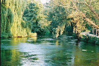
The River Test is a chalk stream in Hampshire in the south of England. It rises at Ashe near Basingstoke and flows southwards for 40 miles (64 km) to Southampton Water. Settlements on the Test include the towns of Stockbridge and Romsey. Below the village of Longparish, the river is broadly followed by the Test Way, a long-distance footpath.

The Río de la Plata, also called the River Plate or La Plata River in English, is the estuary formed by the confluence of the Uruguay River and the Paraná River at Punta Gorda. It empties into the Atlantic Ocean and forms a funnel-shaped indentation on the southeastern coastline of South America. Depending on the geographer, the Río de la Plata may be considered a river, an estuary, a gulf, or a marginal sea. If considered a river, it is the widest in the world, with a maximum width of 220 kilometres (140 mi).
The Kennet is a tributary of the River Thames in Southern England. Most of the river is straddled by the North Wessex Downs AONB. The lower reaches have been made navigable as the Kennet Navigation, which – together with the Avon Navigation, the Kennet and Avon Canal and the Thames – links the cities of Bristol and London.
Geographical exploration, sometimes considered the default meaning for the more general term exploration, refers to the practice of discovering remote lands and regions of the planet Earth. It is studied by geographers and historians.

Sir Alexander Mackenzie was a Scottish explorer and fur trader known for accomplishing the first crossing of North America in 1793. The Mackenzie River and Mount Sir Alexander are named after him.

Jacques Marquette, S.J., sometimes known as Père Marquette or James Marquette, was a French Jesuit missionary who founded Michigan's first European settlement, Sault Sainte Marie, and later founded Saint Ignace. In 1673, Marquette, with Louis Jolliet, an explorer born near Quebec City, was the first European to explore and map the northern portion of the Mississippi River Valley.

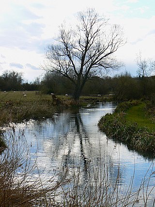
The River Churn is a tributary of the River Thames in central England. It rises at Seven Springs in Gloucestershire and flows south for approximately 37.3 km (23.2 mi) to meet the Thames at Cricklade in Wiltshire. Its length from its source to the confluence with the Thames is greater than that of the Thames from Thames Head, but the Churn is regarded as a tributary, rather than the main river.
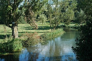
The River Coln is a river in Gloucestershire, England. It rises to the north of Brockhampton, a village to the east of Cheltenham, and flows in a south/south-easterly direction through the Cotswold Hills via Andoversford, Withington, Fossebridge, Bibury, Coln St Aldwyns, Quenington and Fairford. It joins the River Thames to the south-west of Lechlade, near to the confluence with the Thames and Severn Canal.

The River Vyrnwy is a river which flows through northern Powys, Wales, and Shropshire, England. The name derives from Severn, the river of which it is a tributary.

The geography of North Africa has been reasonably well known among Europeans since classical antiquity in Greco-Roman geography. Northwest Africa was known as either Libya or Africa, while Egypt was considered part of Asia.

Davy Crockett Explorer Canoes is a free-floating canoe experience at several Disney theme parks. The oldest of the rides is located at the Disneyland park in Anaheim, California. Boarding from the park's Critter Country section, up to twenty visitors paddle a canoe around the Rivers of America, accompanied by two guides. This is the only Disneyland attraction that is powered by park visitors.

The River Wey is a main tributary of the River Thames in south east England. Its two branches, one of which rises near Alton in Hampshire and the other in West Sussex to the south of Haslemere, join at Tilford in Surrey. Once combined the flow is eastwards then northwards via Godalming and Guildford to meet the Thames at Weybridge. Downstream the river forms the backdrop to Newark Priory and Brooklands. The Wey and Godalming Navigations were built in the 17th and 18th centuries, to create a navigable route from Godalming to the Thames.

Barnard River, a perennial river of the Manning River catchment, is located in the Northern Tablelands and Mid North Coast districts of New South Wales, Australia.

The Carnon River is a heavily polluted river in Cornwall, United Kingdom. It starts in Chacewater. Trewedna Water and River Kennall flow into the Carnon before it merges with Tallack's Creek to become Restronguet Creek, which eventually flows into the English Channel at the mouth of Carrick Roads.
