Madaj Mathmal | |
|---|---|
village | |
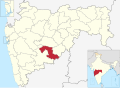
 Madaj Location in Maharashtra, India  Madaj Madaj (India) | |
| Coordinates: 17°55′39″N076°37′16″E / 17.92750°N 76.62111°E | |
| Country | |
| State | Maharashtra |
| District | Osmanabad |
| Tahsil | Umarga |
| Government | |
| • Body | Village panchayat |
| Population (2001) | |
• Total | 5,113 |
| Languages | |
| • Official | Marathi |
| Time zone | UTC+5:30 (IST) |
| Telephone code | 02475 |
| ISO 3166 code | IN-MH |
| Lok Sabha constituency | Osmanabad |
| Vidhan Sabha constituency | Umarga [1] |
Madaj is a panchayat village [2] in the state of Maharashtra, India. [3] [4] Administratively, Madaj is under Umarga Tehsil of Osmanabad District in Maharashtra. [4] There is only the single village of Madaj in the Madaj gram panchayat. [4] The village of Madaj is 17km by road north of the town of Umarga and 20km by road southeast of the village of Sastur.