Madhoganj

Last updated

Madhoganj
city
Madhoganj block map.png
Map of Madhoganj CD block
India Uttar Pradesh location map.svg
Red pog.svg
Madhoganj
Location in Uttar Pradesh, India
Coordinates: 27°07′N80°09′E / 27.12°N 80.15°E / 27.12; 80.15
CountryFlag of India.svg  India
State Uttar Pradesh
District Hardoi
Area
[1]
  Total6 km2 (2 sq mi)
Elevation
131 m (430 ft)
Population
 (2011) [1]
  Total11,523
  Density1,900/km2 (5,000/sq mi)
Languages
  Official Hindi
Time zone UTC+5:30 (IST)
Vehicle registration UP30

Madhoganj is a town and Nagar Panchayat in Bilgram tehsil of Hardoi district, Uttar Pradesh, India. [1] It is located on the north side of the main road from Sitapur to Kanpur, with other roads leading to Bilgram to the northwest, Mallawan to the south, and Beniganj and Balamau to the east. [2] As of 2011, the population of Madhoganj is 11,523, in 2,180 households. [1] It is also the seat of a community development block. [1]

Contents

Geography

Madhoganj is located at 27°07′N80°09′E / 27.12°N 80.15°E / 27.12; 80.15 . [3] It has an average elevation of 131 metres (429 feet). Madhoganj was a Junction Railway Station during Narrow Gauge era in the 1990s connecting Auhadpur via Rudamau, Bilgram & Sandi Nawabganj with a 49 kilometres (30 mi) Line. After Unnao-Balamau Line was made Broad Gauge, Madhoganj-Auhadpur NG Line was closed. Madhoganj is connected to Lucknow via Balamau Junction & to Kanpur via Unnao Junction.

History

Madhoganj originated as a bazaar in the village of Rudamau. [2] At the turn of the 20th century, it was described as "a thriving centre of trade in grain, cotton, and other articles." [2] It had a post office, an upper primary school, and a police force of 11 officers. [2]

Madhoganj's municipal board was established in 1872. [4] In 1903, a railway branch line was built between Madhoganj and Balamau. [2] Then in 1909, another line was built connecting Madhoganj with Sandi via Bilgram. [4]

The 1961 census did not count Madhoganj among the urban areas of Hardoi district, due to "non-fulfilment of urban conditions." [4] Madhoganj's market, held on Tuesdays and Fridays and mainly dealing in grain and kirana items, was recorded as having an average attendance of 6,000 people at the time. [4]

Economy

As of 1971, the economy of Madhoganj was described as a hybrid between the commercial, service, and industrial sectors. [5] The main items imported were jaggery, cloth, and raw groundnuts. [5] The main items manufactured were groundnut oil, handloom cloth, and shoes. [5] The biggest export was groundnut oil, followed by wheat and arhar. [5]

Demographics

Historical population
YearPop.±%
1901 3,594    
1911 2,605−27.5%
1921 3,027+16.2%
1931 3,485+15.1%
1941 3,650+4.7%
1951 3,531−3.3%
1961 Not given    
1971 5,573    
1981 7,643+37.1%
1991 8,723+14.1%
2001 9,863+13.1%
2011 11,523+16.8%
Source: 2011 Census of India [1]

As of 2011 India census, [6] Madhoganj had a population of 11,523. Males constitute 53% of the population and females 47%. Madhoganj has an average literacy rate of 78.69%, higher than the national average of 74.04%: male literacy is 83.75%, and female literacy is 73.07%. In Madhoganj, 9% of the population is under 6 years of age.

Religions in Madhoganj
ReligionPercent
Hindus
83.50%
Muslims
16.13%
Others†
1%
Distribution of religions
Includes Sikhs (0.2%), Buddhists (<0.2%).

Villages

Madhoganj CD block has the following 105 villages: [1]

Village nameTotal land area (hectares)Population (in 2011)
Katarpur 93.1405
Naumalikpur 270.81,560
Khwazapur 92.488
Sadriapur 32.31,436
Barhanpur 246.11,256
Paneora 244752
Fatteypur 209.8480
Jujvamau 327.41,109
Roshanpur 161.72,382
Hirapur 100.71,662
Mahmoodpur Thal 187667
Sadarpur 6644,148
Barhnawa 395.32,472
Kha Dheria Khan Jahanpur 259.22,023
Shekhanpur 223.51,354
Parhra Lakhanpur 327.52,258
Dherhni Saraiya 1952,210
Selapur 267.22,420
Mau 102.3742
Bhainsi Kherha 101861
Shuklapur Bhagat 958.17,200
Usraha 106.2598
Pilkhana 106.3547
Terhiya 125.9204
Barhas 211.92,027
Firozpur 79.51,039
Ruiya 399.61,773
Chandauli 3031,976
Rudamau 680.54,196
Daulatyarpur 361.63,092
Sahijana 334.52,385
Baghaurha 2561,766
Newada Gambhi 1971,307
Shahbda 425.62,933
Barhiya Kherha 450.12,268
Saunhar 218.51,590
Atwa Ali Mardanpur 704.83,811
Seorhai 495.72,894
Gautara 375.61,781
Kursath Buzurg 1,228.61,919
Kursath Khurd 567.31,463
Samukha 261.51,242
Parnakha 274.51,486
Dakauli 235.71,618
Madarpur Khurda 301.41,957
Jalihapur 1811,507
Sendhrauli 1271,131
Bhajehata 171.3790
Khurrampur 47.8298
Sariyan Belwar 80.8537
Terwa 240.91,511
Ruknapur 203.21,819
Sharfuddinpur 162.71,351
Piprawan 141.22,030
Sanjalpur 33473
Khemipur 175.11,049
Keoti Khuwazagipur 188.52,187
Shekhwapur 159.3922
Bhithai 293.72,174
Chandipur 64.2816
Rasoolapur 109.71,087
Qazipur Farhat Nagar 190.22,738
Mohiuddinpur 480.81,157
Unchagaon 264.72,372
Kherwa 197.71,678
Suwapur 108.5180
Qazipur Nai Basti 351.61,722
Iksai 231.52,175
Shahpur Basudev 377.82,095
Saray Ud 1521,055
Neoli 213.81,163
Morhiya Kherha 356.32,233
Gaura 1,029.33,909
Kalhamau 89.6180
Fatteypur Chougawan 330.41,344
Indlapur 252.1582
Hasanpur Jeoli 381.61,804
Hasanpur Gopal 730
Zehdipur 160.81,709
Nibhamau 87.8306
Terwa Kulli 461.44,698
Katriterwa Kulli 915.5451
Lonari Rahimpur 261.31,279
Biraichmau 257.22,755
Mawaiya 174.8454
Matiyamau 6868,585
Babatmau 855.39,104
Babatmau Pansala 313.60
Jalalpur 16.30
Taukalabad 103.6745
Haripura 130.91,437
Balehra Kamal Nagar 311.51,545
Garhi Rasoolpur 195.3974
Mohabbatpur 134.21,438
Narainmau 279.8752
Karwa 414.71,674
Thathia Zahidpur 438.81,722
Newada 47.21,206
Raghopur Sisala 406.95,790
Raghopur Pansala 86.90
Mang Raha Sisala 186.31,818
Mang Raha Pansala 177.70
Mahimpur 341.9738
Kutuapur Sisala 249.73,427
Kutuapur Pansala 866.10

Related Research Articles

Hardoi is a city and municipal board in Hardoi district in the Indian state of Uttar Pradesh. It is the administrative headquarters of Hardoi district. It is also known as Prahalad Nagari. Hardoi is about 100 km from the state capital Lucknow and about 385 km from New Delhi. Hardoi is a temple town.

Sitapur is a city and a municipal board in Sitapur district in the state of Uttar Pradesh, India. It is located 90 kilometres north of state capital, Lucknow. The traditional origin for the name is said to be by the King Vikramāditya from Lord Ram's wife Sita.

<span class="mw-page-title-main">Hardoi district</span> District of Uttar Pradesh in India

Hardoi district is a district situated in the center of Uttar Pradesh, India. The district headquarters is in the city of Hardoi. Hardoi is the third largest district of Uttar Pradesh. It falls under Lucknow division in the historical region of Awadh State.

<span class="mw-page-title-main">Bilgram</span> Town in Uttar Pradesh, India

Bilgram is a town and a nagar palika parishad in Hardoi district in the state of Uttar Pradesh, India. It is located 16 miles (26 km) south of the city of Hardoi, on an elevated bluff that once formed the eastern bank of the Ganges. Important industries in Bilgram include ceramics and embroidery.

<span class="mw-page-title-main">Ganj Muradabad</span> City in Uttar Pradesh, India

Ganj Muradabad is a town and nagar panchayat in Bangarmau tehsil of Unnao district, Uttar Pradesh, India. It also serves as the headquarters of a community development block containing 86 rural villages. Handicrafts are a major industry here. As of 2011, Ganj Moradabad has a population of 10,957, in 1,723 households.

<span class="mw-page-title-main">Mallawan</span> Town in Uttar Pradesh, India

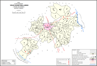
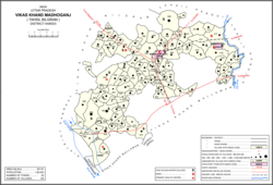
Mallawan, also spelled Mallanwan is a town and Nagar Palika Parishad in Hardoi district of Uttar Pradesh, India. It served as the original district headquarters from 1856 to 1858. It is located south of Bilgram, on the road to Unnao. Mallawan is a major centre of handloom weaving, with handloom cloth being a major export. As of 2011, the population of Mallawan is 36,915, in 6,086 households. It is included in the legislative assembly constituency of Bilgram-Mallanwan.

<span class="mw-page-title-main">Sandi, Uttar Pradesh</span> City in Uttar Pradesh, India

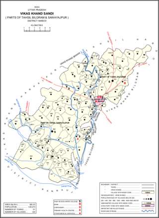
Sandi is a town and a nagar palika parishad in Bilgram tehsil of Hardoi district, Uttar Pradesh, India. It is located on the left bank of the Garra river, on the road from Hardoi to Fatehgarh. As of 2011, its population is 26,007, in 4,396 households.

<span class="mw-page-title-main">Sandila</span> Town in Uttar Pradesh, India

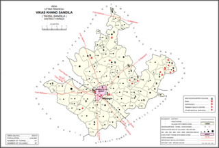
Sandila is a town and nagar palika parishad in Hardoi district in the Indian state of Uttar Pradesh. It serves as a tehsil headquarters within the district. Located midway between Hardoi and Lucknow, Sandila is a well-connected town with roads leading in all directions and a major broad gauge rail line passing through the south side of town. Important industries include sweets — its laddus are especially well-known — as well as beedi production and zardozi work.

Balamau is a train station in Hardoi district of Lucknow division of Uttar Pradesh. It is located in Kachhauna, four miles northeast of its namesake village of Balamau. It lies on the Amritsar–Pt. Deen Dayal Upadhyaya Junction main line, 9 km (5.6 mi) from the previous station at Baghauli and 8 km (5.0 mi) from the next station at Dalelnagar. It is also the terminus of two branch lines, one leading to Kanpur and the other leading to Sitapur. The Balamau–Kanpur and Balamau–Sitapur lines both use metre-gauge tracks.

<span class="mw-page-title-main">Balamau</span> Village in Uttar Pradesh, India

Balamau is a village in Kachhauna block of Hardoi district, Uttar Pradesh, India. It is located about a mile from the left bank of the Sai river, 25 miles from Hardoi and 4 miles southwest of the namesake Balamau station, which is actually in Kachhauna. Balamau was historically the largest settlement in the area, serving as the seat of a pargana since the reign of Akbar. As of 2011, its population is 4,749, in 1,022 households.

Unnao Junction Railway Station, also known as Unnao Railway Station, is a major railway station located in Unnao district in the Indian state of Uttar Pradesh. It serves Unnao and the surrounding areas. The station falls under the jurisdiction of the Northern Railway zone of the Indian Railways and serves as a crucial transportation hub for the region. Unnao Junction railway station is on the Lucknow–Kanpur Suburban Railway and Varanasi–Kanpur branch line.

<span class="mw-page-title-main">Harpalpur, Hardoi</span> Populated place in Uttar Pradesh, India

Harpalpur is a village and corresponding community development block in Sawayajpur tehsil of Hardoi district, Uttar Pradesh, India. It is located west of Sandi, on the road to Fatehgarh. The main staple crops here are wheat, rice, and maize. Markets are held twice weekly. As of 2011, the population of Harpalpur is 8,822, in 1,544 households. The total block population is 172,224, in 29,232 households.

<span class="mw-page-title-main">Khasaura</span> Populated place in Uttar Pradesh, India

Khasaura is a large village in Harpalpur block of Hardoi district, Uttar Pradesh, India. It lies on the left bank of the Ramganga river, to the north of the road connecting Hardoi and Sandi with Farrukhabad. The village hosts a large market twice per week, on Wednesdays and Sundays. It deals mainly in vegetables.

<span class="mw-page-title-main">Kherwa Amjadpur</span> Populated place in Uttar Pradesh, India

Kherwa Amjadpur is a village in Sandi block of Hardoi district, Uttar Pradesh, India. It is located 8 km (5.0 mi) away from Sandi, which is the nearest city. The village has one primary school. The main staple crops are wheat and maize. As of 2011, its population is 752, in 231 households.

<span class="mw-page-title-main">Dasauli</span> Populated place in Uttar Pradesh, India

Dasauli is a village in Sandi block of Hardoi district, Uttar Pradesh, India. It is located 10 km away from Sandi, which is the nearest city. The main staple crops are wheat and rice. As of 2011, its population was 1,950, in 291 households.

<span class="mw-page-title-main">Nikari</span> Populated place in Uttar Pradesh, India

Nikari is a village in Sandi block of Hardoi district, Uttar Pradesh, India. It is located 8 km (5.0 mi) away from Sandi, which is the nearest city. The village has one primary school, and the main staple crops are wheat and rice. As of 2011, the population of Nikari is 1,878, in 283 households.

<span class="mw-page-title-main">Lamkan</span> Populated place in Uttar Pradesh, India

Lamkan is a village in Sandi block of Hardoi district, Uttar Pradesh, India. It is located 6 km away from Sandi, which is the nearest city. It is connected to state and national highways and has a sub post office and two primary schools but no healthcare facilities. The main staple crops are wheat and rice. As of 2011, its population is 3,734, in 577 households.

<span class="mw-page-title-main">Gaju</span> Populated place in Uttar Pradesh, India

Gaju is a village in Kachhauna block of Hardoi district, Uttar Pradesh, India. Located on the road from Balamau station to Beniganj and Sitapur, Gaju has a railway station on the Sitapur-Balamau branch line and hosts a market on Mondays and Thursdays. As of 2011, its population is 8,912, in 1,592 households.

<span class="mw-page-title-main">Ajgain</span> Village in Uttar Pradesh, India

Ajgain is a village in Nawabganj block of Unnao district, Uttar Pradesh, India. It is located northeast of Unnao, near the main Lucknow-Kanpur road. It has a railway station on the Lucknow-Kanpur line, lying between Sonik and Kusumbhi. It holds a market on Mondays and Fridays, with grain and vegetables being the main items of trade. As of 2011, the population of Ajgain is 8,926, in 1,481 households.

<span class="mw-page-title-main">Makhi, Unnao</span> Village in Uttar Pradesh, India

Makhi is a large village in Miyanganj block of Unnao district, Uttar Pradesh, India. It hosts a Ramlila fair for one day during the month of Kuar, and it also holds a market twice per week, on Mondays and Saturdays. The main items sold at the market are grain and vegetables. Makhi also has a train station on the Kanpur-Balamau line, between the stations at Safipur and Patiyara. As of 2011, its population is 13,786, in 2,503 households.

References

  1. 1 2 3 4 5 6 7 "Census of India 2011: Uttar Pradesh District Census Handbook - Hardoi, Part A (Village and Town Directory)" (PDF). Census 2011 India. pp. 282–99, 578–81. Retrieved 5 June 2021.
  2. 1 2 3 4 5 Nevill, H.R. (1904). Hardoi - A Gazetteer. Allahabad: Government Press. pp. 217–8. Retrieved 5 June 2021.
  3. Falling Rain Genomics, Inc - Madhoganj
  4. 1 2 3 4 Census 1961: District Census Handbook, Uttar Pradesh (36 - Hardoi District) (PDF). Lucknow. 1965. pp. III, 149, 166. Retrieved 5 June 2021.{{cite book}}: CS1 maint: location missing publisher (link)
  5. 1 2 3 4 Census 1971 Uttar Pradesh: District Census Handbook Part X-A: Village & Town Directory, District Hardoi (PDF). 1972. pp. viii–xi, 8–9. Retrieved 5 June 2021.
  6. "Census of India 2011: Data from the 2011 Census, including cities, villages and towns (Provisional)". Census Commission of India. Archived from the original on 16 June 2004. Retrieved 27 May 2017.