Bharkhani

Last updated

Bharkhani
Populated place
Bharkhani block map.png
Map showing Bharkhani (#575) in Bharkhani CD block
India Uttar Pradesh location map.svg
Red pog.svg
Bharkhani
Location in Uttar Pradesh, India
India location map.svg
Red pog.svg
Bharkhani
Bharkhani (India)
Coordinates: 27°35′04″N79°47′49″E / 27.584465°N 79.79708°E / 27.584465; 79.79708 [1]
CountryFlag of India.svg  India
State Uttar Pradesh
District Hardoi
Area
[2]
  Total10.661 km2 (4.116 sq mi)
Population
 (2011) [2]
  Total5,681
  Density530/km2 (1,400/sq mi)
Languages
  Official Hindi
Time zone UTC+5:30 (IST)

Bharkhani is a village and corresponding community development block in Hardoi district of Uttar Pradesh, India. [2] It has several schools, one clinic, and a public library, and there is a regular market as well as a weekly haat. [2] A fair called Banshi Baba is held here on Chaitra Badi 30. [3] The main staple crops here are wheat and rice. [4] As of 2011, the population of Bharkhani is 5,681, in 888 households. [2]

Contents

Demographic history

The 1961 census recorded Bharkhani as comprising 6 hamlets, with a combined population of 2,383 (1,263 male and 1,120 female), in 498 households and 294 physical houses. [3] The area of the village was given as 2,682 acres. [3]

The 1981 census recorded Bharkhani as having a population of 3,366, in 656 households, and covering an area of 1,065.98 hectares. [4]

Villages

Bharkhani CD block has the following 183 villages: [2]

Village nameTotal land area (hectares)Population (in 2011)
Lakhnaur 894.74,655
Sahsoga 226.61,020
Kamalpur 9374,450
Hullapur 101.10
Pateora 2711,991
Bhabhar Keshopur 369.22,002
Ahukhana 68.50
Baruara 498.72,489
Kurari 288.91,534
Maikpur 5513,263
Ghaso 374.41,115
Girdhar 153.4931
Jujharpur 175.6536
Ubri Khera 221.11,584
Naibasti 8193,662
Pachdeora 721.44,151
Amtara 432.62,918
Pakra 201.4946
Udaipur 82.6631
Sultanpur 606.21,964
Anangpur 3933,088
Murtaza Nagar 394.81,561
Jalpapur 270.71,708
Dariyabad 102221
Gautia 52.2499
Chakrachha 79.4797
Biriya 92.3234
Jamalpur 52881
Lalpur 67.20
Naya Gaon 87.7305
Chandpur 218.21,100
Nagla Husain 160.81,046
Kundi 368.62,215
Nasa 207.8713
Pipariya 136.61,169
Kapoorpur 202.61,013
Kheriya 182.71,160
Narbha 195.31,026
Chandrampur 158.5585
Birampur 329.71,593
Umaria Kalan 119.7314
Khwajgipur 272.51,895
Mundramau 277.21,681
Randhirpur 160.5579
Kaharkola 332.31,334
Bhahpur Sapha 540.91,234
Dwar Nagla 143.2521
Ghanu Nagla 142.6956
Dhani Nagla 212.5935
Manpara 344.51,200
Rudrapur 53.40
Rupapur 1351,162
Babarpur Pansala 5.50
Babarpur Sisala 396.82,474
Chanduapur 51.80
Menghpur 129.5120
Hunseypur 47.90
Sarai Saif Sisala 48.70
Sarai Saif Pansala 151.1489
Bhagwantpur 72.9825
Sakrauli 165.8553
Naglapattu 416.8982
Ramapur 297.91,276
Kunwarpur 78.3915
Bharkhani (block headquarters)1,066.15,681
Pachraiya 282.7794
Hasnapur 338.91,967
Bilsari Malik 128.3434
Malikapur 240.91,303
Paintpur 350.51,447
Binaika Mafi 188.2426
Deoniapur Balbhadra 906363
Sandi Khera 39.2233
Bahrampur 140741
Serhamau 132.2951
Newada 150.8536
Sahuapur 182.8820
Bilsar Helan 282.91,475
Bilsar Harsen 387.91,309
Naseerpur 138.8690
Bibiyapur 230.456
Bisauli 344.9792
Man Nagla 4742,067
Ismailpur 186.9926
Hathuara 565.91,903
Atariya 200.2437
Daghela 262.92,159
Baragaon 240.6341
Thariya 109.2648
Rajuapur 221.3598
Mahmoodpur 157.31,064
Tera 186.8691
Nagla Bhainsi 187.51,416
Farigahana 3922,629
Aliyapur 103.4613
Behti 2211,417
Jeora 750.72,084
Deoniyapur Sarsai 91.50
Semar Jhala 658.42,275
Dhauraliya 97.7295
Gajiyapur 44.3568
Adampur 44.7473
Nizampur 279.82,853
Pali Dehat Sisala 129.40
Pali Dehat Pansala 13.50
Ahmadpur 81.7511
Rajarampur 73.769
Bhahpur 144.1510
Khankalapur 97.1890
Jahanpur 123.4195
Akhri 71.8177
Munder 655.16,233
Kausiya 122.8576
Sarsai 345.51,645
Timirpur 210.71,325
Saidapur 128.5948
Markara 187.5811
Amirta 342.41,311
Rahtaura 2901,699
Khwajgipur 49.1438
Dharampur 169.1534
Kishanpur 131.10
Ratanpur 165.41,118
Garhuapur 599.10
Ramapur Lal 107.7541
Ramdaspur 68.8480
Mahamdapur 59.80
Khanjahanpur 94.70
Asmadha 134.41,303
Daulatpur 37.1664
Bhorapur 180.51,309
Sahjanpur 4291,836
Nand Khera 269.21,394
Baseliya 82.81,022
Gaura Udaipur 252.81,280
Kahrai Naktaura Sisala 2101,878
Kahrai Naktaura Pansala 720
Raipur 181905
Kankapur Ubariya 450.22,349
Kanhari 2461,471
Bahauddinpur 155.31,191
Kaitha 150.91,014
Pandeypur 273.81,931
Rajpur Labhera 206.4671
Ubriakalan 3601,350
Chakauti Khurd 236.11,114
Chakauti Kalan 255.5943
Ubariya Khurd 254416
Khetauli 188.11,022
Nizampur Saida 49.5408
Rampura Khamariya 560.22,111
Madnapur 1921,692
Chaura Rai 9242,112
Singhapur 205.1717
Jaitpur 328506
Semariya 270.61,380
Khandaua Mirzapur 244.1987
Gaur Khera 236.1971
Sawaizpur 512.55,044
Silwari 6421,862
Dhikaha 814817
Ramapur Misra 129.9579
Pahunchna Khera 85.6223
Lakhmapur Sisala 193789
Lakhmapur Pansala 54.4715
Haran Kuda Sisala 45.7490
Haran Kuda Pansala 720
Gurdharu 84.8549
Salhoni Sisala 136.52,482
Salhoni Pansala 83.30
Dahirapur 1,484.61,005
Saraj Ragho Pansala 100.10
Sarai Ragho Sisala 241.32,363
Nagla Pahladpur 195.2324
Udharna Pur 279.5687
Bhaila Mau Sisala 389.81,695
Bhaila Mau Pansala 40.40
Kankapur Lal 40.3750
Binaika Akbarpur Sisala 51.6632
Binaika Akbarpur Pansala 153.9500
Menhdiyarpur 88.8220
Baroura Sisala 123.81,426
Baraura Pansala 920

Related Research Articles

<span class="mw-page-title-main">Todarpur, Hardoi</span> Populated place in Uttar Pradesh, India

Todarpur, also spelled Tondarpur, is a village and corresponding community development block in Shahabad tehsil of Hardoi district, Uttar Pradesh, India. The village has several schools and one clinic. It hosts neither a haat nor a mandi. The staple crops here are wheat and rice. As of 2011, its population is 3,846, in 603 households.
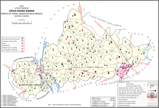
<span class="mw-page-title-main">Bawan</span> Populated place in Uttar Pradesh, India

Bawan is a large village and corresponding community development block in Hardoi district of Uttar Pradesh, India. It is located 10 km west of Hardoi, on the south side of the road to Bazpur-Naktaura and the Sai Ghat. Bawan was historically the seat of a pargana since at least the time of the Mughal Emperor Akbar, and it is also the site of a mela held in honour of Darshan Debi on the first Sunday of Bhadon, at a site called the Suraj Kund. The main staple crops here are wheat, rice, and gram. Markets are held on Mondays and Thursdays. As of 2011, the population of Bawan is 13,524, in 2,230 households.

<span class="mw-page-title-main">Harpalpur, Hardoi</span> Populated place in Uttar Pradesh, India

Harpalpur is a village and corresponding community development block in Sawayajpur tehsil of Hardoi district, Uttar Pradesh, India. It is located west of Sandi, on the road to Fatehgarh. The main staple crops here are wheat, rice, and maize. Markets are held twice weekly. As of 2011, the population of Harpalpur is 8,822, in 1,544 households. The total block population is 172,224, in 29,232 households.

<span class="mw-page-title-main">Satautha</span> Populated place in Uttar Pradesh, India

Satautha is a village in Harpalpur block of Hardoi district, Uttar Pradesh, India. The main staple crops here are wheat and rice. As of 2011, the population of Satathua is 3,992, in 727 households. The village lands cover an area of 797.6 hectares.

<span class="mw-page-title-main">Khasaura</span> Populated place in Uttar Pradesh, India

Khasaura is a large village in Harpalpur block of Hardoi district, Uttar Pradesh, India. It lies on the left bank of the Ramganga river, to the north of the road connecting Hardoi and Sandi with Farrukhabad. The village hosts a large market twice per week, on Wednesdays and Sundays. It deals mainly in vegetables.
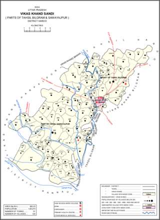
<span class="mw-page-title-main">Kherwa Amjadpur</span> Populated place in Uttar Pradesh, India

Kherwa Amjadpur is a village in Sandi block of Hardoi district, Uttar Pradesh, India. It is located 8 km (5.0 mi) away from Sandi, which is the nearest city. The village has one primary school. The main staple crops are wheat and maize. As of 2011, its population is 752, in 231 households.

<span class="mw-page-title-main">Dasauli</span> Populated place in Uttar Pradesh, India

Dasauli is a village in Sandi block of Hardoi district, Uttar Pradesh, India. It is located 10 km away from Sandi, which is the nearest city. The main staple crops are wheat and rice. As of 2011, its population is 1,950, in 291 households.

<span class="mw-page-title-main">Nikari</span> Populated place in Uttar Pradesh, India

Nikari is a village in Sandi block of Hardoi district, Uttar Pradesh, India. It is located 8 km (5.0 mi) away from Sandi, which is the nearest city. The village has one primary school, and the main staple crops are wheat and rice. As of 2011, the population of Nikari is 1,878, in 283 households.

<span class="mw-page-title-main">Lamkan</span> Populated place in Uttar Pradesh, India

Lamkan is a village in Sandi block of Hardoi district, Uttar Pradesh, India. It is located 6 km away from Sandi, which is the nearest city. It is connected to state and national highways and has a sub post office and two primary schools but no healthcare facilities. The main staple crops are wheat and rice. As of 2011, its population is 3,734, in 577 households.
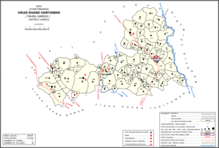
<span class="mw-page-title-main">Hariyawan</span> Populated place in Uttar Pradesh, India

Hariyawan is a village and corresponding community development block in Hardoi district of Uttar Pradesh, India. It hosts a market on Wednesdays and Sundays. The main staple foods here are wheat and rice. As of 2011, its population is 2,997, in 508 households.

<span class="mw-page-title-main">Kurseli</span> Populated place in Uttar Pradesh, India

Kurseli is a large village in Hariyawan block of Hardoi district, Uttar Pradesh, India. It is located north of the city of Hardoi, to the west of the main road to Pihani. Kurseli hosts a market on Mondays and Thursdays, and the main staple foods are wheat and rice. It has several schools and one clinic, along with five practitioners of traditional medicine. The village lands extend a long way to the south, and include a chain of jhils that ultimately drain into the Sai river. As of 2011, the population of Kurseli is 10,404, in 1,936 households.

<span class="mw-page-title-main">Tadiyawan</span> Populated place in Uttar Pradesh, India

Tadiyawan, also spelled Tandiyawan, is a village and corresponding community development block in Hardoi district of Uttar Pradesh, India. Located 14 km from the city of Hardoi, it hosts a regular market and hosts a Deviji festival on Chaitra Sudi 8 dedicated to worship of the goddess Devi. The village has two primary schools but no healthcare facilities. As of 2011, the population of Tadiyawan is 5,998, in 1,079 households.

<span class="mw-page-title-main">Asa, Hardoi</span> Populated place in Uttar Pradesh, India

Asa is a village in Tadiyawan block of Hardoi district, Uttar Pradesh, India. Located 3 km from the city of Hardoi, the village is connected to state highways and has several schools but no healthcare facilities. The main staple foods are wheat and rice. As of 2011, the population of Asa is 5,734, in 944 households.

<span class="mw-page-title-main">Pura Bahadur</span> Populated place in Uttar Pradesh, India

Pura Bahadur is a village in Tadiyawan block of Hardoi district, Uttar Pradesh, India. Located a few kilometres from the city of Hardoi, the village is connected to state highways and hosts a market on Wednesdays and Sundays. Pura Bahadur has two primary schools and a sub post office. There are no hospitals for humans, although there is a veterinary facility. The main staple foods are wheat and rice. As of 2011, the population of Pura Bahadur is 5,594, in 964 households.

<span class="mw-page-title-main">Japra</span> Populated place in Uttar Pradesh, India

Japra is a village in Tadiyawan block of Hardoi district, Uttar Pradesh, India. Located 16 km from the city of Hardoi, the village is not on any major roads and it has 3 primary schools but no healthcare facilities. The main staple foods are wheat and rice. As of 2011, the population of Japra is 3,633, in 555 households.
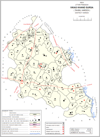
<span class="mw-page-title-main">Sursa</span> Populated place in Uttar Pradesh, India

Sursa is a village and corresponding community development block in Hardoi district of Uttar Pradesh, India. Located 14 or 15 km from the city of Hardoi, the village hosts a market on Mondays and Thursdays. The village has two primary schools and one clinic. As of 2011, the population of Sursa is 2,157, in 373 households.
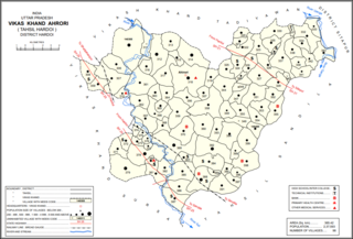
<span class="mw-page-title-main">Ahrori</span> Populated place in Uttar Pradesh, India

Ahrori, also spelled Ahirori, is a village and corresponding community development block in Hardoi district of Uttar Pradesh, India. Located 24 km from the city of Hardoi, it hosts a regular market and hosts a Babaji festival on Asadha Sudi 15 dedicated to worship of the goddess Devi. The village has two primary schools and one clinic, as well as a public library and a sub post office. As of 2011, the population of Ahrori is 8,382, in 1,329 households.
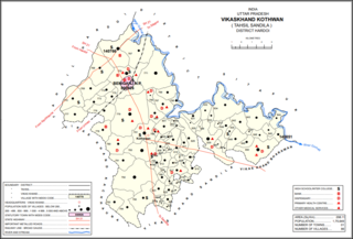
<span class="mw-page-title-main">Kothwan</span> Populated place in Uttar Pradesh, India

Kothwan, also spelled Kothawan, is a village and corresponding community development block in Hardoi district of Uttar Pradesh, India. Located 8 km from the city of Beniganj, Kothwan hosts a Parikrma fair during the month of Phalguna where people gather for worship purposes. Vendors bring various items of merchandise to sell at the fair, including carpets, handloom cloth, glassware, earthen pots, toys, and sweets. Kothwan also hosts a market on Wednesdays and Sundays, which involves the sale of miscellaneous products. The main staple foods in Kothwan are wheat and rice. As of 2011, the population of Kothwan is 5,323, in 1,063 households.

<span class="mw-page-title-main">Bharawan</span> Populated place in Uttar Pradesh, India

Bharawan is a village and corresponding community development block in Sandila tehsil of Hardoi district, Uttar Pradesh, India. Located 23 km from Sandila, it hosts a market on Mondays and Thursdays and has four primary schools and one healthcare facility. The main staple foods are wheat and juwar. As of 2011, the population of Bharawan is 10,443, in 1,649 households.
<span class="mw-page-title-main">Hardoi, Raebareli</span> Village in Uttar Pradesh, India

Hardoi is a village in Maharajganj block of Rae Bareli district, Uttar Pradesh, India. Located on the road from Maharajganj to Bachhrawan, Hardoi historically served as the seat of a pargana and has a now-ruined fort built in the early 1400s under the Jaunpur Sultanate. As of 2011, its population is 2,308, in 415 households.

References

  1. Search for "Bharkhani" here https://geonames.nga.mil/namesgaz/.{{cite web}}: Missing or empty |title= (help)
  2. 1 2 3 4 5 6 "Census of India 2011: Uttar Pradesh District Census Handbook - Hardoi, Part A (Village and Town Directory)" (PDF). Census 2011 India. pp. 146–79. Retrieved 20 May 2021.
  3. 1 2 3 Census 1961: District Census Handbook, Uttar Pradesh (36 - Hardoi District) (PDF). Lucknow. 1965. pp. 158, xiv-xv of section "Shahabad Tahsil". Retrieved 20 May 2021.
  4. 1 2 Census 1981 Uttar Pradesh: District Census Handbook Part XIII-A: Village & Town Directory, District Hardoi (PDF). 1982. pp. 40–1. Retrieved 20 May 2021.