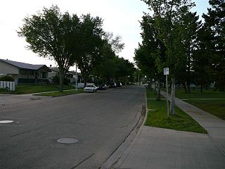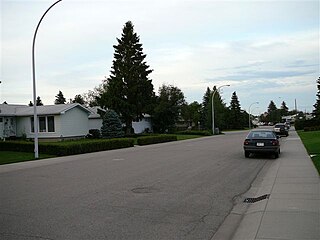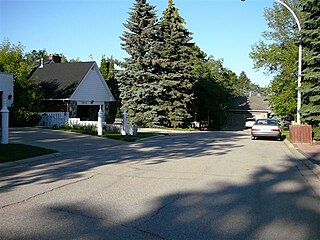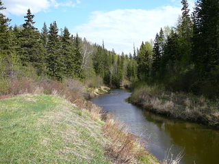
Elmwood is a neighbourhood in west Edmonton, Alberta, Canada that was a part of the Town of Jasper Place prior to Jasper Place's amalgamation with Edmonton in 1964. It is a residential neighbourhood located to the south east of West Edmonton Mall and to the south west of Meadowlark Health and Shopping Centre. Residents also have ready access to the Misericordia Community Hospital located just north of Elmwood in the neighbourhood of West Meadowlark Park.

Lynnwood is a residential neighbourhood in west Edmonton, Alberta, Canada. Its location gives residents good access to downtown, the University of Alberta, MacEwan College, and West Edmonton Mall. It became a part of Edmonton when the Town of Jasper Place amalgamated with Edmonton in 1964.
Strathcona is a residential neighbourhood in south central Edmonton, Alberta, Canada. It is a part of, and should not be confused with, Old Strathcona, although much of the Strathcona neighbourhood is in Old Strathcona. The neighbourhood overlooks both the North Saskatchewan River and the Mill Creek Ravine.
Haddow is a triangle-shaped residential neighbourhood in south west Edmonton, Alberta, Canada. It is bounded on the south west by Anthony Henday Drive and on the south east by Terwillegar Drive. The northern boundary is an undeveloped strip of land about 29 Avenue.
Lansdowne is a neighbourhood in south west Edmonton, Alberta, Canada overlooking the Whitemud Creek Ravine. The Snow Valley Ski Hill is located near the neighbourhood. The neighbourhood is situated directly across from Michener Park, a residential complex for students staying at the University of Alberta.
Parkview is a residential neighbourhood in west Edmonton, Alberta, Canada. Parkview is one of the larger residential neighbourhoods in the city, and is located adjacent to the North Saskatchewan River Valley in the west portion of the City. The neighbourhood has good access to Whitemud Drive and Stony Plain Road, and the interior street layout is based on a modified grid network.

Laurier Heights is a residential neighbourhood in west Edmonton, Alberta, Canada overlooking the North Saskatchewan River valley. A portion of the neighbourhood along Buena Vista Road is located in the river valley, and this portion is sometimes called Buena Vista.
Leger is a newer neighbourhood in the Terwillegar Heights area of south west Edmonton, Alberta, Canada.
Carter Crest is a triangle-shaped residential neighbourhood in south west Edmonton, Alberta, Canada. It is bounded on the north west by Terwillegar Drive, on the north east by Rabbit Hill Road, and on the south by a utility corridor located just north of 29 Avenue.

Whitemud Creek is a tributary of the North Saskatchewan River in central Alberta, Canada.
Bulyea Heights is a residential neighbourhood in the Riverbend area of south west Edmonton, Alberta, Canada. The neighbourhood overlooks Whitemud Creek Ravine. The neighbourhood is named for George H. V. Bulyea, first Lieutenant-Governor of the Province of Alberta.
Ramsay Heights is a residential neighbourhood in south west Edmonton, Alberta, Canada overlooking the North Saskatchewan River valley. It is named for Walter Ramsay, who came to the city in 1899 as a teacher and later became the city's first commercial florist.
Terwillegar Drive is a developing freeway in south-west Edmonton, Alberta. It is under construction, with the majority of its intersection at-grade, it retains its arterial road status. Once completed, it will be the third freeway in Edmonton not to have a highway designation after Groat Road and Wayne Gretzky Drive. South of Windermere Boulevard the roadway goes by 170 Street SW.
Mactaggart is a neighbourhood in southwest Edmonton, Alberta, Canada that was established in 2005 through the adoption of the Mactaggart Neighbourhood Area Structure Plan (NASP).
South Terwillegar is a neighbourhood in southwest Edmonton, Alberta, Canada that was established in 2003 through the adoption of the South Terwillegar Neighbourhood Area Structure Plan (NASP).
Quesnell Heights is a neighbourhood in west Edmonton, Alberta, Canada. It is bounded by the Rio Terrace neighbourhood across 149 Street to the west, Whitemud Drive to the north and east, the North Saskatchewan River valley to the south, Quesnell Heights is also the smallest neighbourhood in Edmonton.
Rio Terrace is a neighbourhood in west Edmonton, Alberta, Canada. It is bounded by the Patricia Heights neighbourhood across 156 Street to the west, the Lynnwood neighbourhood across Whitemud Drive to the north, the Quesnell Heights neighbourhood across 149 Street to the east, and the North Saskatchewan River valley to the south.
Patricia Heights is a neighbourhood in west Edmonton, Alberta, Canada. It is bounded by the Patricia Ravine of the North Saskatchewan River valley and ravine system to the south and southwest, the Westridge neighbourhood to the west, the Elmwood and Lynnwood neighbourhoods across Whitemud Drive to the north, and the Rio Terrace neighbourhood across 156 Street to the east.
Terwillegar Heights is a residential area in the southwest portion of the City of Edmonton in Alberta, Canada. It was established in 1992 through Edmonton City Council's adoption of the Terwillegar Heights Servicing Concept Design Brief, which guides the overall development of the area.


