
Makati, officially the City of Makati, is a highly urbanized city in the National Capital Region of the Philippines, known for being one of the leading financial centers in the country. As of 2013, the city has the highest concentration of multinational and local corporations in the Philippines. Major banks, corporations, department stores as well as foreign embassies are based in Makati. Makati is also known for being a major cultural and entertainment hub in Metro Manila. According to the 2020 census, it had a population of 629,616 people, making it as the 47th most populous city in the country and ranked as the 43rd most densely populated city in the world with 19,336 inhabitants per square kilometer or 50,080 inhabitants per square mile.

The Ayala Center is a 50-hectare (120-acre) mixed-use major commercial development operated by Ayala Land located in Barangay San Lorenzo within the Makati Central Business District in Makati, Metro Manila, Philippines. The complex comprises three shopping malls; three department stores, each with its own retail shops, restaurant arcades and cinemas; several hotels, eight residential towers, five office towers, four parking buildings and leisure amenities such as the Greenbelt Park, Glorietta 3 Park, and the Ayala Museum, showcasing exhibits on Philippine history and art.

Ayala Corporation is the publicly listed holding company for the diversified interests of the Ayala Group. Founded in the Philippines by Domingo Róxas and Antonio de Ayala during Spanish colonial rule, it is the country's oldest and largest conglomerate. The company has a portfolio of diverse business interests, including investments in retail, education, real estate, banking, telecommunications, water infrastructure, renewable energy, electronics, information technology, automotive, healthcare, management, and business process outsourcing. As of November 2015, it is the country's largest corporation in terms of assets.
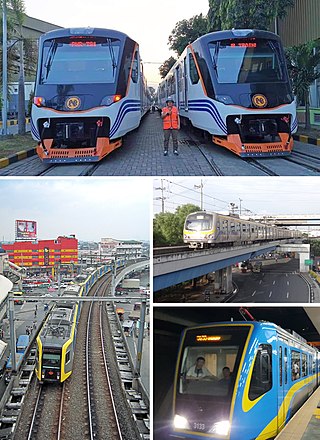
Rail transportation in the Philippines is currently used mostly to transport passengers within Metro Manila and provinces of Laguna and Quezon, as well as a commuter service in the Bicol Region. Freight transport services once operated in the country, but these services were halted. However, there are plans to restore old freight services and build new lines. From a peak of 1,100 kilometers (680 mi), the country currently has a railway footprint of 533.14 kilometers (331.28 mi), of which only 129.85 kilometers (80.69 mi) are operational as of 2024, including all the urban rail lines. World War II, natural calamities, underspending, and neglect have all contributed to the decline of the Philippine railway network. In the 2019 Global Competitiveness Report, the Philippines has the lowest efficiency score among other Asian countries in terms of efficiency of train services, receiving a score of 2.4, and ranking 86th out of 101 countries globally. The government is currently expanding the railway network up to 1,900 kilometers (1,200 mi) by 2022 through numerous projects.

Glorietta, also known as Ayala Malls Glorietta formerly known as Quad, is a shopping mall complex in the Ayala Center, Makati, Metro Manila, Philippines. The mall is owned by Ayala Land and operated through its subsidiary, the Ayala Malls. The mall is divided into five sections and contains many shops and restaurants, as well as cinemas, gyms, arcades and two central activity centers. Visitors have described the mall as maze-like, due to the complexity of its interior layout.

Bonifacio Global City is a central business district and major financial hub located in Taguig, Metro Manila, Philippines. It is located 11 kilometers (6.8 mi) southeast of the capital city of Manila. The district experienced commercial growth following the sale of a 440 ha military base at Fort Bonifacio by the Bases Conversion and Development Authority (BCDA). The entire district used to be the part of the main Philippine Army camp.

A subway, also known as an underpass, is a grade-separated pedestrian crossing running underneath a road or railway in order to entirely separate pedestrians and cyclists from motor or train traffic.

Ayala station, also known as Ayala Avenue station and Ayala Center station, is an underground Metro Rail Transit (MRT) station located on the MRT Line 3 (MRT-3) system in Makati. It is one of two underground stations that can be found on the line, the other being Buendia. The station is located in Makati and is named so due to its proximity to two places bearing the Ayala name: Ayala Center and Ayala Avenue.
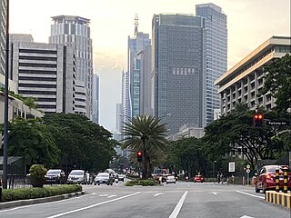
Ayala Avenue is a major thoroughfare in Makati, the Philippines. It is one of the busiest roads in Metro Manila, crossing through the heart of the Makati Central Business District. Because of the many businesses located along the avenue, Ayala Avenue is nicknamed the "Wall Street of the Philippines" and dubbed in the 1970s and 1980s as the "Madison Avenue of the Philippines".

Greenbelt, also known as Ayala Malls Greenbelt, is a shopping mall located at Ayala Center, Makati, Metro Manila, Philippines. It is owned by Ayala Malls, a real-estate subsidiary of Ayala Land, which is an affiliate of Ayala Corporation. It opened in 1988 after merging existing structures and is one of the Ayala Corporation's flagship projects. The mall offers a mix of high-end retail shops, restaurants, amenities, leisure and entertainment. Currently, the mall has five sections: two enclosed areas, two buildings with open-air shopping areas, and Greenbelt 5, which was opened in 2007.

Ayala Malls is a retail subsidiary of real estate company Ayala Land, an affiliate of Ayala Corporation. Founded in 1988, Ayala Malls owns a chain of large shopping malls, all located in the Philippines. Ayala Malls is one of the largest shopping mall retailer in the Philippines, along with SM Supermalls and Robinsons Malls.

Rizal Avenue, also known as Avenida Rizal or simply Avenida, is one of Manila's main thoroughfares running with two to six lanes from its Santa Cruz and Quiapo districts to the Bonifacio Monument (Monumento) Circle in Caloocan. Named after the national hero José Rizal, it is a part of Radial Road 9 (R-9). The LRT Line 1 elevated railroad is built above the street in its entire length, and several jeepneys ply the area taking passengers from Caloocan, Quezon City, and Valenzuela. Most of the street is within Santa Cruz, Manila. The avenue forms part of National Route 150 (N150) of the Philippine highway network.

Antonio Arnáiz Avenue, also known simply as Avenida Arnáiz and by its former official name Pásay Road, is a major east–west collector road that links Makati and Pasay in the Philippines. It stretches across western Metro Manila from Roxas Boulevard in Pasay to Epifanio de los Santos Avenue (EDSA/C-4) in Makati.

The Makati Central Business District is a privately-owned financial and central business district in the Philippines located in the heart of Makati in Metro Manila. It is politically and administratively known as "Central Cluster" in the West District of Makati. It is different from the Makati civic center known as "Makati Poblacion" which is situated at the northeast portion of the district. It is bounded by EDSA, Amorsolo Street, Ayala Avenue, Gil Puyat Avenue, Osmeña Highway, South Luzon Expressway, Metro Manila Skyway, Zobel Roxas Street, Ocampo Street, Metropolitan Avenue, Nicanor Garcia Street, Kalayaan Avenue, Makati Avenue, Anza Street, Polaris Street, Orion Street, Mercedes Street, Amapola Street and Estrella Street. The whole district occupies barangays of San Antonio, San Lorenzo, Bel-Air, and Urdaneta.
Aseana City is a 204-hectare (500-acre) mixed-use central business district development located in Parañaque, Metro Manila, Philippines. Owned and developed by D.M. Wenceslao & Associates (DMWAI) through Aseana Holdings, it is situated in the centermost portion of the Central Business Park between the SM business complex in the north and Asiaworld in the south within the Bay City area.

The Legazpi Active Park is a privately owned public space and pocket park in the Makati Central Business District in Makati, Metro Manila, Philippines. It is located in Legazpi Village in the western side of the CBD, adjacent to Washington SyCip Park and near Greenbelt. The park, best known as the location of a weekend market known as the Legazpi Sunday Market, is maintained by the Makati Commercial Estate Association which is headquartered in a two-storey building at the adjoining parking lot since 2017. Its name is in reference to its location along Legazpi Street within the formerly gated Legazpi Village that was merged with the neighboring gated San Lorenzo Village to form Barangay San Lorenzo.

The Lagusnilad Underpass refers to the pedestrian underpass in Manila, Philippines which connects the Manila City Hall and Intramuros. It also refers to the nearby vehicular underpass where part of the Taft and Padre Burgos Avenues merge.

The De La Rosa Elevated Walkway is a network of elevated pedway in Makati, Metro Manila, Philippines. Measuring 1,110 meters (3,640 ft), the structure is the longest elevated pedway in the Philippines. It runs mostly along De La Rosa Street in Legazpi Village of Makati Central Business District from Greenbelt at Ayala Center to Ayala North Exchange along Salcedo Street. It physically links buildings such as the Ayala North Exchange, Makati Medical Center, Eton Tower Makati, De La Rosa Car Park 1 & 2, The Enterprise Center Tower, and Greenbelt.

Cycling is a popular mode of transport and recreational sport in the Philippines. Bicycles were first introduced to the archipelago in the 1880s during the Spanish colonial occupation of the Philippines and served as a common mode of transport, especially among the local mestizo population.

One Ayala, also known as One Ayala Avenue (OAA), is a mixed-use development developed by Ayala Land located at Ayala Center via EDSA (C-4) in Makati, Metro Manila, Philippines. It is located across Glorietta mall and occupies the former InterContinental Manila and EDSA Carpark sites. It aims to combine retail, hotel, and office facilities in a single contiguous space. Construction began in 2016 with the demolition of InterContinental Manila and EDSA Carpark and parts of the development opened in 2022.


