Pasay Road station

Last updated
Pasay Road
Philippine National Railways (PNR).svg
03301jfInterchange Pasay Road railway station Makati Cityfvf 03.jpg
Station platform of Pasay Road station
General information
LocationEstacion Street, Pio del Pilar
Coordinates 14°32′58.68″N121°0′44.22″E / 14.5496333°N 121.0122833°E / 14.5496333; 121.0122833
Owned by Philippine National Railways
Operated byPhilippine National Railways
Line(s)  South Main Line
Planned: South Commuter
Platforms1 side platform and 1 island platform
Tracks2, 1 reserve
ConnectionsBuses and jeepneys
Construction
Structure type At grade
ParkingYes (Avida Towers San Lorenzo, WalterMart Makati)
AccessibleYes
Other information
Station codePRD
History
OpenedJune 21, 1908
ClosedMarch 28, 2024
Rebuilt1975 and 2009
Previous namesCuli-culi
Pio del Pilar
Services
Preceding station PNR Following station
Dela Rosa
towards Tutuban
Metro South Commuter EDSA
towards IRRI
España
towards Tutuban
Bicol Express Alabang
towards Legazpi
Isarog Limited Alabang
towards Naga
Location
Metro Manila location map.svg
Red pog.svg
Pasay Road
Location in Metro Manila
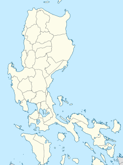
Philippines location map (Luzon mainland).svg
Red pog.svg
Pasay Road
Location in Luzon
Philippines location map (square).svg
Red pog.svg
Pasay Road
Location in the Philippines

Pasay Road station is a railway station located on the South Main Line in Makati, Metro Manila, Philippines. It is one of two stations (the other is Santa Mesa) in the line to have its own access road. It is named after Pasay Road, the old name of the Makati section of the adjacent Arnaiz Avenue.

Contents

The station is the tenth station from Tutuban and is one of three stations serving Makati, the other two being Dela Rosa and EDSA. It is the only station in Makati, and the only station between España and Alabang, which serves intercity trains, being a stopping point for the Bicol Express and Mayon Limited.

In addition to having its own dedicated access road, Pasay Road station is also one of three stations (the others being Santa Mesa and España) to have its original platforms extended and raised in order to accommodate new PNR diesel multiple units. The original platforms have been retained for the use of Commuter Express locomotives and especially for intercity trains.

Nearby landmarks

The station is adjacent to Waltermart Makati, the Don Bosco Technical Institute, Wilcon Depot Pasong Tamo, and several condominium developments such as the Cityland Pasong Tamo Tower, Laureano Di Trevi Towers, and Avida Towers San Lorenzo. Further away from the station are Makati Cinema Square, San Ildefonso Parish Church, Ayala Center, the Makati Central Business District, Ayala Museum, other condominium developments such as The Shang Grand Tower, the BSA Tower, The Beacon, and The Columns Legazpi Village.

Pasay Road station is accessible by jeepneys plying the Chino Roces and Arnaiz Avenue routes, as well as buses plying the South Luzon Expressway route.

History

Pasay Road was opened on June 21, 1908 as Culi-culi station, [1] named after the barrio of the same name (the present-day Barangay Pio del Pilar) where it is located. [2] Originally part of the Batangas Line, it is the first railroad station in Makati, which was then a town named San Pedro [de] Macati in Rizal. [1] [3] It also served as the terminal of the defunct Manila Railroad branch towards Nielson Field. [4] A wooden station building and raised elevation was built in 1924, while the yard trackage was increased. [5]

The station building and platforms were renovated in 1975 as Pio Del Pilar station, following the track duplication of the line from Paco up to this station. [6] The track duplication of the line was further extended, reaching Sucat by 1978.

A new platform was built in 2009 north of the old station building.

On March 28, 2024, station operations were temporarily suspended to make way for the construction of the North–South Commuter Railway. [7]

Station layout

L1
Platforms
Side platform, doors will open on the right
Platform A PNR Metro Commuter towards Tutuban (←)
Platform B PNR Metro Commuter towards Alabang (→)
Island platform, doors will open on either the left or the right
Platform B PNR Metro Commuter towards Tutuban (←) or Alabang (→)
L1Concourse/
Street Level
Ticket Booths, Station Control, Shops, The Columns Legazpi Village, Cityland Pasong Tamo Tower, Avida Towers San Lorenzo, Waltermart Makati, The Beacon, Don Bosco Technical Institute

Related Research Articles

<span class="mw-page-title-main">Makati</span> Highly urbanized city in Metro Manila, Philippines

Makati, officially the City of Makati, is a highly urbanized city in the National Capital Region of the Philippines, known for being one of the leading financial centers in the country. As of 2013, the city has the highest concentration of multinational and local corporations in the Philippines. Major banks, corporations, department stores as well as foreign embassies are based in Makati. Makati is also known for being a major cultural and entertainment hub in Metro Manila. According to the 2020 census, it had a population of 629,616 people, making it as the 47th most populous city in the country and ranked as the 43rd most densely populated city in the world with 19,336 inhabitants per square kilometer or 50,080 inhabitants per square mile.

<span class="mw-page-title-main">Magallanes station</span> Train station in Makati, Philippines

Magallanes station is an elevated Metro Rail Transit (MRT) station located on the MRT Line 3 (MRT-3) system in Makati. The station is named after barangay Magallanes of Makati, which in turn is named after Ferdinand Magellan. Although the station is named after Magallanes, it also serves passengers from Kayamanan-C and barangays Dasmariñas, Pio del Pilar, and San Lorenzo in Makati, and those from Taguig.

<span class="mw-page-title-main">Pío del Pilar</span>

Pío del Pilar was a Filipino revolutionary general. He was one of the lead figures in the Philippine Revolution, and fought major battles in Manila and Cavite.

<span class="mw-page-title-main">Santa Mesa station</span> PNR Railway Station in Manila, Philippines

Santa Mesa station is a railway station located on the South Main Line in the city of Manila, Philippines. It is one of two stations in the line to have its own access road.

<span class="mw-page-title-main">Blumentritt station (PNR)</span> Southrail station in Manila

Blumentritt station is a railway station located on the South Main Line in the city of Manila, Philippines. It is currently being repurposed as an elevated station of the under construction North–South Commuter Railway. It derives its name from nearby Blumentritt Road, which is named after the Bohemian professor Ferdinand Blumentritt, a friend of José Rizal and sympathizer of the Filipino cause.

<span class="mw-page-title-main">Buendia station (PNR)</span>

Buendia station is a former railway station located on the South Main Line in Makati, Metro Manila, Philippines.

<span class="mw-page-title-main">EDSA station (PNR)</span> Southrail stop in Makati, Philippines

EDSA station is a railway station located on the South Main Line in Makati, Metro Manila, Philippines. It derives its name from nearby Epifanio de los Santos Avenue. It is currently being repurposed to become a station of the under construction North–South Commuter Railway.

<span class="mw-page-title-main">Caloocan station</span> Railway station in Metro Manila, Philippines

Caloocan station is a railway station located on the North Main Line in Caloocan, Metro Manila, Philippines. It is rebuilt from its original location, now situated adjacent to the Caloocan railway depot, near Samson Road.

<span class="mw-page-title-main">Gil Puyat Avenue</span> Road in Metro Manila, Philippines

Senator Gil J. Puyat Avenue, also known simply as Gil Puyat Avenue and by its former official name Buendia Avenue, is a major arterial thoroughfare which travels east–west through the cities of Makati and Pasay in western Metro Manila, Philippines. It is one of the busiest avenues in Metro Manila linking the Makati Central Business District with the rest of the metropolis.

<span class="mw-page-title-main">Makati Avenue</span> Thoroughfare in Makati, Philippines

Makati Avenue is a major commercial thoroughfare in Makati, Metro Manila, Philippines. It forms the eastern border of Ayala Triangle and is one of the three main avenues of the Makati Central Business District. The avenue runs in a somewhat north–south diagonal direction almost parallel with Epifanio de los Santos Avenue (EDSA). It passes through two distinct neighborhoods of the city: the Makati CBD and the old Makati Población. At its northern end lies the older part of Makati starting from J.P. Rizal Avenue. It continues through Población to Gil Puyat Avenue, marking the southern edge of the old district. South of Gil Puyat onto the CBD, the avenue becomes more commercial and upscale. The shopping hub of Ayala Center and Arnaiz Avenue lie at its southern end.

<span class="mw-page-title-main">Arnaiz Avenue</span> Collector road in Metro Manila, Philippines

Antonio Arnáiz Avenue, also known simply as Avenida Arnáiz and by its former official name Pásay Road, is a major east–west collector road that links Makati and Pasay in the Philippines. It stretches across western Metro Manila from Roxas Boulevard in Pasay to Epifanio de los Santos Avenue (EDSA/C-4) in Makati.

<span class="mw-page-title-main">Chino Roces Avenue</span> Road in Metro Manila, Philippines

Chino Roces Avenue, formerly known as Pasong Tamo, is a prominent north–south road in the cities of Makati and Taguig, Metro Manila, Philippines. It runs for 5.80 kilometers from Olympia and Tejeros to Fort Bonifacio. The avenue is named after the Filipino journalist Joaquin "Chino" Roces. The fact that the avenue is the location of various media establishments influenced the renaming.

<span class="mw-page-title-main">McKinley Road</span> Avenue in Metro Manila, Philippines

McKinley Road is a tree-lined avenue linking the central business districts of Makati and Bonifacio Global City, Taguig in Metro Manila, Philippines. It is a continuation of Ayala Avenue, south of Epifanio de los Santos Avenue (EDSA), which runs for approximately 1.9 kilometers (1.2 mi) through the affluent neighborhoods of Forbes Park and Dasmariñas Village. It is home to the exclusive Manila Polo Club and the Manila Golf and Country Club.

<span class="mw-page-title-main">Lawton Avenue</span> Road in Taguig, Philippines

Lawton Avenue, also known as the Fort Bonifacio–Nichols Field Road and Nichols Field Road, is the main road in Fort Bonifacio, Taguig, Metro Manila, Philippines. It follows a part of the alignment of the old Nichols route running roughly southwest to northeast from Sales Interchange to 5th Avenue and the Manila American Cemetery and Memorial. It was named after Henry Ware Lawton, a US Army general killed during the Philippine–American War.

<span class="mw-page-title-main">Outline of Metro Manila</span> Overview of and topical guide to Metro Manila

The following outline is provided as an overview of and topical guide to Metro Manila:

<span class="mw-page-title-main">Index of Metro Manila–related articles</span>

The following is an alphabetical list of articles related to the Philippine capital region of Metro Manila.

<span class="mw-page-title-main">Osmeña Highway</span> Major road in Metro Manila, Philippines

The President Sergio Osmeña Sr. Highway, also known as the South Superhighway, is a 4.595-kilometer (2.855 mi) major highway that links Quirino Avenue in Paco, Manila to Epifanio de los Santos Avenue (EDSA) and South Luzon Expressway (SLEX) at the Magallanes Interchange in Makati.

<span class="mw-page-title-main">Dela Rosa station</span> Railway station in the Philippines

Dela Rosa station is a railway station located on the South Main Line in Makati, Metro Manila, Philippines.

References

  1. 1 2 General Map of the Island of Luzon, Phil. Is. Showing the Manila Railroad Company's Railway & Water Lines (Map). 1:1,060,000. Bureau Coast and Geodetic Survey Litho. 1930. Retrieved March 9, 2022.
  2. Republic Act No. 2570 (June 21, 1959), An Act Changing the Name of the Barrio of Culi-Culi in the Municipality of Makati, Province of Rizal, to Pio Del Pilar , retrieved March 9, 2022
  3. "PHILIPPINE RAILWAYS" (PDF). November 10, 2018. Retrieved January 6, 2023.
  4. Manila, Philippines map (Map). American Red Cross Service Bureau. August 1945.
  5. Report of the General Manager for the Year Ended December 31, 1923. Manila: Bureau of Printing. 1924. Retrieved March 11, 2022.
  6. "1975 1128 New PNR Pio del Pilar Station". Flickr. Retrieved March 11, 2022.
  7. Sarao, Zacarian (March 8, 2024). "PNR to suspend Metro Manila operations for 5 years starting March 28". Philippine Daily Inquirer. Retrieved November 8, 2024.