Central Terminal (LRT)

Last updated

Central Terminal
ManilaLine1Logo.svg
Central Terminal Platform.jpg
The Platform of the station
General information
LocationAntonio Villegas Street, Ermita, Manila, Metro Manila, Philippines
Owned by Department of Transportation
Light Rail Manila Corporation
Line(s)      Line 1
Platforms2 (2 side)
Tracks2
Connections BSicon BUS2.svg Lawton Park N' Ride
BSicon BUS2.svg Manila Multimodal Terminal
PasigRiverFerryServiceLogo.png Lawton Ferry Station
Construction
Structure typeViaduct
ParkingYes (Lawton Park N' Ride, UDM, Bonifacio Shrine, SM City Manila)
Bicycle facilities Bicycle racks
Other information
Station codeCT
History
OpenedMay 12, 1985;38 years ago (1985-05-12)
Services
Preceding station Lrtalogo.svg
Manila LRT
Following station
Carriedo Line 1 United Nations
towards Baclaran
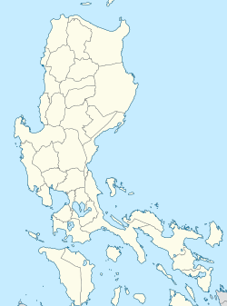
Location
Location map Manila.png
Red pog.svg
Central Terminal
Location within Metro Manila

Central Station (sometimes called Arroceros station or Lawton station) is an elevated Manila Light Rail Transit (LRT) station situated on Line 1. It is located in Ermita, Manila. A popular name for the station is Arroceros due to its proximity to the Arroceros Forest Park.

Contents

Central Terminal is the last station of LRT Line 1 south of the Pasig River and serves as the ninth station for trains headed to Fernando Poe Jr. and the twelfth station for trains headed to Baclaran. It is also near some of Manila's major landmarks, such as the Mehan Gardens and the Manila Metropolitan Theater. It is also near the Manila City Hall, Liwasang Bonifacio, Manila Central Post Office, Manila Hall of Justice, Bonifacio Shrine, and the National Museum of Fine Arts. SM City Manila is also a nearby shopping center.

Due to its location in Manila's University Belt, the station is near educational institutions such as the Colegio de San Juan de Letran, the Philippine Normal University, the city-owned Pamantasan ng Lungsod ng Maynila, the Mapúa University, and the Lyceum of the Philippines University. All those institutions, except the Philippine Normal University, lie within the former Spanish walled city of Intramuros.

Central Terminal is one of the four stations and terminals in the whole LRT-1 system that allows commuters to catch a train going in the opposite direction without paying a new fare due to the station's layout. The other three stops are Carriedo, Balintawak, and Fernando Poe Jr.

Owing to its name, Central Terminal is a major transportation hub for LRT-1 commuters. Next to the station is the Lawton bus terminal, also known as Lawton Park N' Ride, which is served by intercity and intracity buses, jeepneys, and UV Express vehicles. The Manila Multimodal Terminal by the Pasig River is also located near the station. Taxis also serve the vicinity of the station and of the bus terminal. The Lawton station of the Pasig River Ferry Service is also located nearby.

Station layout

Street level

Bust of Andres Bonifacio at the station's ground level Ermita, Manila Aroceros (Metro Manila; 2023-08-18) E911a 03.jpg
Bust of Andres Bonifacio at the station's ground level

Central Terminal has a unique layout as the only station on the line with separate street-level exits that bypass the station concourse, which are located on all of its four corners. Access to the station concourse is provided by two large staircases, in which only one is normally in use. Each of the four corner exits on the street level have one-way revolving doors to prevent counterflow entry through these exits.

The street level of the station has multiple shops, stalls, and some street vendors.

Station concourse

The concourse of the station is much wider than most stations on the LRT-1 mainline, allowing space for more ticket offices and fare gates. Some of the operations offices are also located at the concourse, as well as a restroom.

Platform level

Each platform of the station has two entrances and two exits. The middle-north and middle-south staircases of each platform provides direct exit access to the street level, while the north staircases on each platform serve as both the entrance and exit of each platform to the station concourse. The south staircases on both platforms are currently not in use. A clinic is located on the south end of the northbound platform.

Nearby buildings

The northern and middle exits provide access to the Arroceros Forest Park, Lawton Park 'N Ride, Lawton Bus Terminal, the Manila Metropolitan Theater, and the Mehan Gardens. Commuters going to Intramuros and the Port Area are usually advised to take the Lawton underpass at the Lawton Bus Terminal.

The middle exit provides access to the Metropolitan Trial Court, Maynilad Water Services, Civil Service Commission, Manila Youth Reception Center.

The southern exits provide access to the Manila City Hall, Universidad de Manila, Office of the Ombudsman, Bonifacio Park, Philippine Normal University, Adamson University, National Museum of the Philippines, and SM City Manila.

See also

14°35′34.45″N120°58′53.84″E / 14.5929028°N 120.9816222°E / 14.5929028; 120.9816222

Related Research Articles

<span class="mw-page-title-main">Ermita</span> District of Manila, Metro Manila, Philippines

Ermita is a district in Manila, Philippines. Located at the central part of the city, the district is a significant center of finance, education, culture, and commerce. Ermita serves as the civic center of the city, bearing the seat of city government and a large portion of the area's employment, business, and entertainment activities.

<span class="mw-page-title-main">Monumento station</span>

Monumento station is an elevated Manila Light Rail Transit (LRT) station situated on Line 1. The station serves the southern portion of Caloocan, and is named after the most famous landmark of Caloocan, the Monumento Circle, which houses the Bonifacio Monument, a famous monument to Andrés Bonifacio. The name Monumento itself is derived from the Spanish word for monument. Being a former northern terminus of Line 1, it is called Monumento Terminal.

<span class="mw-page-title-main">Doroteo Jose station</span> LRT Line 1 stop in Manila, Philippines

Doroteo Jose station is an elevated Manila Light Rail Transit (LRT) station situated on Line 1. The station is located in Santa Cruz in Manila, on Rizal Avenue and slightly past Doroteo Jose Street. Both the station and the street are named after Doroteo Jose, a Filipino who was arrested by Spanish authorities in 1898 for leading a movement against a corrupt archbishop.

<span class="mw-page-title-main">Recto station</span> LRT Line 2 station in Manila

Recto station is an elevated Manila Light Rail Transit (LRT) station situated on Line 2. Located on Recto Avenue at the district boundary of Santa Cruz and Quiapo in Manila, it is the western terminus of the line. Its convenient location has helped create many businesses in the area, from the number of hotels and motels to restaurants and shops, with a good majority of them being a short walk from the station. It is the busiest station in the rail line.

<span class="mw-page-title-main">Araneta Center–Cubao station (LRT)</span> LRT Line 2 station in Quezon City

Araneta Center–Cubao station is an elevated Manila Light Rail Transit (LRT) station situated on Line 2. The station is located in Cubao in Quezon City and is named after the old name of Araneta City, a mixed-use development.

<span class="mw-page-title-main">Carriedo station</span>

Carriedo station is an elevated Manila Light Rail Transit (LRT) station situated on Line 1. The station is located along the district boundary of Santa Cruz and Quiapo in Manila.

<span class="mw-page-title-main">Shaw Boulevard station</span>

Shaw Boulevard station is an elevated Manila Metro Rail Transit (MRT) station situated on Line 3. The station is located in the Mandaluyong portion of Ortigas Center and is named after Shaw Boulevard, since the station lies directly above the boulevard. Being at the center of the whole line, many commuters regard Shaw Boulevard station as the "central terminal" of the line.

<span class="mw-page-title-main">Ayala station</span> Metro station in Manila, Philippines

Ayala station is an underground Manila Metro Rail Transit (MRT) station situated on Line 3. It is one of two underground stations that can be found on the line, the other being Buendia. The station is located in Makati and is named so due to its proximity to two places bearing the Ayala name: Ayala Center and Ayala Avenue.

<span class="mw-page-title-main">Guadalupe station (MRT)</span> MRT Line 3 station in Makati, Philippines

Guadalupe station is an elevated Manila Metro Rail Transit (MRT) station situated on Line 3. It is located in Makati, Philippines and is named because of its location between the barangays of Guadalupe Nuevo and Guadalupe Viejo, both are in turn named after Our Lady of Guadalupe.

<span class="mw-page-title-main">Boni station</span>

Boni station is a Manila Metro Rail Transit (MRT) station situated on Line 3. It is located in Mandaluyong and is named so due to its proximity to Boni Avenue, which is in turn named after the nickname of Bonifacio Javier, a World War II guerilla leader and former mayor of Mandaluyong. It has several restaurants and shops that surround the station, including a public market located across the train station.

<span class="mw-page-title-main">Pureza station</span> LRT Line 2 station in Santa Mesa, Manila

Pureza station is an elevated Manila Light Rail Transit (LRT) station situated on Line 2. The station is located in Santa Mesa, Manila and is named because of its location on Pureza Street.

<span class="mw-page-title-main">Transportation in Metro Manila</span> Overview of Metro Manilas transportation system

The transportation system in Metro Manila is currently inadequate to accommodate the mobility and other basic needs of a densely populated metropolis, the result of many factors and problems that the government has failed to provide or address. Metro Manila exists in a state of near-permanent gridlock, with people and goods trapped by the very system that is supposed to move them quickly and efficiently. Car ownership has also risen dramatically, both because of the insufficient public transportation network and of cars being viewed as status symbols. In recent years, however, the Philippine government has been pushing to improve the mass transit system through various infrastructure projects, hoping to solve the interlinked problems of transportation, land use and environment.

<span class="mw-page-title-main">Padre Burgos Avenue</span> Street in Manila, Philippines

Padre Burgos Avenue, also known as Padre Burgos Street, is a 14-lane thoroughfare in Manila, Philippines.

<span class="mw-page-title-main">Parián (Manila)</span>

Parián or Pantin, also Parián de Arroceros was an area adjacent to Intramuros built to house Chinese (Sangley) merchants in Manila in the 16th and 17th centuries during the Spanish rule in the Philippines. The place gave its name to the gate connecting it to Intramuros, the Puerta del Parián.

<span class="mw-page-title-main">Arroceros Urban Forest Park</span>

<span class="mw-page-title-main">Liwasang Bonifacio</span>

The Liwasang Bonifacio, also known by its former name, Plaza Lawton, is a city square and transport hub in front of the Manila Central Post Office in the Ermita district of Manila, Philippines. It lies at the south end of Jones Bridge, MacArthur Bridge, and Quezon Bridge that link the northern districts of Binondo, Santa Cruz, and Quiapo to the central district of Ermita. The plaza straddles the dividing line between Ermita and Intramuros and is the starting point of Padre Burgos Avenue which connects to Taft Avenue and Roxas Boulevard in Rizal Park.

The Metro Rail Transit Line 4 (MRT-4) is an upcoming rapid transit line serving the Greater Manila Area of the Philippines. The 12.7 km (7.9 mi), 10-station elevated railway will connect Ortigas Center in Metro Manila and the suburban municipality of Taytay in the neighboring province of Rizal. It will traverse along Ortigas Avenue and Manila East Road, starting at the former's junction with EDSA in Quezon City to the west until it terminates near the New Taytay Public Market to the east.

<span class="mw-page-title-main">Circumferential Road 1</span>

Circumferential Road 1 (C-1), informally known as the C-1 Road, is a network of roads and bridges that all together form the first and innermost beltway of Metro Manila in the Philippines. Spanning some 5.98 kilometers (3.72 mi), it connects the districts of Ermita, Intramuros, San Miguel, Quiapo, Sampaloc, Santa Cruz, Binondo, San Nicolas, and Tondo in Manila.

<span class="mw-page-title-main">Outline of Metro Manila</span> Overview of and topical guide to Metro Manila

The following outline is provided as an overview of and topical guide to Metro Manila:

<span class="mw-page-title-main">Index of Metro Manila–related articles</span>

The following is an alphabetical list of articles related to the Philippine capital region of Metro Manila.