Santa Mesa station

Last updated
Santa Mesa
Philippine National Railways (PNR).svg
Santa Mesa PNR 2020-02-22.jpg
Santa Mesa station platform area in February 2020.
General information
LocationAltura Extension, Santa Mesa
Manila, Metro Manila
Philippines
Coordinates 14°36′2.74″N121°0′37.25″E / 14.6007611°N 121.0103472°E / 14.6007611; 121.0103472
Owned by Philippine National Railways
Operated byPhilippine National Railways
Line(s)  South Main Line
Planned: South Commuter
Former:  Antipolo
Platforms Side platforms
Tracks2
Connections Lrtalogo.svg Pureza
Maki7-ferry.svg PasigRiverFerryServiceLogo.png PUP Ferry Station
Jeepneys, buses, cycle rickshaws
Construction
Structure type At grade
ParkingYes
AccessibleYes
Other information
Station codeSA
History
OpenedDecember 22, 1905;118 years ago (1905-12-22)
Rebuilt1920;104 years ago (1920)
2009;15 years ago (2009)
Services
Preceding station PNR Following station
España North Shuttle Paco
towards Bicutan
España
towards Tutuban
Metro South Commuter Pandacan
towards IRRI
Out-of-system interchange
Preceding station Lrtalogo.svg
Manila LRT
Following station
V. Mapa
towards Antipolo
Line 2
transfer at Pureza
Legarda
towards Recto
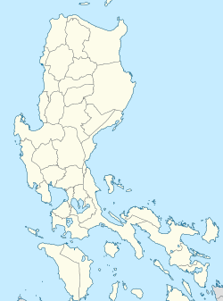
Location
Location map Manila.png
Red pog.svg
Santa Mesa
Location within Metro Manila

Santa Mesa station is a railway station located on the South Main Line in the city of Manila, Philippines. It is one of two stations (the other is Pasay Road) in the line to have its own access road.

Contents

The station is the fourth station southbound from Tutuban and is the only railway station serving Santa Mesa.

In addition to having its own dedicated access road, Santa Mesa station is also one of three stations (the others being Pasay Road and España) to have its original platforms extended and raised in order to accommodate new PNR diesel multiple units. The original platforms have been retained for the use of Commuter Express locomotives and especially for intercity trains, although Santa Mesa is not designated as a station where these trains can stop. The station used to serve the Santa Mesa-Mandaluyong branch line, also known as Guadalupe line, which used to run up to Antipolo and Montalban. This line has since been dismantled.

History

Santa Mesa was opened on December 22, 1905 as a station originally situated on the Antipolo and Montalban lines. From this station, the Main Line South, as well as its subsequent branch lines which were later abandoned (Naic and Carmona, Cavite; Batangas; Bay, Santa Cruz and Pagsanjan, Laguna; Canlubang, Laguna), branched out southwest from the line heading east southeast to Antipolo and Montalban. Main Line South was constructed not long afterward and was the first railway line of Manila Railroad Company (MRR, later PNR) crossing the Pasig River, with Pandacan and all the oil refineries and other branch lines, including one right to the former site of Philippine Vegetable Oil Company in Santa Mesa, being constructed right after the Pasig River bridge. [1]

Station layout

L1
Platforms
Side platform, doors will open on the right
Platform A PNR Metro Commuter towards Tutuban (←)
Platform B PNR Metro Commuter towards Alabang (→)
Side platform, doors will open on the right
L1Concourse/
Street Level
Ticket Booths, Station Control, Shops, Line 2 Pureza Station, Polytechnic University of the Philippines, Puregold Sta. Mesa

Nearby landmarks

The station is near landmarks such as the Santa Mesa Public Market, SM City Sta. Mesa, Puregold Sta. Mesa, the main campus of the Polytechnic University of the Philippines (PUP), the Eulogio "Amang" Rodriguez Institute of Science and Technology (EARIST), the Sacred Heart of Jesus Catholic School, and the Philippine headquarters of the Tzu Chi Foundation.

Santa Mesa station is accessible by jeepneys and buses plying the Ramon Magsaysay Boulevard route. Several cycle rickshaw terminals are also located near the station.

A Line 2 station, Pureza, is a short walk from Santa Mesa station. Alternately, commuters may opt to ride tricycles to there.

Reconstruction

Santa Mesa station will be reconstructed as part of the North–South Commuter Railway. The two side platforms at the new station building's fifth level will be the highest in the world from ground level at 29.9 m (98 ft), exceeding Smith–Ninth Streets station's 26.7 m (88 ft). [2]


Related Research Articles

<span class="mw-page-title-main">Transportation in the Philippines</span> Overview of the transportation in the Philippines

Transportation in the Philippines covers the transportation methods within this archipelagic nation of over 7,500 islands. From a previously underdeveloped state of transportation, the government of the Philippines has been improving transportation through various direct infrastructure projects, and these include an increase in air, sea, road, and rail transportation and transport hubs.

<span class="mw-page-title-main">Pasig</span> Highly urbanized city in Metro Manila, Philippines

Pasig, officially the City of Pasig, is a highly urbanized city in the National Capital Region of the Philippines. According to the 2020 census, it has a population of 803,159 people.

<span class="mw-page-title-main">Philippine National Railways</span> Railway company in the Philippines

The Philippine National Railways (PNR) is a state-owned railway company in the Philippines which operates one commuter rail service between Metro Manila and Laguna, and local services between Sipocot, Naga and Legazpi in the Bicol Region. It is an attached agency of the Department of Transportation.

<span class="mw-page-title-main">Antipolo</span> Capital of Rizal, Philippines

Antipolo, officially the City of Antipolo, is a 1st class component city and capital of the province of Rizal, Philippines. According to the 2020 census, it has a population of 887,399 people. It is the most populous city in the Calabarzon region, and the seventh most-populous city in the Philippines. And also, it is the most populated city under the component city status.

<span class="mw-page-title-main">Rail transportation in the Philippines</span> Overview of rail transport in the Philippines

Rail transportation in the Philippines is currently used mostly to transport passengers within Metro Manila and provinces of Laguna and Quezon, as well as a commuter service in the Bicol Region. Freight transport services once operated in the country, but these services were halted. However, there are plans to restore old freight services and build new lines. From a peak of 1,100 kilometers (680 mi), the country currently has a railway footprint of 533.14 kilometers (331.28 mi), of which only 129.85 kilometers (80.69 mi) are operational as of 2024, including all the urban rail lines. World War II, natural calamities, underspending, and neglect have all contributed to the decline of the Philippine railway network. In the 2019 Global Competitiveness Report, the Philippines has the lowest efficiency score among other Asian countries in terms of efficiency of train services, receiving a score of 2.4, and ranking 86th out of 101 countries globally. The government is currently expanding the railway network up to 1,900 kilometers (1,200 mi) by 2022 through numerous projects.

<span class="mw-page-title-main">203 series</span> Japanese train type

The 203 series (203系) is an electric multiple unit (EMU) train type operated in Japan between 1982 and 2011 by Japanese National Railways (JNR) and later by East Japan Railway Company, and currently operated by KAI Commuter and Philippine National Railways.

<span class="mw-page-title-main">Blumentritt station (PNR)</span> Southrail station in Manila

Blumentritt station is a railway station located on the South Main Line in the city of Manila, Philippines. It derives its name from nearby Blumentritt Road, which is named after the Bohemian professor Ferdinand Blumentritt, a friend of José Rizal and sympathizer of the Filipino cause.

<span class="mw-page-title-main">Pasay Road station</span> Railway station in Makati, Philippines

Pasay Road station is a railway station located on the South Main Line in Makati, Metro Manila, Philippines. It is one of two stations in the line to have its own access road. It is named after Pasay Road, the old name of the Makati section of the adjacent Arnaiz Avenue.

<span class="mw-page-title-main">Sucat station</span> Railway station in Muntinlupa, Philippines

Sucat station is a railway station located on the South Main Line in Muntinlupa, Metro Manila, Philippines. It was originally established by the Manila Railway Company in 1908 as part of the construction of the original Southern Lines to the province of Tayabas, since renamed Quezon. It is also the southernmost area on the PNR Metro Commuter Line to be upgraded to double track as a result of a proposed electrification scheme in 1978.

<span class="mw-page-title-main">San Pedro station</span> Railway station in San Pedro, Laguna, Philippines

San Pedro station is a railway station located on the South Main Line in Laguna, Philippines.

<span class="mw-page-title-main">PNR Metro Commuter Line</span> Commuter rail line in the Philippines

The PNR Metro Commuter Line is a commuter rail line operated by the Philippine National Railways. It was first inaugurated as the Metro Manila Commuter Service in 1970, and originally served the North Main Line and the South Main Lines, as well as the defunct Carmona and Guadalupe branch lines. Since then, it adopted several names such as Metrotrak and Metrotren, before adopting its present name in the late 2000s. The line is also nicknamed the Orange Line due to its designation in the 1970s.

<span class="mw-page-title-main">Outline of Metro Manila</span> Overview of and topical guide to Metro Manila

The following outline is provided as an overview of and topical guide to Metro Manila:

<span class="mw-page-title-main">Index of Metro Manila–related articles</span>

The following is an alphabetical list of articles related to the Philippine capital region of Metro Manila.

<span class="mw-page-title-main">North–South Commuter Railway</span> Future commuter railway line in the Philippines

The North–South Commuter Railway (NSCR), also known as the Clark–Calamba Railway, is a 147-kilometer (91-mile) urban rail transit system under construction in the island of Luzon, Philippines. Running from New Clark City in Capas to Calamba, Laguna with 36 stations and four services, the railway is designed to improve connectivity within the Greater Manila Area, and it will be integrated with the railway network in the region.

<span class="mw-page-title-main">PNR South Main Line</span> Philippine rail line

The PNR South Main Line is one of the two trunk lines that form the Philippine National Railways' network in the island of Luzon, Philippines. It was opened in stages between 1916 and 1938 by the Manila Railroad. Services peaked in the 1940s until the late 1960s, when the system started to decline. Since 1988, it was the only functioning inter-city rail after its counterpart to the north, the North Main Line, was closed. The intercity section of the line in Laguna, Quezon and the Bicol Region was then closed and reopened repeatedly between 2004 and 2014 due to a combination of declining ridership and was closed since then. Currently, only a little more than half of line is operational PNR Metro Commuter Line between Tutuban station and Laguna, Inter-Provincial Commuter from San Pedro to Lucena and the Bicol Commuter regional rail service between Sipocot, Naga Camarines Sur and Legazpi Albay.

College Station is a railway station located on the South Main Line in Los Baños, Laguna, Philippines.

<span class="mw-page-title-main">PNR South Long Haul</span> Philippine rail line

The PNR South Long Haul Project, also known as PNR Bicol is a proposed inter-city rail line in southern Luzon, Philippines. It is part of the larger Luzon Rail System, a network of long-distance standard-gauge lines being built by the Philippine National Railways throughout Luzon. It is one of the two lines that will reconstruct the historic PNR South Main Line, along with the electrified North–South Commuter Railway South section to Calamba, Laguna.

<span class="mw-page-title-main">PNR North Main Line</span> Rail service between the NCR and Central Luzon, Philippines

The PNR North Main Line is one of the two trunk lines of the Philippine National Railways in the island of Luzon, the other being the PNR South Main Line. The line during its maximum extent led to various cities and municipalities in Central Luzon and the Ilocos Region.

<span class="mw-page-title-main">Rail transportation in the Greater Manila Area</span>

Rail transportation in the Greater Manila Area is a major part of the transportation system in Metro Manila and its surrounding areas. It consists of the Manila Light Rail Transit System, Manila Metro Rail Transit System, and the PNR Metro Commuter Line. The network makes up the majority of active railways in the country and bear the brunt of providing the metropolis with rail as a faster alternative mode of transport other than buses and jeepneys. However, these systems are currently insufficient for the rapidly expanding metropolis; to address this, new lines and line extensions are under construction, which will extend the system far out into neighboring regions.

References

  1. General Map of the Island of Luzon, Phil. Is. Showing the Manila Railroad Company's Railway & Water Lines (Map). 1:1,060,000. Bureau Coast and Geodetic Survey Litho. 1930. Retrieved March 10, 2022.
  2. Structural Drawings. NSRP Detailed Design Package CP S-02: Santa Mesa station (Report). October 2020. Retrieved August 18, 2021.