This article needs additional citations for verification .(February 2024) |
 Alabang station in 2019 | ||||||||||||||||||||||||||||||||||||
| General information | ||||||||||||||||||||||||||||||||||||
| Location | T. Molina Street, Alabang Muntinlupa, Metro Manila Philippines | |||||||||||||||||||||||||||||||||||
| Coordinates | 14°25′10.46″N121°2′51.63″E / 14.4195722°N 121.0476750°E | |||||||||||||||||||||||||||||||||||
| Owned by | Philippine National Railways | |||||||||||||||||||||||||||||||||||
| Operated by | Philippine National Railways | |||||||||||||||||||||||||||||||||||
| Line(s) | South Main Line Planned: South Commuter | |||||||||||||||||||||||||||||||||||
| Platforms | Side platform | |||||||||||||||||||||||||||||||||||
| Tracks | 1, plus 1 siding track | |||||||||||||||||||||||||||||||||||
| Connections | Buses, jeepneys, and PUVs | |||||||||||||||||||||||||||||||||||
| Construction | ||||||||||||||||||||||||||||||||||||
| Structure type | At grade | |||||||||||||||||||||||||||||||||||
| Bicycle facilities | No | |||||||||||||||||||||||||||||||||||
| Accessible | Yes (2016) | |||||||||||||||||||||||||||||||||||
| Other information | ||||||||||||||||||||||||||||||||||||
| Status | Mostly Terminus | |||||||||||||||||||||||||||||||||||
| Station code | AA | |||||||||||||||||||||||||||||||||||
| History | ||||||||||||||||||||||||||||||||||||
| Opened | 1908 | |||||||||||||||||||||||||||||||||||
| Closed | March 28, 2024 | |||||||||||||||||||||||||||||||||||
| Rebuilt | April 19, 2010 | |||||||||||||||||||||||||||||||||||
| Services | ||||||||||||||||||||||||||||||||||||
| ||||||||||||||||||||||||||||||||||||
| ||||||||||||||||||||||||||||||||||||
| ||||||||||||||||||||||||||||||||||||
PNR Metro Commuter | ||||||||||||||||||||||||||||||||||||||||||||||||||||||||||||||||||||||||||||||||||||||||||||||||||||||||||||||||||||||||||||||||||||||||||||||||||||||||||||||||||||||||||||||||||||||||||||||||||||||||||||||||||||||||||||||||||||||||||||||||||||||||||||||||||||||||||||||||||||||||||||||||||||||||||||||||||||||||||||||||||||||||||||||||||||||||||||||||||||||||||||||||||||||||||||||||||||||||||||||||||||||||||||||||||||||||||||||||||||||||||||||||||||||||||||||||||||||||||||||||||||||||||||||||||||||||||||||||||||||||||||||||||||||||||||||||||||||||||||||||||||||||||||||||||||||||||||||
|---|---|---|---|---|---|---|---|---|---|---|---|---|---|---|---|---|---|---|---|---|---|---|---|---|---|---|---|---|---|---|---|---|---|---|---|---|---|---|---|---|---|---|---|---|---|---|---|---|---|---|---|---|---|---|---|---|---|---|---|---|---|---|---|---|---|---|---|---|---|---|---|---|---|---|---|---|---|---|---|---|---|---|---|---|---|---|---|---|---|---|---|---|---|---|---|---|---|---|---|---|---|---|---|---|---|---|---|---|---|---|---|---|---|---|---|---|---|---|---|---|---|---|---|---|---|---|---|---|---|---|---|---|---|---|---|---|---|---|---|---|---|---|---|---|---|---|---|---|---|---|---|---|---|---|---|---|---|---|---|---|---|---|---|---|---|---|---|---|---|---|---|---|---|---|---|---|---|---|---|---|---|---|---|---|---|---|---|---|---|---|---|---|---|---|---|---|---|---|---|---|---|---|---|---|---|---|---|---|---|---|---|---|---|---|---|---|---|---|---|---|---|---|---|---|---|---|---|---|---|---|---|---|---|---|---|---|---|---|---|---|---|---|---|---|---|---|---|---|---|---|---|---|---|---|---|---|---|---|---|---|---|---|---|---|---|---|---|---|---|---|---|---|---|---|---|---|---|---|---|---|---|---|---|---|---|---|---|---|---|---|---|---|---|---|---|---|---|---|---|---|---|---|---|---|---|---|---|---|---|---|---|---|---|---|---|---|---|---|---|---|---|---|---|---|---|---|---|---|---|---|---|---|---|---|---|---|---|---|---|---|---|---|---|---|---|---|---|---|---|---|---|---|---|---|---|---|---|---|---|---|---|---|---|---|---|---|---|---|---|---|---|---|---|---|---|---|---|---|---|---|---|---|---|---|---|---|---|---|---|---|---|---|---|---|---|---|---|---|---|---|---|---|---|---|---|---|---|---|---|---|---|---|---|---|---|---|---|---|---|---|---|---|---|---|---|---|---|---|---|---|---|---|---|---|---|---|---|---|---|---|---|---|---|---|---|---|---|---|---|---|---|---|---|---|---|---|---|---|---|---|---|---|---|---|---|---|---|---|---|---|---|---|---|---|---|---|---|---|---|---|---|---|---|---|---|---|---|---|---|---|---|---|---|---|---|---|---|---|---|---|---|---|---|---|---|---|---|---|---|---|---|---|---|---|---|---|---|---|---|---|---|---|---|---|---|---|---|---|---|---|---|---|---|---|---|---|---|---|---|---|---|---|---|---|---|---|---|---|---|---|---|---|---|---|---|---|---|---|---|---|---|---|---|---|---|---|---|---|---|---|---|---|---|---|---|---|---|---|---|---|---|---|---|---|---|---|---|---|---|---|
| ||||||||||||||||||||||||||||||||||||||||||||||||||||||||||||||||||||||||||||||||||||||||||||||||||||||||||||||||||||||||||||||||||||||||||||||||||||||||||||||||||||||||||||||||||||||||||||||||||||||||||||||||||||||||||||||||||||||||||||||||||||||||||||||||||||||||||||||||||||||||||||||||||||||||||||||||||||||||||||||||||||||||||||||||||||||||||||||||||||||||||||||||||||||||||||||||||||||||||||||||||||||||||||||||||||||||||||||||||||||||||||||||||||||||||||||||||||||||||||||||||||||||||||||||||||||||||||||||||||||||||||||||||||||||||||||||||||||||||||||||||||||||||||||||||||||||||||||
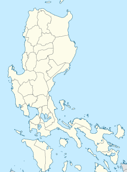
Alabang station is a railway station located on the PNR South Main Line in Muntinlupa, Metro Manila, Philippines. It is the sixteenth station southbound from Tutuban and is one of three Philippine National Railways (PNR) stations serving Muntinlupa, the two others being Sucat and Muntinlupa. The station is located on T. Molina Street in Alabang, Muntinlupa.
Contents
Alabang station is the only PNR station to be completely rebuilt in a different location, having been moved from its original location at Montillano Street to the back of Starmall Alabang on T. Molina Street. The new station was opened on April 19, 2010. The other one is Dela Rosa station, which was moved a block south to accommodate the longer trains and mitigate traffic congestion at the grade crossing along Gil Puyat Avenue. On March 28, 2024, station operations were temporarily suspended to make way for the construction of the North–South Commuter Railway. The station will be repurposed as an elevated station. [1] [2]
There are 397 observed road crossings between Alabang and Legazpi. Of these, 214 are authorized and 183 are unauthorized. Only 31 of the authorized crossings are officially staffed by PNR and none of the unauthorized crossings are staffed. Unauthorized crossings are ones that have been established without the formal consent of PNR and are often in areas of high encroachment.


