Pureza station

Last updated
Pureza
Lrtalogo.svg
Line 2 Pureza Station Platform 4.jpg
General information
Location Magsaysay Boulevard, Santa Mesa
Manila, Metro Manila
Philippines
Coordinates 14°36′6.0″N121°0′18.7″E / 14.601667°N 121.005194°E / 14.601667; 121.005194
Owned by Department of Transportation
Operated by Light Rail Transit Authority
Line(s)      LRT Line 2
Platforms2 (2 side)
Tracks2
Connections Philippine National Railways (PNR).svg Santa Mesa
PasigRiverFerryServiceLogo.png PUP Ferry Station
Bus-logo.svg   2   (Angono - Quiapo)   3   (Antipolo - Quiapo)
Construction
Structure typeElevated
AccessibleConcourse: South Entrance only
Platforms: All platforms
Other information
Station codePU
History
OpenedApril 5, 2004
Services
Preceding station Lrtalogo.svg
Manila LRT
Following station
V. Mapa
towards Antipolo
LRT Line 2 Legarda
towards Recto
Out-of-system interchange
Preceding station PNR Following station
España North Shuttle
transfer at Santa Mesa
Paco
towards Bicutan
España
towards Tutuban
Metro South Commuter
transfer at Santa Mesa
Pandacan
towards IRRI
Location
Manila (proper) location map.svg
Red pog.svg
Pureza
Location in Manila
Metro Manila location map.svg
Red pog.svg
Pureza
Location in Metro Manila
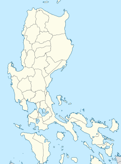
Philippines location map (Luzon mainland).svg
Red pog.svg
Pureza
Location in Luzon
Philippines location map (square).svg
Red pog.svg
Pureza
Location in the Philippines

Pureza station is an elevated Light Rail Transit (LRT) station located on the LRT Line 2 (LRT-2) system in Santa Mesa, Manila. It is named because of its location on Pureza Street. The name originated from the Spanish word for "purity". [1] [2]

Contents

The station is the third station for trains headed to Antipolo and the eleventh station for trains headed to Recto.

Accessibility

Pureza station is fully wheelchair accessible in the south entrance. However, the north entrance doesn't have an elevator to the concourse area.

Nearby landmarks

The station's north entrance is interconnected with The Station Point commercial building, where the AMA Computer College Manila Campus is located. Landmarks nearby the station include other educational institutions such as De Ocampo Memorial College, Pio del Pilar Elementary School, Polytechnic University of the Philippines, Sacred Heart of Jesus Parish and Catholic School, Nuestra Señora de Salvacion Parish, and Eulogio "Amang" Rodriguez Institute of Science and Technology (EARIST). Commercial establishments in the vicinity include Puregold Jr. Pureza, Savemore Market, variety retail shops, and flea markets.

Some students studying in the University of Santo Tomas opt to depart from this station. A tricycle is available for transport to a jeepney terminal bound for Tayuman. The other station used by UST students in going to the university is the Legarda station. A bus terminal of AB Liner Inc., where buses bound for Tagkawayan, Quezon could be found, is located near the station. [3]

A Philippine National Railways station, Santa Mesa, is a short walk from Pureza station. Also, it is planned to connect with the future station of the North–South Commuter Railway located in the same site. The PUP ferry station for the Pasig River Ferry Service is further south from Santa Mesa station.

See also

Related Research Articles

<span class="mw-page-title-main">Rail transportation in the Philippines</span>

Rail transportation in the Philippines is currently used mostly to transport passengers within Metro Manila and provinces of Laguna and Quezon, as well as a commuter service in the Bicol Region. Freight transport services once operated in the country, but these services were halted. However, there are plans to restore old freight services and build new lines. From a peak of 1,100 kilometers (680 mi), the country currently has a railway footprint of 533.14 kilometers (331.28 mi), of which only 129.85 kilometers (80.69 mi) are operational as of 2024, including all the urban rail lines. World War II, natural calamities, underspending, and neglect have all contributed to the decline of the Philippine railway network. In the 2019 Global Competitiveness Report, the Philippines has the lowest efficiency score among other Asian countries in terms of efficiency of train services, receiving a score of 2.4, and ranking 86th out of 101 countries globally. The government is currently expanding the railway network up to 1,900 kilometers (1,200 mi) by 2022 through numerous projects.

<span class="mw-page-title-main">Blumentritt station (LRT)</span> Train station in Manila, Philippines

Blumentritt station is an elevated Light Rail Transit (LRT) station located on the LRT Line 1 (LRT-1) system in Manila, Philippines. The station is situated above Rizal Avenue, particularly at its intersections with Old Antipolo Street and Blumentritt Road, from which the station's name is derived. The latter is named to honor Bohemian professor Ferdinand Blumentritt, one of José Rizal's closest associates and a sympathizer of the Propaganda Movement.

<span class="mw-page-title-main">Doroteo Jose station</span> Train station in Manila, Philippines

Doroteo Jose station is an elevated Light Rail Transit (LRT) station located on the LRT Line 1 (LRT-1) system in Santa Cruz, Manila. The station is situated on Rizal Avenue and slightly past Doroteo Jose Street. Both the station and the street are named after Doroteo Jose, a Filipino who was arrested by Spanish authorities in 1898 for leading a movement against a corrupt archbishop.

<span class="mw-page-title-main">Central Terminal (LRT)</span> Train station in Manila, Philippines

Central Terminal, formerly and widely known as Arroceros station, is an elevated Light Rail Transit (LRT) station located on the LRT Line 1 (LRT-1) system in Ermita, Manila. A popular name for the station is Arroceros due to its proximity to the Arroceros Forest Park; Arroceros is also the former name of Antonio Villegas Street, where the station is located.

<span class="mw-page-title-main">Gil Puyat station</span> Train station in Pasay, Philippines

Gil Puyat station is an elevated Light Rail Transit (LRT) station located on the LRT Line 1 (LRT-1) system in Pasay, Philippines. It is situated above the intersection of Taft Avenue and Gil Puyat Avenue, where the station derived its name. The avenue itself is named after Gil Puyat, a former senator and statesman. The station was opened to the public on December 1, 1984, as part of LRT's inaugural southern section, known as the Taft Line.

<span class="mw-page-title-main">Baclaran station</span> Train station in Pasay, Philippines

Baclaran station is an elevated Light Rail Transit (LRT) station located on the LRT Line 1 (LRT-1) system in Pasay. Situated on the last stretches of Taft Avenue right at the border with Baclaran, Parañaque. The station is named after the famous shopping district of the same name, which is located on the borders of the cities of Pasay and Parañaque. Opened in 1984, the station served as the line's initial southern terminus, historically known as South Terminal, until Phase 1 of the Cavite Extension was opened in 2024.

<span class="mw-page-title-main">Recto station</span> LRT Line 2 station in Manila

Recto station is the western terminus of the Light Rail Transit Line 2 (LRT-2) system. It is situated on Recto Avenue at the district boundary of Santa Cruz and Quiapo, Manila.

<span class="mw-page-title-main">Carriedo station</span> Train station in Manila, Philippines

Carriedo station is an elevated Light Rail Transit (LRT) station located on the LRT Line 1 (LRT-1) system along the district boundary of Santa Cruz and Quiapo in Manila.

<span class="mw-page-title-main">Libertad station</span> Train station in Pasay, Philippines

Libertad station is an elevated Light Rail Transit (LRT) station located on the LRT Line 1 (LRT-1) system in Pasay, Metro Manila, Philippines. It is situated at the intersection of Taft Avenue and Arnaiz Avenue. The station is named after the former Libertad Street, now a part of Arnaiz Avenue. The name Libertad survives as an area name after the old street.

<span class="mw-page-title-main">V. Mapa station</span> LRT Line 2 station in Manila

V. Mapa station is an elevated Light Rail Transit (LRT) station located on the LRT Line 2 (LRT-2) system in Sampaloc, Manila. It is one of the four stations in the line with a reserve track nearby together with Santolan, Anonas and Araneta Center–Cubao. The station during its inception was formerly called as G. Araneta station but was renamed into the current name due to the minor realignment of some stations that has caused the change of proximity to the V. Mapa Street. The station serves the areas of Santa Mesa, Manila, Quezon City, and San Juan. The station is situated at Ramon Magsaysay Boulevard, near its intersection with Victorino Mapa Street in Santa Mesa, Manila.

<span class="mw-page-title-main">Legarda station</span> LRT Line 2 station in Sampaloc, Manila

Legarda station is an elevated Light Rail Transit (LRT) station located on the LRT Line 2 (LRT-2) system in Sampaloc, Manila. It is named after Legarda Street, where the station sits above it. The street in turn is named after Benito Legarda, a Filipino legislator.

<span class="mw-page-title-main">North Avenue station (MRT)</span> Elevated passenger train station in Quezon City, Philippines

North Avenue station is an elevated Metro Rail Transit (MRT) station located on the MRT Line 3 (MRT-3) system in Diliman, Quezon City. Located on the Epifanio de los Santos Avenue (EDSA), it is named after the adjacent North Avenue, which intersects the highway. It is the current northern terminus of the line.

<span class="mw-page-title-main">Santolan–Annapolis station</span> Train station in Quezon City, Philippines

Santolan–Annapolis station, also simply known as Santolan station, is an elevated Metro Rail Transit (MRT) station located on the MRT Line 3 (MRT-3) system in Quezon City. It is the ninth station for trains headed to North Avenue and the fifth station for trains headed to Taft Avenue. The station is named after the streets it is situated in between Santolan Road and Annapolis Street, and near the eastern San Juan–Quezon City boundary.

<span class="mw-page-title-main">Anonas station</span> LRT Line 2 station in Quezon City

Anonas station is an elevated Light Rail Transit (LRT) station located on the LRT Line 2 (LRT-2) system in Cubao, Quezon City. It is named because of its location near Anonas Street.

<span class="mw-page-title-main">Bambang station</span> Train station in Manila, Philippines

Bambang station is an elevated Light Rail Transit (LRT) station located on the LRT Line 1 (LRT-1) system in Santa Cruz, Manila. The station is situated on the intersection of Rizal Avenue and Bambang Street, where the station got its name.

<span class="mw-page-title-main">R. Papa station</span> Train station in Manila, Philippines

R. Papa station is an elevated Light Rail Transit (LRT) station located on the LRT Line 1 (LRT-1) system in Tondo, Manila, Philippines. It is situated on Rizal Avenue Extension in Barrio Obrero. The station is named after Ricardo Papa Street, which is in turn named after a former Manila police chief-turned-Commanding General of the Philippine Army. The station is the first station in Rizal Avenue Extension going north and the last in the city of Manila, located just next to the city's boundary with Caloocan.

<span class="mw-page-title-main">Santa Mesa station</span> PNR Railway Station in Manila, Philippines

Santa Mesa station is a railway station located on the South Main Line in the city of Manila, Philippines. It is one of two stations in the line to have its own access road.

<span class="mw-page-title-main">Blumentritt station (PNR)</span> Southrail station in Manila

Blumentritt station is a railway station located on the South Main Line in the city of Manila, Philippines. It is currently being repurposed as an elevated station of the under construction North–South Commuter Railway. It derives its name from nearby Blumentritt Road, which is named after the Bohemian professor Ferdinand Blumentritt, a friend of José Rizal and sympathizer of the Filipino cause.

<span class="mw-page-title-main">Transportation in Metro Manila</span> Overview of Metro Manilas transportation system

The transportation system in Metro Manila covers the road network, rail network, ferries, ports and airports located within the metropolitan Manila area. Road transportation in Metro Manila is diverse, composed of many types of private and public transport vehicles. These include taxis, buses, jeepneys, tricycles and pedicabs. In some areas, especially in Divisoria and large public markets, two-stroke motors are fitted in the pedicabs and are used for goods transport. Regardless of modernity, horse-drawn kalesas are still used in the streets of Binondo and Intramuros. Ridesharing services such as Grab also operate within Metro Manila.

<span class="mw-page-title-main">Rail transportation in the Greater Manila Area</span>

Rail transportation in the Greater Manila Area is a major part of the transportation system in Metro Manila and its surrounding areas. The railway network, collectively known as the Greater Capital Region Railway System, consists of the Manila Light Rail Transit System (LRT), Manila Metro Rail Transit System (MRT), and Philippine National Railways lines within the region.

References

  1. Constantino, Renato Redentor (June 14, 2024). "Street names and the persistence of memory". ABS-CBN News . Retrieved December 7, 2024.
  2. Daluyan: a historical dictionary of the streets of Manila. Manila: National Historcal Institute (Philippines). 2006. p. 89. ISBN   9715381979. OCLC   76481651.
  3. Google Maps (Map). Google Street View. Retrieved 8 June 2020.