United Nations station is served by buses, jeepneys, and UV Express along Taft Avenue and other nearby routes. Regular taxis, cycle rickshaws, tricycles, and e-tricycles also stop at and near the station.
Gallery
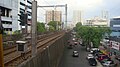
Overview of the area south of United Nations station
This page is based on this Wikipedia article Text is available under the CC BY-SA 4.0 license; additional terms may apply. Images, videos and audio are available under their respective licenses.