EDSA station (PNR)

Last updated

EDSA
Philippine National Railways (PNR).svg
South Superhighway, PNR EDSA Station (Magallanes, Makati)(2018-03-28).jpg
EDSA Station below South Superhighway (2018)
General information
Location Osmeña Highway, Bangkal
Makati, Metro Manila
Philippines
Coordinates 14°32′30.33″N121°0′59.39″E / 14.5417583°N 121.0164972°E / 14.5417583; 121.0164972
Owned by Philippine National Railways
Operated byPhilippine National Railways
Line(s)  South Main Line
Planned: South Commuter
PlatformsSide platforms
Tracks2
Connections 3 Magallanes
Buses, jeepneys, and taxis
Construction
Structure type At grade
ParkingYes (San Lorenzo Place)
AccessibleYes
Other information
Station codeEDS
History
Rebuilt2005
Services
Preceding station PNR Following station
Dela Rosa North Shuttle FTI
towards Bicutan
Pasay Road
towards Tutuban
Metro South Commuter Nichols
towards IRRI
Out-of-system interchange
Preceding station Manila MRT Following station
Ayala
towards North Avenue
MRT Line 3
transfer at Magallanes
Taft Avenue
Terminus
Future services
Preceding station PNR Following station
Buendia NSCR Commuter
CIA–Calamba
Senate
towards Calamba
Buendia
towards Tutuban
NSCR Commuter
Tutuban–Calamba
Buendia Commuter Express
CIA–Calamba
FTI
towards Calamba
Buendia
towards Tutuban
Commuter Express
Tutuban–Calamba
Location
Metro Manila location map.svg
Red pog.svg
EDSA
Location in Metro Manila
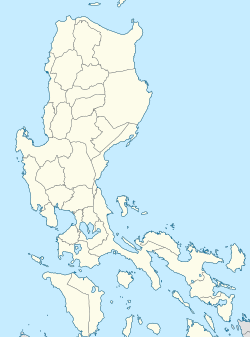
Philippines location map (Luzon mainland).svg
Red pog.svg
EDSA
Location in Luzon
Philippines location map (square).svg
Red pog.svg
EDSA
Location in the Philippines

EDSA station is a railway station located on the South Main Line in Makati, Metro Manila, Philippines. It derives its name from the nearby Epifanio de los Santos Avenue.

Contents

EDSA is the eleventh station from Tutuban and is one of three stations serving Makati, the other two being Buendia and Pasay Road, and is the last station to be physically located in Makati before entering Taguig.

The station was rebuilt in 2005 by the Makati City Government as part of the overall redevelopment and beautification of the Magallanes Interchange Park which sits below the interchange. As a result, unlike other stations, EDSA station was not included in the 2009 remodeling of stations as part of PNR's rehabilitation efforts. A product of the prior rehabilitation is the station's lower platforms, which are designed only to accommodate older long-distance trains. For the convenience of passengers, the station has staircases to facilitate the boarding and alighting of passengers on PNR diesel multiple unit trains.

Since September 10, 2018, PNR extended the Caloocan Shuttle Line from Dela Rosa to FTI as its new terminus, thus EDSA station is included in the newly extended line. [1]

Nearby landmarks

The station's major landmarks are the Alphaland Southgate Tower and Mall, San Lorenzo Place and Mall, and Studio 300 on Chino Roces Avenue. Further away from the station are Bangkal, Paseo de Magallanes, Magallanes Village, Dasmariñas Village, San Lorenzo Village, and Ecology Village.

EDSA station is accessible by jeepneys plying the Chino Roces Avenue and South Luzon Expressway routes, as well as buses plying the South Luzon Expressway route. Unusually for a PNR station, a taxi stand is located outside the station's entrance.

An MRT-3 station, Magallanes, is a short walk from EDSA station.

Station layout

L1
Platforms
Side platform, doors will open on the right
Platform A PNR Metro Commuter towards Tutuban (←)
Platform B PNR Metro Commuter towards Alabang (→)
Side platform, doors will open on the right
L1Concourse/
Street Level
Ticket Booths, Station Control, Shops, Magallanes Interchange Park

Related Research Articles

<span class="mw-page-title-main">EDSA</span> Limited-access circumferential highway around Metro Manila

Epifanio de los Santos Avenue, commonly referred to by its acronym EDSA, is a limited-access circumferential highway around Manila, the capital city of the Philippines. It passes through 6 of Metro Manila's 17 local government units or cities, namely, from north to south, Caloocan, Quezon City, San Juan, Mandaluyong, Makati, and Pasay.

<span class="mw-page-title-main">South Luzon Expressway</span> Major controlled-access highway in the Philippines

The South Luzon Expressway (SLEX), signed as E2 of the Philippine expressway network and R-3 of the Metro Manila arterial road network, is a controlled-access highway that connects Metro Manila to the provinces in the Calabarzon, Mimaropa and Bicol Region on the island of Luzon in the Philippines. The expressway has a length of 49.56 km, traveling from its northern terminus at the Magallanes Interchange in Makati to its southern terminus at Santo Tomas, Batangas, connecting it to the Southern Tagalog Arterial Road. A portion of the expressway from the Magallanes Interchange to the Calamba Exit is part of Asian Highway 26 of the Asian highway network. It will be the longest expressway in the Philippines starting with the completion of Toll Road 4 surpassing the Subic–Clark–Tarlac Expressway (SCTEX) as well as providing a gateway to Visayas upon the completion of Toll Road 5.

<span class="mw-page-title-main">Rail transportation in the Philippines</span>

Rail transportation in the Philippines is currently used mostly to transport passengers within Metro Manila and provinces of Laguna and Quezon, as well as a commuter service in the Bicol Region. Freight transport services once operated in the country, but these services were halted. However, there are plans to restore old freight services and build new lines. From a peak of 1,100 kilometers (680 mi), the country currently has a railway footprint of 533.14 kilometers (331.28 mi), of which only 129.85 kilometers (80.69 mi) are operational as of 2024, including all the urban rail lines. World War II, natural calamities, underspending, and neglect have all contributed to the decline of the Philippine railway network. In the 2019 Global Competitiveness Report, the Philippines has the lowest efficiency score among other Asian countries in terms of efficiency of train services, receiving a score of 2.4, and ranking 86th out of 101 countries globally. The government is currently expanding the railway network up to 1,900 kilometers (1,200 mi) by 2022 through numerous projects.

<span class="mw-page-title-main">Magallanes station</span> Train station in Makati, Philippines

Magallanes station is an elevated Metro Rail Transit (MRT) station located on the MRT Line 3 (MRT-3) system in Makati. The station is named after barangay Magallanes of Makati, which in turn is named after Ferdinand Magellan. Although the station is named after Magallanes, it also serves passengers from Kayamanan-C and barangays Dasmariñas, Pio del Pilar, and San Lorenzo in Makati, and those from Taguig.

<span class="mw-page-title-main">Radial Road 3</span> Road in the Philippines

Radial Road 3 (R-3), informally known as the R-3 Road, is a network of roads and bridges which comprise the third arterial road of Metro Manila in the Philippines. It connects the cities of Manila, Makati, Pasay, Taguig, Parañaque, and Muntinlupa.

<span class="mw-page-title-main">Buendia station (PNR)</span>

Buendia station is a former railway station located on the South Main Line in Makati, Metro Manila, Philippines.

<span class="mw-page-title-main">CEM Trans Services</span>

CEM Trans Services, Inc. is a city bus company known for the use of an animated character Road Runner This company plies routes to parts of Quezon City, Valenzuela City and San Jose del Monte, Bulacan. This company is a sister company of Joanna Jesh Transport

<span class="mw-page-title-main">Nichols station</span> Commuter rail stop in Taguig, Metro Manila

Nichols station is a railway station located on the South Main Line in Taguig, Metro Manila, Philippines, near the city's boundary with Pasay. It derives its name from one of the area's popular nicknames, Nichols, which is also the former name of Villamor Air Base. It was opened for revenue service on March 25, 2010.

<span class="mw-page-title-main">Pasay Road station</span> Railway station in Makati, Philippines

Pasay Road station is a railway station located on the South Main Line in Makati, Metro Manila, Philippines. It is one of two stations in the line to have its own access road. It is named after Pasay Road, the old name of the Makati section of the adjacent Arnaiz Avenue.

<span class="mw-page-title-main">FTI station</span> Southrail railway station in Metro Manila, Philippines

FTI station is a railway station located on the South Main Line in Taguig, Metro Manila, Philippines. It is named after its major landmark, the grounds of the formerly state-owned Food Terminal, Inc. which is now renamed as Arca South.

<span class="mw-page-title-main">Sucat station</span> Railway station in Muntinlupa, Philippines

Sucat station is a railway station located on the South Main Line in Muntinlupa, Metro Manila, Philippines. It was originally established by the Manila Railway Company in 1908 as part of the construction of the original Southern Lines to the province of Tayabas, since renamed Quezon. It is also the southernmost area on the PNR Metro Commuter Line to be upgraded to double track as a result of a proposed electrification scheme in 1978.

<span class="mw-page-title-main">10th Avenue station (PNR)</span> Railway station in the Philippines

10th Avenue station is a railway station located on the North Main Line in Caloocan, Metro Manila, Philippines, near the original Caloocan railway station. It is currently being repurposed to become a station of the under-construction North–South Commuter Railway.

<span class="mw-page-title-main">Caloocan station</span> Railway station in Metro Manila, Philippines

Caloocan station is a railway station located on the North Main Line in Caloocan, Metro Manila, Philippines. It is rebuilt from its original location, now situated adjacent to the Caloocan railway depot, near Samson Road.

<span class="mw-page-title-main">Magallanes Interchange</span> Road junction

The Magallanes Interchange is a four-level partial turbine interchange in Makati, Metro Manila, Philippines. It serves as the junction between the Osmeña Highway, Epifanio de los Santos Avenue (EDSA), and South Luzon Expressway (SLEX) while also intersecting with inner streets and Chino Roces Avenue. It is also an interchange between the two train lines of Metro Manila, the MRT-3, which is over EDSA, and the PNR Metro Commuter Line beside Osmeña Highway and SLEX. It is currently one of the busiest intersections in Metro Manila.

<span class="mw-page-title-main">Arnaiz Avenue</span> Collector road in Metro Manila, Philippines

Antonio Arnáiz Avenue, also known simply as Avenida Arnáiz and by its former official name Pásay Road, is a major east–west collector road linking Makati and Pasay in the Philippines. It stretches across western Metro Manila from Roxas Boulevard in Pasay to Epifanio de los Santos Avenue (EDSA/C-4) in Makati.

<span class="mw-page-title-main">Chino Roces Avenue</span> Road in Metro Manila, Philippines

Chino Roces Avenue, formerly known as Pasong Tamo, is a prominent north–south road in Makati and Taguig, Metro Manila, Philippines. It runs 5.80 kilometers from Olympia and Tejeros to Fort Bonifacio. The avenue is named after the Filipino journalist Joaquin "Chino" Roces. The fact that the avenue is the location of various media establishments influenced the renaming.

<span class="mw-page-title-main">Makati Central Business District</span> Central business district in Makati, Metro Manila, Philippines

The Makati Central Business District is a privately-owned financial and central business district in the Philippines located in the heart of Makati in Metro Manila. It is politically and administratively known as "Central Cluster" in the West District of Makati. It is different from the Makati civic center known as "Makati Poblacion" which is situated at the northeast portion of the district. It is bounded by EDSA, Amorsolo Street, Ayala Avenue, Gil Puyat Avenue, Osmeña Highway, South Luzon Expressway, Metro Manila Skyway, Zobel Roxas Street, Ocampo Street, Metropolitan Avenue, Nicanor Garcia Street, Kalayaan Avenue, Makati Avenue, Anza Street, Polaris Street, Orion Street, Mercedes Street, Amapola Street and Estrella Street. The whole district occupies barangays of San Antonio, San Lorenzo, Bel-Air, and Urdaneta.

<span class="mw-page-title-main">Index of Metro Manila–related articles</span>

The following is an alphabetical list of articles related to the Philippine capital region of Metro Manila.

<span class="mw-page-title-main">Osmeña Highway</span> Major road in Metro Manila, Philippines

The President Sergio Osmeña Sr. Highway, also known as the South Superhighway, is a 4.595-kilometer (2.855 mi) major highway that links Quirino Avenue in Paco, Manila to Epifanio de los Santos Avenue (EDSA) and South Luzon Expressway (SLEX) at the Magallanes Interchange in Makati.

<span class="mw-page-title-main">Dela Rosa station</span> Railway station in the Philippines

Dela Rosa station is a railway station located on the South Main Line in Makati, Metro Manila, Philippines.

References

  1. "PNR launches its Sangandaan-FTI rail line". Manila Bulletin News. September 11, 2018. Retrieved September 11, 2018.