
Cloncurry is a town and locality in the Shire of Cloncurry, Queensland, Australia. It is the administrative centre of the shire. At the 2016 census, Cloncurry recorded a population of 2,719 people.

The Flinders Highway is a highway that crosses Queensland east to west, from Townsville on the Pacific coast to Cloncurry. The road continues as the Barkly Highway from Cloncurry to the Northern Territory border at Camooweal and beyond. The Flinders Highway passes a number of small outback towns and typical outback landscape predominates towards the inland. It was known as National Route 78 before Queensland began to convert to the alphanumeric system being adopted in Australia and is now designated as A6. The highway is also known as Overlanders Way. Its entire length is part of the National Land Transport Network.

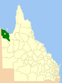
The City of Mount Isa is a local government area in north west Queensland. The City covers the urban locality of Mount Isa, the administrative centre, and surrounding area, sharing a boundary with the Northern Territory to the west.

Dajarra is a town and a locality in the Shire of Cloncurry, Queensland, Australia. In the 2016 census, Dajarra had a population of 191 people.

Julia Creek is a town and a locality in the Shire of Mckinlay, Queensland, Australia. At the 2016 census, Julia Creek had a population of 511.

The Shire of Mckinlay is a local government area in north-western Queensland, Australia.
The Shire of Carpentaria is a local government area in Far North Queensland, Australia on the Gulf of Carpentaria, for which it is named.
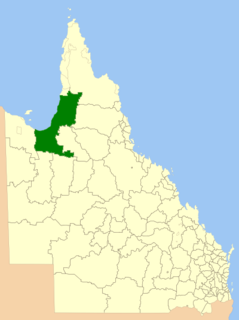
The Shire of Burke is a local government area in North West Queensland, Australia. The shire lies on the south coast of the Gulf of Carpentaria and abuts the border with the Northern Territory. It covers an area of 40,126.8 square kilometres (15,493.0 sq mi), and has existed as a local government entity since 1885. The major town and administrative centre of the shire is Burketown. The shire and town and the Burke River passing through all are named in honour of ill-fated explorer Robert O'Hara Burke.
Dajarra and Selwyn Branch Railways were lines in north-west Queensland, Australia. Along with the Mount Cuthbert and Dobbyn Branch Railways, they were essentially built to tap large deposits of copper discovered in the Cloncurry region.
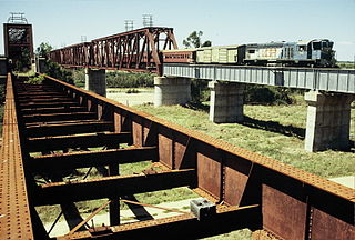
The Great Northern Railway is a 3 ft 6 in gauge railway line in Queensland, Australia. The line stretches nearly 1,000 kilometres linking the port city of Townsville, Australia to the mining town of Mount Isa in north-west Queensland. Along with a passenger service called the Inlander, it is a major freight route connecting the Mount Isa Mines to the Townsville Port. In 2010 the line moved 5.8 million tonnes of cargo, and this is expected to increase significantly in coming years.
Duchess is a town and a locality in the Shire of Cloncurry, Queensland, Australia.
The Great Western Railway was a railway development proposal involving a total of five new lines in western Queensland, Australia. Construction started in 1911 on sections of four of the lines, and three were opened in part before the project was effectively abandoned in 1920.
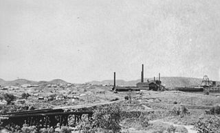
Mount Cuthbert is a former copper mining town in the locality of Three Rivers, Shire of Cloncurry, Queensland, Australia. It is now a ghost town.

Cloncurry Post Office is a heritage-listed post office at 47 Scarr Street, Cloncurry, Shire of Cloncurry, Queensland, Australia. It was designed by Queensland Works Department and built in 1906. It was added to the Queensland Heritage Register on 27 May 2005.
Three Rivers is a locality in the Shire of Cloncurry, Queensland, Australia.
Four Ways is a locality in the Shire of Cloncurry, Queensland, Australia.
Dobbyn is a ghost town and former copper mine in the locality of Three Rivers, Shire of Cloncurry, Queensland, Australia. It was at one point the railhead for the Mount Cuthbert and Dobbyn railway lines.
The Monument is a town in the locality of Djarra in the Shire of Cloncurry, Queensland, Australia.


