
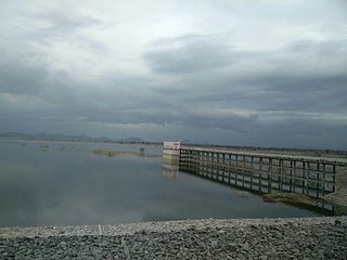
Jagtial is a city in and the district headquarters of Jagtial district of Telangana state, India. Located about 190 kilometres (118 mi) north of the state capital Hyderabad, it has an average elevation of 293 metres (961 ft). In 2011 the population was about 104,000

Karimnagar district is one of the 33 districts of the Indian state of Telangana. Karimnagar city is its administrative headquarters. The district shares boundaries with Peddapalli, Jagityal, Sircilla, Siddipet, Jangaon, Hanamkonda district and Jayashankar Bhupalapally districts.

Nizamabad district is a district located in the north-western region of the Indian state of Telangana. The city of Nizamabad is the district headquarters. The district share boundaries with Jagtial, Sircilla, Nirmal, Kamareddy districts and with Nanded district of the state boundary of Maharashtra.
Kapra is a neighbourhood of Hyderabad city. It falls under Medchal-Malkajgiri district of the Indian state of Telangana and serves as the mandal headquarters of Kapra mandal in Keesara revenue division. It is administered as Circle No. 1 of Greater Hyderabad Municipal Corporation. There are six wards under this circle i.e., Kapra (1), Dr AS Rao Nagar (2), Cherlapally (3), Meerpet HB Colony (4), Mallapur (5) and Nacharam (6).
Raikal It is located in the Jagtial district, Telangana, India
Dharmapuri is a village and the mandal headquarters of Dharmapuri mandal in Jagtial district of Telangana, India.

Korutla municipality is the second largest town and revenue division in the Jagtial district in the Indian state of Telangana. It is a historical town ruled by Jain Kings and second largest town in Jagtial district. It is the headquarters of Koratla constituency. It is located about 23 kilometres (14 mi) from the district headquarters Jagtial, 235 kilometers from Hyderabad, 73 kilometers from Karimnagar and 76 kilometers from Nizamabad.
Gollapally is a village located in Gollapalle mandal of Jagtial district in Telangana, India. Before the reorganisation of districts in Telangana, Gollapally was part of Karimnagar district. And in this village there is a river named ganga
Sarangapur is a village Sarangapur mandal in Jagtial district of the Indian state of Telangana. Before reorganisation of districts in Telanaga in 2016, Sarangapur mandal was a part of Karimnagar district.
Mallapur is also known as Mallapuram before (2000's) is a neighbourhood in Hyderabad in the Indian state of Telangana. It falls under Uppal mandal of Medchal-Malkajgiri district. It is administered as Ward No. 5 of Greater Hyderabad Municipal Corporation.
Metpally is a town and Revenue Division and third largest town in Jagtial district of the Indian state of Telangana. It is located 222 km away from state capital Hyderabad, 67 km from Nizamabad, 80 km from Karimnagar and 33 km far away from District Headquarter Jagtial. It have great history many Dynasties ruled including Sathavahana's and Kakatiya's. The Kakatiyas built a temple named Chennakesava.
Pegadapally is a village in Pegadapally mandal of Jagtial district in the state of Indian state of Telangana.
Nadergul is a part of Bandangpet Nagar Panchayath in Rangareddy district of Telangana state, India. It hosts Nadirgul Airfield.
Bathikepelly is a village located in Pegadapally mandal, in the Jagtial district of Telangana state. Prior to the formation of Telangana, the village was part of Karimnagar district in Andhra Pradesh.
Adilabad mandal is one of the 52 mandals in Adilabad district of the Indian state of Telangana. It is under the administration of Adilabad revenue division and the headquarters are located at Adilabad. The mandal is bounded by Jainad, Bela, Inderavelly, Gudihatnur, Talamadugu and Tamsi mandals.
Mancherial district is a district located in the northern region of the Indian state of Telangana. The district comprises 18 mandals and two revenue divisions – Mancherial and Bellampalli. The district headquarters is located at Mancherial town. It is surrounded by Komaram Bheem, Nirmal, Jagtial, Peddapalli and Bhupalpally districts of Telangana and with Maharashtra state.

Nirmal district is a district located in the northern region of the Indian state of Telangana. The district headquarters is located in the town of Nirmal. It borders the Telangana districts of Adilabad, Nizamabad, Mancherial, Asifabad, Jagtial districts as well as Nanded district of the state Maharashtra.
Jagtial district is a district located in the northern region of the Indian state of Telangana. Its administrative headquarters is the city of Jagtial. The district shares boundaries with Nirmal, Mancherial, Karimnagar, Peddapalli, Sircilla and Nizamabad districts.
Pedapalli district is a district located in the northern region of the Indian state of Telangana. Its administrative headquarters is at Peddapalli and Commissionerate is at Ramagundam. The district shares boundaries with Mancherial, Karimnagar, Jagtial and Jayashankar Bhupalpally districts. This district covers Ramagundam city which is situated in the Godavari valley coalfields and has one of the India's largest thermal power stations in south region under NTPC. Mostly industries are connected with Godavarikhani - NTPC - Ramagundam.

Rajanna Sircilla district is a district in the Indian state of Telangana. Sircilla is the district headquarters. The district shares boundaries with Karimnagar, Siddipet, Jagtial, Kamareddy, and Nizamabad districts.

