Manamedu | |
|---|---|
Village | |
 Manamedu Location in Puducherry, India  Manamedu Manamedu (India) | |
| Coordinates: 11°48′43″N79°41′02″E / 11.812034°N 79.683902°E | |
| Country | |
| State | Puducherry |
| District | Pondicherry |
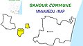
| Taluk | Bahour |
| Commune | Bahour |
| Population (2001) | |
• Total | 36,983 |
| Languages | |
| • Official | French, Tamil, English |
| Time zone | UTC+5:30 (IST) |
| PIN | 607 402 |
| Telephone code | 0413 |
| Vehicle registration | PY-01 |
| Sex ratio | 50% ♂/♀ |
Manamedu is a village [1] in Bahour Commune of Bahour taluk in the Union Territory of Puducherry, India. It is one of the 11 Enclaves of Puducherry. Manmedu serves as a gateway to Pondicherry - Nellikuppam route. It lies on the banks of Pennaiyar River