
Honolulu is the capital and most populous city of the U.S. state of Hawaii, which is in the Pacific Ocean. An unincorporated city, it is the county seat of the consolidated City and County of Honolulu, situated along the southeast coast of the island of Oʻahu, and is the westernmost and southernmost major U.S. city. Honolulu is Hawaii's main gateway to the world. It is also a major hub for business, finance, hospitality, and military defense in both the state and Oceania. The city is characterized by a mix of various Asian, Western, and Pacific cultures, reflected in its diverse demography, cuisine, and traditions.

King Salmon is a census-designated place (CDP) in Bristol Bay Borough in the U.S. state of Alaska. It is 284 miles (457 km) southwest of Anchorage. As of the 2020 census the population was 307, down from 374 in 2010. It is home to Katmai National Park and Preserve. King Salmon is the borough seat of neighboring Lake and Peninsula Borough, but does not serve that purpose in its own borough, whose borough seat is in Naknek.
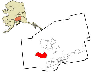
Skwentna is a census-designated place (CDP) on Iditarod Trail in Matanuska-Susitna Borough, Alaska, United States. Located 61 miles northwest of Wasilla along the Skwentna River, it is part of the Anchorage, Alaska Metropolitan Statistical Area. At the 2020 census the population was 62, up from 37 in 2010. The town is served by Skwentna Airport.

Hilo is the largest settlement in Hawaii County, Hawaii, United States, which encompasses the Island of Hawaii, and is a census-designated place (CDP). The population was 44,186 according to the 2020 census. It is the fourth-largest settlement in the state of Hawaii and largest settlement in the state outside of Oahu.

Kukuihaele is a census-designated place (CDP) in Hawaiʻi County, Hawaiʻi, United States. The population was 281 at the 2020 census.
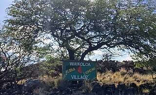
Waikōloa Village is a census-designated place (CDP) in Hawaiʻi County, Hawaii, United States. The population was 6,362 at the 2010 census, up from 4,806 at the 2000 census. The name Waikoloa is used by the local post office.

ʻAiea is a census-designated place (CDP) located in the City and County of Honolulu, Hawaii, United States. As of the 2010 Census, the CDP had a total population of 9,338.

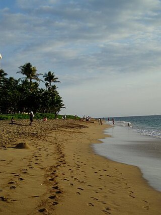
ʻEwa Beach or simply ʻEwa is a census-designated place (CDP) located in ʻEwa District and the City & County of Honolulu along the coast of Māmala Bay on the leeward side of Oʻahu in Hawaii. As of the 2010 Census, the CDP had a total population of 14,955. The U.S. postal code for ʻEwa Beach is 96706.
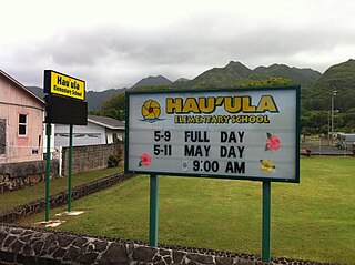
Hauʻula is a census-designated place and rural community in the Koʻolauloa District on the island of Oʻahu, City & County of Honolulu. In Hawaiian, hauʻula means "red hau". There is a small commercial center. As of the 2020 census, the CDP population was 4,018.
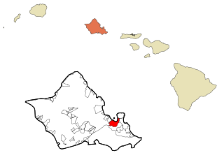
Kaneohe or Kāneʻohe is a census-designated place (CDP) included in the City and County of Honolulu and in Hawaiʻi state District of Koʻolaupoko on the island of Oʻahu. In the Hawaiian language, kāne ʻohe means "bamboo man". According to an ancient Hawaiian story, a local woman compared her husband's cruelty to the sharp edge of cutting bamboo; thus the place was named Kāneʻohe or "bamboo man".

Pūpūkea is a community and census-designated place (CDP) in the Koʻolauloa District on the island of Oʻahu, City & County of Honolulu, Hawaii, United States. In Hawaiian, pūpūkea means "white shell". As of the 2020 census, the CDP had a population of 5,130. The Koʻolauloa District ends at Waimea Bay, with the Waialua District extending south and westward.

Lihue is an unincorporated community, census-designated place (CDP) and the county seat of Kauai County, Hawaii, United States. Lihue is the second-largest town on the Hawaiian island of Kauaʻi, following Kapaʻa. As of the 2010 census, the CDP had a population of 6,455, up from 5,694 at the 2000 census.
Kaanapali is a planned resort community in Maui County, Hawaii, United States, on the island of Maui located in the Old Hawaii ahupuaa of Hanakaʻōʻō, as in the same name of the southern end of Kaanapali Beach's Hanakaʻōʻō Canoe Beach. The population was 1,161 at the 2020 census. For statistical purposes, the United States Census Bureau has defined Kaanapali as a census-designated place (CDP).

Kahului is an unincorporated community and a census-designated place (CDP) in Maui County in the U.S. state of Hawaii. It hosts the county's main airport, a deep-draft harbor, light industrial areas, and commercial shopping centers. The population was 28,219 at the 2020 census. Kahului is part of the Kahului-Wailuku-Lahaina Metropolitan Statistical Area which comprises all of Maui County, including nearby Wailuku and the West Maui town of Lahaina.

Kapalua is a census-designated place (CDP) in Maui County, Hawaiʻi, United States. A resort development by the Maui Land & Pineapple Company extends inland from Kapalua Bay and Honolua Bay. The population was 495 at the 2020 census.

Lāna‘i City is a census-designated place (CDP) on the island of Lāna‘i, in Maui County, Hawai‘i, United States. The population was 3,332 at the 2020 census. Lāna‘i City is the island's commercial center. Many of the island's restaurants and shops are in the town square that surrounds Dole Park, and the only hospital on the island, Lāna‘i Community Hospital, is located near the park.

Greilickville is an unincorporated community and census-designated place (CDP) in Leelanau County in the U.S. state of Michigan. At the 2020 census, the population was 1,634, up from 1,530 at the 2010 census. The community is located within Elmwood Charter Township, and is located in the extreme southeast of the Leelanau Peninsula.

White City is an unincorporated community and census-designated place (CDP) in Jackson County, Oregon, United States. The population was 7,975 at the 2010 census, up from 5,466 at the 2000 census. White City is about 9 miles (14 km) north of the center of Medford and 4 miles (6 km) south of Eagle Point.
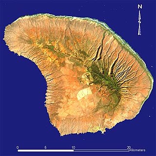
Lanai is the sixth-largest of the Hawaiian Islands and the smallest publicly accessible inhabited island in the chain. It is colloquially known as the Pineapple Island because of its past as an island-wide pineapple plantation. The island's only settlement of note is the small town of Lanai City. As of 2012, the island is 98% owned by Larry Ellison, co-founder and chairman of Oracle Corporation; the remaining 2% is owned by the state of Hawaii or individual homeowners.

Tamuning, also known as Tamuning-Tumon-Harmon is a village located on the western shore of the United States territory of Guam. The village of Tamuning is the economic center of Guam, containing tourist center Tumon, Harmon Industrial Park, and other commercial districts. Its central location along Marine Corps Drive, the island's main thoroughfare, has aided in its development.


