This article may need to be rewritten to comply with Wikipedia's quality standards, as this is GNIS "community" horsefeathers. Baker 1995, p. 209 clearly states that this was a village.(February 2025) |
Manhattan, Indiana | |
|---|---|
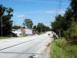 Manhattan is a small town along the National Road. | |
 Manhattan  Manhattan | |
| Coordinates: 39°33′18″N86°55′39″W / 39.55500°N 86.92750°W | |
| Country | United States |
| State | Indiana |
| County | Putnam |
| Township | Washington |
| Elevation | 643 ft (196 m) |
| Time zone | UTC-5 (Eastern (EST)) |
| • Summer (DST) | UTC-4 (EDT) |
| ZIP code | 46171 |
| Area code | 765 |
| GNIS feature ID | 438515 [1] |
Manhattan is an unincorporated community in central Washington Township, Putnam County, in the U.S. state of Indiana. [1]
