
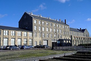
Gawber is an area of Barnsley in South Yorkshire, England. The area falls within the Darton West ward of the Barnsley MBC. There is a Primary School, Gawber Primary School, a Pre-School, Gawber Pre-School, and a church, St Thomas.
Major-General William Roy was a Scottish military engineer, surveyor, and antiquarian. He was an innovator who applied new scientific discoveries and newly emerging technologies to the accurate geodetic mapping of Great Britain. His masterpiece is usually referred to as Roy's Map of Scotland.

Melcombe Horsey is a civil parish in the county of Dorset in South West England. It contains the small settlements of Melcombe Bingham, Bingham's Melcombe and Higher Melcombe, the last being the site of the deserted village of Melcombe Horsey. In the 2011 census the parish had a population of 141.

The Royal Commission on the Ancient and Historical Monuments of Wales, established in 1908, is a Welsh Government sponsored body concerned with the archaeological, architectural and historic environment of Wales. It is based in Aberystwyth.

Ordnance Survey Ireland is the national mapping agency of Ireland. It was established in 2002 as a body corporate. It is the successor to the former Ordnance Survey of Ireland. It and the Ordnance Survey of Northern Ireland (OSNI) are the ultimate successors to the Irish operations of the British Ordnance Survey. OSI is part of the Irish public service. OSI has made modern and historic maps of the state free to view on its website. OSI is headquartered at Mountjoy House in the Phoenix Park in Dublin. Mountjoy House was also the headquarters, until 1922, of the Irish section of the British Ordnance Survey.

The Hull–Scarborough line, also known as the Yorkshire Coast Line, is a minor railway line in northern England used primarily for passenger traffic. It runs northwards from Hull Paragon via Beverley and Driffield to Bridlington, joining the York–Scarborough line at a junction near Seamer before terminating at Scarborough railway station.

The Royal Commission on the Ancient and Historical Monuments of Scotland (RCAHMS) was an executive non-departmental public body of the Scottish Government, which was "sponsored" [financed and with oversight] through Historic Scotland, an executive agency of the Scottish Government.
The Historic England Archive is the public archive of Historic England, located in The Engine House on Fire Fly Avenue in Swindon, formerly part of the Swindon Works of the Great Western Railway.
The Royal Commission on the Historical Monuments of England (RCHME) was a government advisory body responsible for documenting buildings and monuments of archaeological, architectural and historical importance in England. It was established in 1908 ; and was merged with English Heritage in 1999. The research section and the archive are now part of Historic England.
British History Online is a digital library of primary and secondary sources on medieval and modern history of Great Britain and Ireland. It was created and is managed as a cooperative venture by the Institute of Historical Research, University of London and the History of Parliament Trust. Access to the majority of the content is free, but other content is available only to paying subscribers.

Ordnance Survey (OS) is the national mapping agency for Great Britain. The agency's name indicates its original military purpose, which was to map Scotland in the wake of the Jacobite rising of 1745. There was also a more general and nationwide need in light of the potential threat of invasion during the Napoleonic Wars. Since 1 April 2015 Ordnance Survey has operated as Ordnance Survey Ltd, a government-owned company, 100% in public ownership. The Ordnance Survey Board remains accountable to the Secretary of State for Business, Energy and Industrial Strategy. It was also a member of the Public Data Group.
John Cossins was an early cartographer, renowned for the following city maps:
(John) Brian Harley was a geographer, cartographer, and map historian at the universities of Birmingham, Liverpool, Exeter and Wisconsin–Milwaukee. He helped found the History of Cartography Project and was the founding co-editor of the resulting The History of Cartography. In recent years, Harley's work has gained broad prominence among geographers and social theorists, and it has contributed greatly to the emerging discipline of critical cartography.

Little Gidding is a small village and civil parish in Cambridgeshire, England. It lies approximately 9 miles (14 km) northwest of Huntingdon, near Sawtry, within Huntingdonshire, which is a district of Cambridgeshire as well as a historic county.
Peter Atkinson (1735–1805) was an English architect. He was born at or near Ripon and started work as a carpenter. He later became an assistant to John Carr and was employed at Buxton, Harewood and elsewhere. In 1786 he became responsible for maintaining York's corporation property, and subsequently took over Carr's extensive works in Yorkshire and further north.

John Rocque's Map of London, 1746, more formally "A plan of the cities of London and Westminster, and borough of Southwark", surveyed by John Rocque and engraved by John Pine, is a map of Georgian London to a scale of 26 inches to a mile. The map consists of twenty-four sheets and is 3.84 by 2.01 metres in overall size. Taking nearly ten years to survey, engrave and publish, it has been described as "a magnificent example of cartography ... one of the greatest and most handsome plans of any city".
The Ordnance Survey Great Britain County Series maps were produced from the 1840s to the 1890s by the Ordnance Survey, with revisions published until the 1940s. The series mapped the counties of Great Britain at both a six inch and twenty-five inch scale with accompanying acreage and land use information. Following the introduction of the Ordnance Survey National Grid in the 1930s the County Series maps were replaced by a new series of maps at each scale.

High Roding is a village and civil parish in the Uttlesford district of Essex, England. The village is included in the eight hamlets and villages called The Rodings. High Roding is 9 miles (14 km) northwest from the county town of Chelmsford.

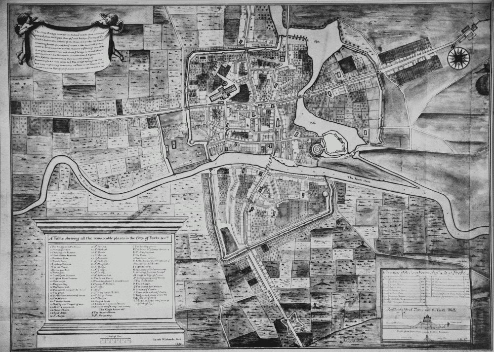
Lendal Tower is a medieval tower that formed part of the city defences of York, England. It is located on the east bank of the River Ouse at the point where the river enters the walled city from the northwest. The building was used as a waterworks from 1616 until being converted into offices in 1846. It has since been turned into rental accommodation.