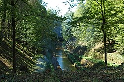
The Saône is a river in eastern France. It is a right tributary of the Rhône, rising at Vioménil in the Vosges department and joining the Rhône in Lyon, at the southern end of the Presqu'île.

The Moselle is a river that rises in the Vosges mountains and flows through north-eastern France and Luxembourg to western Germany. It is a left bank tributary of the Rhine, which it joins at Koblenz. A small part of Belgium is in its basin as it includes the Sauer and the Our.

Toul is a commune in the Meurthe-et-Moselle department in north-eastern France.

The Ill is a river in Alsace, in north-eastern France, and a left-bank, or western, tributary of the Rhine. It is 217 km (135 mi) long.

The Marne is a river in France, an eastern tributary of the Seine in the area east and southeast of Paris. It is 514 kilometres (319 mi) long. The river gave its name to the departments of Haute-Marne, Marne, Seine-et-Marne, and Val-de-Marne.

The Aisne is a river in northeastern France. It is a left tributary of the Oise. It gave its name to the French department of Aisne. It was known in the Roman period as Axona.

The Yonne is a river in France, a left-bank tributary of the Seine. It is 292 km (181 mi) long. The river gives its name to the Yonne département. It rises in the Nièvre département, in the Morvan hills near Château-Chinon. It flows into the river Seine at Montereau-Fault-Yonne.
The Route nationale 4 is a trunk road (nationale) in France between Paris and the frontier with Germany.

The Saint-Louis-Arzviller inclined plane is an inclined plane on the Marne-Rhine Canal that enables the canal to cross the Vosges Mountains. It is located in the commune of Saint-Louis, between the towns of Saint-Louis and Arzviller in the département of the Moselle.

Souffelweyersheim is a commune in the Bas-Rhin department, Alsace, Grand Est, northeastern France, and is part of metropolitan Strasbourg.

The Rhône–Rhine Canal is one of the important watershed canals of the French waterways, connecting the Rhine to the Saône and the Rhône and thereby the North Sea and the Mediterranean. As built, the canal was made up of four distinct sections:
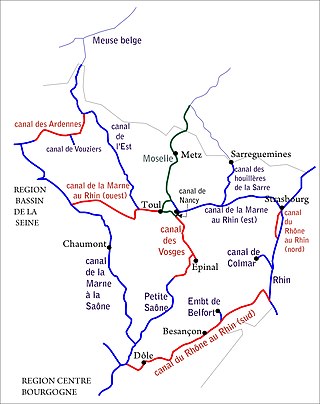
The Canal de la Meuse is the current name of what used to be the northern branch of the Canal de l'Est. It is a canal in northeastern France, predominantly made up of the canalised river Meuse. The Canal de l'Est was built from 1874 to 1887 to provide a waterway inside the new border with Prussia after the Franco-Prussian War, Overall, the canal had a total length of 394 kilometres (245 mi). In 2003, the northern and southern branches were officially renamed Canal de la Meuse and Canal des Vosges respectively.
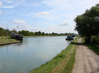
The Canal latéral à l'Aisne is a canal in northern France, which connects the Canal des Ardennes at Vieux-lès-Asfeld to the canalised river Aisne at Condé-sur-Aisne. It is 51.3 km (31.9 mi) long, with 8 locks. It runs alongside the Aisne. It has junctions with the Canal de l'Aisne à la Marne at Berry-au-Bac and with the Canal de l'Oise à l'Aisne in Bourg-et-Comin.

The Canal de l’Aisne à la Marne is a canal in northeastern France which connects the Aisne and the Marne valleys. It runs from the Canal latéral à l'Aisne at Berry-au-Bac to Condé-sur-Marne on the Canal latéral à la Marne, a distance of 58 km. The canal rises 40m through 16 locks via the cathedral city of Reims, which is also a busy commercial port, to a summit level at an altitude of 95.70m. After crossing the watershed through a tunnel 2302m long at Mont-de-Billy, the canal drops down 23.80m through a flight of 8 locks towards the Marne.
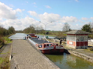
The Canal de Saint-Quentin is a canal in northern France connecting the canalised river Escaut in Cambrai to the Canal latéral à l'Oise and Canal de l'Oise à l'Aisne in Chauny.
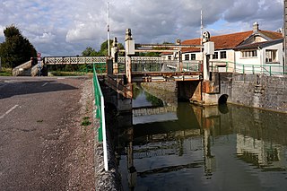
The Canal entre Champagne et Bourgogne, previously named Canal de la Marne à la Saône, is a canal in north-eastern France connecting the towns of Vitry-le-François and Maxilly-sur-Saône. It is a summit level canal of Freycinet dimensions connecting the Marne and the Saône. It is 224.191 kilometres long, and has 114 locks and two tunnels, Condes which is 275 metres long and the tunnel on the summit level between Balesmes-sur-Marne and Noidant-Chatenoy, 4820 metres long. which runs almost exactly underneath the source of the Marne.

The Dunkirk-Scheldt Canal is a 189 km long series of historic canals, and the canalised river Scheldt that were substantially rebuilt from the mid-1950s up to ca. 1980, with some new sections, from Dunkirk to the Belgian border at Mortagne-du-Nord. Existing canals were straightened and widened; and new locks were built, also on the river Scheldt, from the junction at Bouchain to the border. The route is also known as the Liaison 'à grand gabarit'Dunkerque-Escaut. Some authors have separated the waterway into the canal proper and the canalised river Scheldt, but current practice is to use the simple name throughout. The Liaison was designed for large commercial vessels up to 85m long by 11.50m wide. The entire route is being further upgraded to offer European Class Vb dimensions, for push-tows 185m by 11.50m, and motor barges up to 125m long, as part of the current EU-funded Seine-Scheldt-Rhine waterway corridor investments, including the new Seine-Nord Europe Canal.

The Canal de la Sarre, originally called Canal des Houillères de la Sarre, connects the Canal de la Marne au Rhin in Gondrexange to the canalised river Sarre in Sarreguemines in northeastern France. For convenience this entry covers the entire waterway in France, including the canalised river. The canal is 63 km long, and the French portion of the canalised river Sarre is 12 km long, making a total of 75 km, with respectively 28 and 2 locks.

The Canal de la Bruche is a canal in eastern France that originally connected Soultz-les-Bains, near Molsheim, to the city of Strasbourg. It was built in 1682 by the famous military engineer Vauban, principally to transport sandstone from the quarries of Soultz for use in the construction of the fortifications of Strasbourg. The last commercial load was carried in 1939 and the canal formally closed in 1957, after bridges damaged during World War II were rebuilt with insufficient headroom for navigation.

The railway from Paris-Est to Strasbourg-Ville is a 493-kilometre-long railway line that connects Paris to Strasbourg via Châlons-en-Champagne and Nancy, France. Officially, the line does not start at the Gare de l'Est in Paris: the first 9 km until Noisy-le-Sec is shared with the railway from Paris to Mulhouse. The railway was opened in several stages between 1849 and 1852. The opening of the LGV Est high speed line from Paris to Baudrecourt in Lorraine in 2007 has decreased the importance of the section Paris–Sarrebourg for passenger traffic.
