Marriott's Way

Last updated

Marriott's Way
Thorpe Marriott.JPG
The way at Thorpe Marriott village green, near Taverham
Length39.5 km (24.5 mi)
Location Norfolk, England
Trailheads Norwich
52°38′09″N1°17′14″E / 52.6357°N 1.2873°E / 52.6357; 1.2873 (Norwich (Norwich trailhead))
Aylsham
52°47′27″N1°15′15″E / 52.7909°N 1.2541°E / 52.7909; 1.2541 (Aylsham (Aylsham trailhead))
UseHiking, cycling, horse-riding
SeasonAll year
The way in summer close to Cawston Marriott'sWayinSummer.jpg
The way in summer close to Cawston

The Marriott's Way is a footpath, cycle-path and bridleway in north Norfolk, England, between Norwich and Aylsham via Themelthorpe. It forms part of the National Cycle Network (NCN) (Route 1) and the red route of Norwich's Pedalways cycle path network. [1] It is open to walkers, cyclists and horse riders. Its total length is 24.6 miles (39.5 km). It has a mixture of surfaces: tarmac, compacted gravel and earth. The name of the route originates from the chief engineer and manager of the Midland and Great Northern Joint Railway (M&GNJR), William Marriott, who held the position for 41 years. [2]

Contents

Railway history

The path uses the trackbeds of two former railway lines: from Norwich to Themelthorpe and from Themelthorpe to Aylsham. The Themelthorpe to Norwich line was built in 1882 by the Lynn and Fakenham Railway Company, which was taken over by the M&GNJR in 1893 as part of a line that ran to Melton Constable; this line gave a through route to the Midlands. The Themelthorpe to Aylsham line was completed in 1893 by the Great Eastern Railway to provide a link to its other lines at Wroxham and County School, close to North Elmham. The lines were never profitable. Freight services were largely based on farm products and the line closed to passenger traffic in 1959.

In 1960, the two lines were joined by the so-called Themelthorpe Curve, believed to be the sharpest bend on the British Rail network. Its construction was to maintain the important movement of concrete products from Lenwade railway station; once production ceased in 1985, the line was closed. [2]

Route

At Norwich, the path begins to the north of the Barn Road and Barker Street Inner Ring Road roundabout; much of this area was part of the former Norwich City railway station. The path, which is also known as the Railway Path, follows approximately the course of the River Wensum which forms a boundary with the 12 acres (4.9 ha) Train Wood. [3]

The A Frame bridge Marriotts Way4.JPG
The A Frame bridge

After crossing a footbridge, the industrial landscape gives way to the water-meadows of the Sweetbriar Road Meadows before crossing the Wensum over the A frame bridge at Hellesdon. Travelling in a northerly direction from the junction of Marlpit Lane and Hellesdon Road, through the site of the former Hellesdon railway station, the way soon crosses the tiny River Tud at Costessey. The tree-lined River Wensum can be seen to the east, as the path passes through the open country side of the Wensum Valley. The river is crossed by means of an A-frame bridge (there are only three in Norfolk), before arriving at Drayton. [4] The original Drayton railway station is now an industrial estate; the path follows a gravel path before crossing a minor road and entering a deep cutting to cross the busy A1067 road, close to Taverham. To the west is Thorpe Marriott, a large housing estate built in the late 20th century.

Bridge at Mileplain plantation Marriotts Way2.JPG
Bridge at Mileplain plantation

The tranquil path passes through extensive mixed woodland of the Mileplain plantation to cross the Wensum below Attlebridge. To the east of the way, the circular Winch's Way [5] can be accessed which links to the Swannington and Alderford commons. After reaching a country lane, the privately-owned former Attlebridge railway station can be viewed; the way can be accessed close to a car park and picnic area. After passing through birch woods, the large industrial estate of Lenwade can be seen to the west of the way and water filled gravel pits to the east.
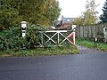
Sign at Lenwade Marriotts Way1.JPG
Sign at Lenwade

Crossing the Wensum for the last time, and close to the former Lenwade railway station which is now privately owned, and on to Whitwell railway station. The (NCN) leaves Marriott's Way to follow a short cut along quiet lanes to Reepham. The way carries on to Themelthorpe and follows the curve to the important stop of Reepham railway station, where the preserved station and engineering shed can be found. Following an easterly course, the path passes close by to the village of Cawston on the B1145 road and then crosses the B1149 road. To the north, the way links to Blickling Hall via Weavers Way before reaching the end of the trail at Aylsham; directly opposite is Aylsham railway station and Bure Valley Path, a walking and cycling route. [6]

Ecology

While the railway line was in use, trackside vegetation would have been partly controlled. The vegetation would have been cut regularly or sprayed with herbicides, so that trains were not obstructed and to lessen the risk of fire. When the railway closed, such management ceased and a wide variety of plants colonised the track; this has made it the diverse habitat for wildlife that it is today.

Today

In the Wensum Valley, immediately above the flood plain between Hellesdon and Drayton, over 100 species of vegetation have been recorded including hawthorn, guelder rose, wild rose, blackthorn, scrub oak, gorse and broom. Many wild flowers can be found such as shepherd's purse, ox-eye daisy, white campion and meadow saxifrage. Closer to the river, the soil becomes heavier and wetter and vegetation includes alder, elder, marsh marigold and willow.

To the north of Drayton, the way passes over a variety of soil types. On the chalky soils, typical plants found are the sycamore, birch and chalk grassland species such as wild carrot, self heal, bird's-foot-trefoil, knapweed and mullein. On the sandy soils bracken, birch and gorse are the more dominant species. Also of note are lichens, which are colonising many of the concrete structures and bridges along the track. The way is an important area for insects, birds and small mammals because of the variety of wild plants that are found.

Public works of art

Wooden bench Marriotts Way3.JPG
Wooden bench
Concrete sculpture at Lenwade inscribed with the words: "Figure in a landscape 7 3/4 miles from Reepham with disused railway and gravel pits contemplating the history of industry and their back turned on the old concrete works, which once produced beams for motorway bridges but now crushes cars" Lenwade7.JPG
Concrete sculpture at Lenwade inscribed with the words: "Figure in a landscape 7¾ miles from Reepham with disused railway and gravel pits contemplating the history of industry and their back turned on the old concrete works, which once produced beams for motorway bridges but now crushes cars"

Several concrete public works of art can be seen along the way, as a constant reminder of the line's connection with the concrete industry and of its last days as a freight line, carrying concrete products. Also on view are hand crafted benches and places to rest; many of these memorials are to cyclists and other way users.

The route is marked by steel benches, fabricated from flat-bottomed rail at intervals of 1 mile starting from the site of Norwich City station. Each bench is to a different design, often with the rail twisted or bent, but always with a flat length at sitting height.

Steel zip sculpture/bench, located 1 mile north of the site of Norwich City station on Marriott's Way. Marriott's Way mile marker bench 1 mile.jpg
Steel zip sculpture/bench, located 1 mile north of the site of Norwich City station on Marriott's Way.

Public access

Apart from the main trailheads at Norwich and Aylsham, the trail can be accessed at various points throughout its length.

See also

Related Research Articles

<span class="mw-page-title-main">North Norfolk Railway</span> Heritage railway in Norfolk, England

The North Norfolk Railway (NNR) – also known as the "Poppy Line" – is a 5+14-mile (8.4 km) heritage steam railway in Norfolk, England, running between the towns of Sheringham and Holt. The North Norfolk Railway is owned and operated as a public limited company, originally called Central Norfolk Enterprises Limited. The railway is listed as exempt from the UK Railways (Interoperability) Regulations 2000.

<span class="mw-page-title-main">Bure Valley Railway</span>

The Bure Valley Railway is a 15 in minimum gauge visitors' attraction in Norfolk, England. It was created on the original disused full-gauge bed of a defunct passenger service to incorporate a new, adjacent pedestrian footpath.

<span class="mw-page-title-main">Aylsham</span> Town in Norfolk, England

Aylsham is a historic market town and civil parish on the River Bure in north Norfolk, England, nearly 9 mi (14 km) north of Norwich. The river rises near Melton Constable, 11 miles (18 km) upstream from Aylsham and continues to Great Yarmouth and the North Sea, although it was only made navigable after 1779, allowing grain, coal and timber to be brought up river.

<span class="mw-page-title-main">River Wensum</span> River in Norfolk, England

The River Wensum is a chalk river in Norfolk, England and a tributary of the River Yare, despite being the larger of the two rivers. The river is a biological Site of Special Scientific Interest and Special Area of Conservation.

<span class="mw-page-title-main">Midland and Great Northern Joint Railway</span> Former railway network in England

The Midland and Great Northern Joint Railway (M&GNJR) was a railway network in England, in the area connecting southern Lincolnshire, the Isle of Ely and north Norfolk. It developed from several local independent concerns and was incorporated in 1893. It was jointly owned by the Midland Railway and the Great Northern Railway, and those companies had long sponsored and operated the predecessor companies.

<span class="mw-page-title-main">Bawdeswell</span> Small rural village and civil parish in Norfolk, England

Bawdeswell is a small rural village and civil parish in Norfolk, England. At the time of the 2011 census it had a population of 828 and an area of 487 hectares. The village is situated almost in the centre of Norfolk about 14 miles (23 km) northwest of Norwich. For the purposes of local government it falls within the Upper Wensum Ward of Breckland District Council and the Elmham and Mattishall Division of Norfolk County Council. It is on a Roman road that ran east–west between Durobrivae near modern Peterborough and Smallburgh, crossing the Fen Causeway.

<span class="mw-page-title-main">Reepham, Norfolk</span> Town in Norfolk, England

Reepham is a market town and civil parish in the Broadland district of Norfolk, England. Reepham is situated on the B1145 road between the Bure and Wensum valleys. The town is 12 miles (19 km) northwest of Norwich. At the time of the 2001 census the civil parish had a population of 2,455 residents in 970 households, occupying an area of 1,909 hectares. increasing to a population of 2,709 in 1,169 households at the 2011 census.

The following are lists of recreational walks in Norfolk, England.

<span class="mw-page-title-main">Whitwell & Reepham railway station</span> Railway station in Norfolk, England

Whitwell and Reepham railway station, also known as Whitwell station, is a former station situated in Norfolk, England. The station closed in 1959 and is a notable stop on the Marriott's Way long-distance footpath. It is being restored as a railway museum, including the re-laying of track.

<span class="mw-page-title-main">Lenwade</span> Human settlement in England

Lenwade is a village in the civil parish of Great Witchingham, Norfolk, situated in the Wensum Valley adjacent to the A1067 road 14 miles (23 km) south-east of Fakenham and some 11 miles (18 km) north-west of Norwich. The River Ainse joins the Wensum at Lenwade. In 2001 it had a population of 464.

<span class="mw-page-title-main">Themelthorpe</span> Human settlement in England

Themelthorpe is a civil parish in the English county of Norfolk, 3 miles (4.8 km) north west of Reepham. It covers an area of 2.69 km2 (1.04 sq mi) and had a population of 65 in 27 households at the 2001 census. For the purposes of local government, it falls within the district of Broadland.

<span class="mw-page-title-main">Drayton, Norfolk</span> Human settlement in England

Drayton, Norfolk, is a suburban village in the English county of Norfolk. The village is located in the district of Broadland, 4.3 miles (6.9 km) north west of Norwich, on the A1067 road between Hellesdon and Taverham. Today, Drayton is largely dominated by the Thorpe Marriott housing estate built in the late Twentieth Century.

<span class="mw-page-title-main">Hellesdon railway station</span> Former railway station in Norfolk, England

Hellesdon railway station is a former railway station in Norfolk, England, which served the area of Hellesdon, today virtually an outer suburb of Norwich. It opened on 2 December 1882 and was closed on 15 September 1952, six years before passenger service was withdrawn along the rest of the line.

<span class="mw-page-title-main">Attlebridge railway station</span> Former railway station in Norfolk, England

Attlebridge railway station is a closed station in Norfolk, England. It served the small village of Attlebridge. It was constructed by the Midland and Great Northern Joint Railway in the 1880s on the line between Melton Constable and Norwich City.

<span class="mw-page-title-main">Reepham railway station (Norfolk)</span>

Reepham (Norfolk) was a railway station in Reepham, Norfolk. It was opened in 1882 and closed to passengers in 1952 and finally shut to goods services in 1981. The tracks through Reepham remained in place until 1985, latterly serving a concrete factory in Lenwade.

<span class="mw-page-title-main">East Norfolk Railway</span>

The East Norfolk Railway was a pre-grouping railway company operating a standard gauge 25 mile, mostly single track, railway running between Norwich Thorpe railway station and Cromer in the English county of Norfolk. It opened in 1874, reaching Cromer three years later, and remains mostly operational. The company also operated a branch between Wroxham and County School, which closed to passengers in 1952, and had proposed a branch to Blakeney in 1878, which was never constructed.

<span class="mw-page-title-main">Network Norwich</span> Bus service

Network Norwich is the brand name given to First Norfolk & Suffolk bus services in and around the city of Norwich. First launched in September 2012, the network now consists of nine colour-coded lines extending across Norwich city centre, outer suburbs, and surrounding towns and villages across Norfolk and into Suffolk.

References

  1. Norwich pedalways Retrieved 27 April 2015
  2. 1 2 Marriott's Way Retrieved 21 November 2008
  3. "Friends of Trainwood & Marriott's Way". Trainwood. Retrieved 1 April 2018.
  4. 'A Frame bridge' Retrieved 21 November 2008
  5. Winch's Way Retrieved 27 April 2015
  6. Marriott's Way information Retrieved 31 January 2023

52°39′45″N1°13′47″E / 52.6626°N 1.2297°E / 52.6626; 1.2297