
Mission is a city in the Lower Mainland of the province of British Columbia, Canada. It was originally incorporated as a district municipality in 1892, growing to include additional villages and rural areas over the years, adding the original Town of Mission City, long an independent core of the region, in 1969. It is bordered by the city of Abbotsford to the south and the city of Maple Ridge to the west. To the east are the unincorporated areas of Hatzic and Dewdney.

West Nipissing is a municipality in Northeastern Ontario, Canada, on Lake Nipissing in the Nipissing District. It was formed on January 1, 1999, with the amalgamation of seventeen and a half former towns, villages, townships and unorganized communities.

Oliver is a town near the south end of the Okanagan Valley in the Southern Interior of British Columbia, Canada, with a population of nearly 5,000 people. It is located along the Okanagan River by Tuc-el-nuit Lake between Osoyoos and Okanagan Falls, and is labelled as the Wine Capital of Canada by Tourism British Columbia. It was once "The Home of the Cantaloupe" as well as the "Home of the International Horseshow."
Kaleden is an unincorporated community about midway along the western shore of Skaha Lake in the Okanagan region of south central British Columbia. Adjacent to BC Highway 97, the locality is by road about 13 kilometres (8 mi) south of Penticton.

Pemberton is a town in the South West region of Western Australia, named after original settler Pemberton Walcott.
Derwent Bridge is a rural locality in the local government area (LGA) of Central Highlands in the Central LGA region of Tasmania. The locality is about 101 kilometres (63 mi) north-west of the town of Hamilton. The 2021 Census it listed with a population of 40 for the state suburb of Derwent Bridge. It is on the Lyell Highway at the southern edge of the Cradle Mountain-Lake St Clair National Park.
Mesachie Lake is an unincorporated community in the Cowichan Valley region of Vancouver Island, British Columbia, Canada. It lies on the south shore of Cowichan Lake, British Columbia. The name is from the Chinook Jargon for "bad, evil, naughty". It was founded in 1942 by the Hillcrest Lumber Company, which built houses for its workers and their families. This company also planted many non-native fruit and shade trees which have since been given heritage status.
Woolgarlo is a locality on the foreshores of the Yass River arm of Lake Burrinjuck, in the far eastern part of the Riverina in the Yass Valley Shire of New South Wales, Australia. At the 2016 census, it had a population of 26.
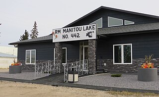
The Rural Municipality of Manitou Lake No. 442 is a rural municipality (RM) in the Canadian province of Saskatchewan within Census Division No. 13 and SARM Division No. 6.
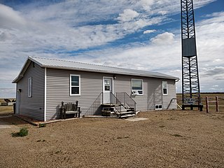
The Rural Municipality of Reno No. 51 is a rural municipality (RM) in the Canadian province of Saskatchewan within Census Division No. 4 and SARM Division No. 3. Located in the southwest corner of the province, it is adjacent to the United States border to the south and the Alberta boundary to the west.
Seymour Arm, known historically also as Ogdensville or Ogden City and Seymour, is an unincorporated area and former town located at the head of the inlet of the same name on Shuswap Lake in British Columbia, Canada. Located at the mouth of the Seymour River, adjacent to Silver Beach Provincial Park, and functioning as the disembarkation point for trails over passes across the Monashee Mountains connecting that river's valley to that of the Columbia River, and navigable by water from Savona at the farther end of Kamloops Lake,
Alta Lake was a recreational community and railway station on the west side of Alta Lake. It is now a neighbourhood of Whistler, British Columbia, Canada. The post office was renamed Whistler in 1976 when the area was incorporated as part of the Resort Municipality of Whistler.
Devine is a rural locality located in the Gates Valley of the Lillooet Country in the southwestern Interior of British Columbia, Canada, about 3 km (2 mi) from D'Arcy, at the head of Anderson Lake.
The Marron River is a very small & very short river in southern British Columbia. It is located just west of Skaha Lake, and is about 7.8 km long.

The Rural Municipality of Last Mountain Valley No. 250 is a rural municipality (RM) in the Canadian province of Saskatchewan within Census Division No. 11 and SARM Division No. 5.

The Rural Municipality of Ponass Lake No. 367 is a rural municipality (RM) in the Canadian province of Saskatchewan within Census Division No. 14 and SARM Division No. 4.

Currawang is a rural locality, located to the north of Lake George. in New South Wales, Australia. It lies on the intersection between three councils, with the majority straddling the boundary between the Queanbeyan–Palerang Regional Council and Goulburn-Mulwaree Council and a small portion of the locality in the Upper Lachlan Shire. It shares its name with the Currawang Parish of Argyle County, in which it is located. This was formerly known as the parish of Currowang. Both names derive from an Aboriginal word for the spearwood tree.

Paulina is an unincorporated community located in Blairstown in Warren County, in the U.S. state of New Jersey.

