Marrowbone, Kentucky | |
---|---|
Coordinates: 36°49′39″N85°30′24″W / 36.82750°N 85.50667°W | |
Country | United States |
State | Kentucky |
County | Cumberland |
Area | |
• Total | 1.29 sq mi (3.34 km2) |
• Land | 1.27 sq mi (3.30 km2) |
• Water | 0.01 sq mi (0.04 km2) |
Elevation | 643 ft (196 m) |
Population (2020) | |
• Total | 147 |
• Density | 115.38/sq mi (44.54/km2) |
Time zone | UTC-6 (Central (CST)) |
• Summer (DST) | UTC-5 (CDT) |
ZIP codes | 42759 |
FIPS code | 21-50124 |
GNIS feature ID | 497558 |
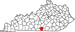
Marrowbone is a census-designated place in Cumberland County, Kentucky, United States. As of the 2010 census it had a population of 217. [2] It has a post office, with the ZIP code of 42759. [3]
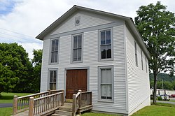
The Marrowbone Historic District, which includes three properties, is listed on the National Register of Historic Places.
It lies along Kentucky Route 90 west of the city of Burkesville, the county seat of Cumberland County. [4] Its elevation is 643 feet (196 m), and it is located at about (36.8288889, -85.5030556). [5]
Census | Pop. | Note | %± |
---|---|---|---|
2020 | 147 | — | |
U.S. Decennial Census [6] |
Perkins is a census-designated place and unincorporated community in Jenkins County, Georgia, United States. As of the 2010 census it had a population of 91.
Summersville is a census-designated place (CDP) and unincorporated community in Green County, Kentucky, United States. As of the 2010 census it had a population of 568.
Dubre is an unincorporated community in Cumberland County, Kentucky, United States. It lies along Route 90 west of the city of Burkesville, the county seat of Cumberland County. Its elevation is 640 feet (195 m). Dubre had a post office, with the ZIP code of 42731. The postmaster of Dubre, Ms. Hazel Anderson Alexander, died November 18, 2010. The post office, which had been open only two hours a day was suspended by the USPS several weeks after her death, on December 3, 2010. Ms. Alexander began her tenure with the Dubre post office March 31, 1970. The Post Office was located inside of the Anderson Grocery, which also closed after Alexander's death.
Paint Lick is an unincorporated community in Garrard County, Kentucky, United States. It lies along Routes 21 and 52 east of the city of Lancaster, the county seat of Garrard County. In 2015, a new route for KY 52 opened, bypassing the town. Its elevation is 820 feet (250 m). It has a post office with the ZIP code 40461. Historic sites within the community include Paint Lick Presbyterian Church (1879).
Hazel Green is a census-designated place and unincorporated community in Wolfe County, Kentucky, United States. It lies along Routes 191 and 205 northeast of the city of Campton, the county seat of Wolfe County. Its elevation is 922 feet (281 m). It has a post office with the ZIP code 41332.
Ezel is an unincorporated community and census-designated place (CDP) in Morgan County, Kentucky, United States. As of the 2020 census, it had a population of 209. It has a small post office, with the ZIP code 41425.
Pentress is a census-designated place (CDP) in northern Monongalia County, West Virginia, United States. It lies along West Virginia Route 7 northwest of the city of Morgantown, the county seat of Monongalia County. Its elevation is 951 feet (290 m). "Pentress" is not the only name the community has had; at various times in its history, it has been known as Minors Mills, New Brownsville, Pentrees, Pentress Junction, Statler Town, Statlers Town, Statlersville, and Stradlerstown. The present name of Pentress was selected by an early settler who reportedly wanted a Welsh name. It has a post office with the ZIP Code of 26544. As of the 2010 census, its population was 175.
McGregor is an unincorporated community and census-designated place (CDP) in northeastern Williams County, North Dakota, United States. It lies along North Dakota Highway 40, northeast of the city of Williston, the county seat of Williams County. McGregor's elevation is 2,218 feet (676 m). Although unincorporated, it has a post office, with the ZIP code of 58755. It was first listed as a CDP prior to the 2020 census.
Champion is an unincorporated community and census-designated place in central Chase County, Nebraska, United States. As of the 2010 census, it had a population of 103. It has a post office with the ZIP code 69023.
Galloway is a census-designated place (CDP) and coal town in northwestern Barbour County, West Virginia, United States. It lies along West Virginia Route 76 northwest of the city of Philippi, the county seat of Barbour County. Its elevation is 1,073 feet (327 m). It has a post office with the ZIP code 26349. As of the 2010 census, its population is 143.
Ames is an unincorporated hamlet in southern Dodge County, Nebraska, United States. As of the 2010 census it had a population of 24.
Inland is a census-designated place in northwestern Clay County, Nebraska, United States. As of the 2010 census it had a population of 62. Although Inland is unincorporated, it has a post office, with the ZIP code of 68954.
Neal is an unincorporated community in eastern Greenwood County, Kansas, United States. As of the 2020 census, the population of the community and nearby areas was 37. It is located approximately 10 miles east of the city of Eureka along U.S. Route 54 highway.
Salt Rock is a census-designated place (CDP) in southern Cabell County, West Virginia, United States. As of the 2010 census, its population was 388. It lies along West Virginia Route 10 southeast of the city of Huntington, the county seat of Cabell County. Its elevation is 581 feet (177 m). Although Salt Rock is unincorporated, it has a post office, with the ZIP code of 25559. The community most likely was so named on account of there being a small-scale local salt manufacturing industry.
Watkins is an unincorporated community and census-designated place in southeastern Benton County, Iowa, United States. As of the 2010 census, it had a population of 118. Watkins lies along local roads south of the city of Vinton, the county seat of Benton County. Its elevation is 830 feet (250 m) above sea level. Although Watkins is unincorporated, it has a post office, with the ZIP code of 52354, which opened on 15 December 1873.
South Amana is an unincorporated community and census-designated place (CDP) in northern Iowa County, Iowa, United States, and is part of the "seven villages" of the Amana Colonies. As of the 2010 census, it had a population of 159.
Conroy is an unincorporated community and census-designated place (CDP) in central Iowa County, Iowa, United States. It lies along local roads southeast of the city of Marengo, the county seat of Iowa County. Its elevation is 879 feet (268 m). Conroy has a post office with the ZIP Code of 52220, which opened on 5 January 1885. As of the 2010 census the population was 259.
Buffalo is an unincorporated community and census-designated place (CDP) in southern LaRue County, Kentucky, United States. Its population was 498 as of the 2010 census. It lies along Kentucky Route 61 south of the city of Hodgenville, the county seat of LaRue County. Its elevation is 748 feet (228 m), and it is located at 37°30′43″N85°41′55″W. Although Buffalo is unincorporated, it has a post office, with the ZIP code of 42716.
Wallace is a census-designated place and unincorporated community in northwestern Marlboro County, South Carolina, United States. It lies at the intersection of U.S. Route 1 with SC 9 and SC 177, northwest of the city of Bennettsville, the county seat of Marlboro County. Its elevation is 151&feet (46 m). Although Wallace is unincorporated, it has a post office, with the ZIP code of 29596; the ZCTA for ZIP code 29596 had a population of 2,606 at the 2000 census.
Animas is an unincorporated community and census-designated place (CDP) in west-central Hidalgo County, New Mexico, United States, in the southwestern corner of the state. As of the 2010 census it had a population of 237.