
Interstate 97 (I-97) is a north-south Interstate Highway in the eastern United States. It runs entirely within Anne Arundel County, Maryland for 17.62 miles (28.36 km) from U.S. Route 50/U.S. Route 301 (US 50/US 301) in Parole near Annapolis north to I-695 and I-895 in Brooklyn Park near Baltimore. The interstate is the primary highway between Baltimore and Annapolis. I‑97 connects Annapolis with Baltimore/Washington International Airport and links the northern Anne Arundel County communities of Crownsville, Millersville, Severna Park, Glen Burnie, and Ferndale. It is the second shortest primary Interstate Highway after I-87 in North Carolina.

The Baltimore–Washington Parkway is a limited-access highway in the U.S. state of Maryland, running southwest from Baltimore to Washington, D.C. The road begins at an interchange with U.S. Route 50 (US 50) near Cheverly in Prince George's County at the Washington, D.C. border, and continues northeast as a parkway maintained by the National Park Service (NPS) to MD 175 near Fort Meade, serving many federal institutions. This portion of the parkway is dedicated to Gladys Noon Spellman, a representative of Maryland's 5th congressional district, and has the unsigned Maryland Route 295 (MD 295) designation. Commercial vehicles, including trucks, are prohibited within this stretch. This section is administered by the NPS's Greenbelt Park unit. After leaving park service boundaries the highway is maintained by the state and signed with the MD 295 designation. This section of the parkway passes near Baltimore–Washington International Thurgood Marshall Airport.
Interstate 795 (I-795), also known as the Northwest Expressway, is a nine-mile (14 km) auxiliary Interstate Highway linking Baltimore's northwestern suburbs of Pikesville, Owings Mills, and Reisterstown, Maryland, to the Baltimore Beltway (I-695). The route bypasses Maryland Route 140, carrying part of the Maryland Transit Administration (MTA)'s Baltimore Metro SubwayLink in its median for a four-mile (6.4 km) stretch, and provides direct access to the former Owings Mills Mall. It never connects to its parent, I-95, except via I-695.

Interstate 895 (I-895) is an auxiliary Interstate Highway in the US state of Maryland. Known as the Harbor Tunnel Thruway, the highway runs 11.44 miles (18.41 km) between one junction with I-95 in Elkridge and another interchange with I-95 on the east side of Baltimore. I-895 is a toll road that crosses the Patapsco River estuary via the Baltimore Harbor Tunnel, connecting U.S. Route 1 (US 1), I-695, and the Baltimore–Washington Parkway in the southwestern suburbs of Baltimore with US 40 on the east side of Baltimore. In conjunction with a pair of spurs, unsigned I-895A and I-895B, I-895 provides access to the tunnel from I-97 and Maryland Route 2 (MD 2) in Glen Burnie. The highway is designed for through traffic by having partial interchanges that require vehicles from almost all starting points to pass through the tunnel and the tunnel toll plaza, where a $1.40-$6.00 toll is charged to passenger vehicles, before exiting the facility.

Interstate 695 (I-695) is a 51.46-mile-long (82.82 km) auxiliary Interstate Highway that is a full beltway extending around Baltimore, Maryland, United States. I-695 is officially designated the McKeldin Beltway but is colloquially referred to as either the Baltimore Beltway or 695. The route is an auxiliary route of I-95, intersecting that route southwest of Baltimore near Arbutus and northeast of the city near White Marsh. It also intersects other major roads radiating from the Baltimore area, including I-97 near Glen Burnie, the Baltimore–Washington Parkway near Linthicum, I-70 near Woodlawn, I-795 near Pikesville, and I-83 in the Timonium area. The 19.37-mile (31.17 km) portion of the Baltimore Beltway between I-95 northeast of Baltimore and I-97 south of Baltimore is officially Maryland Route 695 (MD 695) and is not part of the Interstate Highway System but is signed as I-695. This section of the route includes the Francis Scott Key Bridge that crosses over the Patapsco River. The bridge and its approaches are maintained by the Maryland Transportation Authority (MDTA) while the remainder of the Baltimore Beltway is maintained by the Maryland State Highway Administration (MDSHA).

Maryland Route 100 is a major east–west highway connecting U.S. Route 29 in Ellicott City and MD 177 in Pasadena. MD 100 also connects to Interstate 95 (I-95), US 1, the Baltimore–Washington Parkway, and I-97. The highway connects Howard County to the west with Anne Arundel County and the Chesapeake Bay to the east. MD 100 also provides access to the Baltimore–Washington International Airport (BWI) and the Arundel Mills shopping mall.
Maryland Route 2 is the longest state highway in the U.S. state of Maryland. The 79.24-mile (127.52 km) route runs from Solomons Island in Calvert County north to an intersection with U.S. Route 1 /US 40 Truck in Baltimore. The route runs concurrent with MD 4 through much of Calvert County along a four-lane divided highway known as Solomons Island Road, passing through rural areas as well as the communities of Lusby, Port Republic, Prince Frederick, and Huntingtown. In Sunderland, MD 2 splits from MD 4 and continues north as two-lane undivided Solomons Island Road into Anne Arundel County, still passing through rural areas. Upon reaching Annapolis, the route runs concurrent with US 50/US 301 to the north of the city. Between Annapolis and Baltimore, MD 2 runs along the Governor Ritchie Highway, a multilane divided highway that heads through suburban areas, passing through Arnold, Severna Park, Pasadena, Glen Burnie, and Brooklyn Park. In Baltimore, the route heads north on city streets and passes through the downtown area of the city.

Maryland Route 450 is a state highway in the U.S. state of Maryland. The state highway runs 30.19 miles (48.59 km) from U.S. Route 1 Alternate in Bladensburg east to US 50/US 301 and MD 2 near Arnold. MD 450 forms a local complement to US 50 from near Washington, D.C. through Annapolis. In Prince George's County, the highway is a four- to six-lane divided highway that serves Bladensburg, Landover Hills, New Carrollton, Lanham, and Bowie. In Anne Arundel County, MD 450 connects Crofton with Parole and Annapolis with the portion of the county east of the Severn River. The highway serves as one of the main streets of Annapolis, including the state capital's historic core, and is the primary vehicular access to the U.S. Naval Academy.
Maryland Route 3, part of the Robert Crain Highway, is the designation given to the former alignment of U.S. Route 301 from Bowie, Maryland, United States, to Baltimore. It is named for Robert Crain of Baltimore. It is unique in Maryland in that it has a business route and a truck route which do not connect to their parent; however, the business route is also a part of the Robert Crain Highway. MD 3's current orientation is vestigial from the construction of Maryland's freeway system.

Maryland Route 648 is a collection of state highways in the U.S. state of Maryland. These nine highways are current or former sections of the Baltimore–Annapolis Boulevard between Annapolis and Baltimore via Glen Burnie. There are five signed mainline segments of MD 648 through Arnold, Severna Park, Pasadena, Glen Burnie, Ferndale, and Pumphrey in northern Anne Arundel County; Baltimore Highlands in southern Baltimore County; and the independent city of Baltimore. MD 648 mainly serves local traffic along its meandering route, with long-distance traffic intended to use the parallel and straighter MD 2 south of Glen Burnie and freeway-grade Interstate 97 (I-97), I-695, and MD 295 between Glen Burnie and Baltimore.

Maryland Route 170 is a state highway in the U.S. state of Maryland. The state highway runs 12.98 miles (20.89 km) from MD 175 in Odenton north to MD 2 in Brooklyn Park. MD 170 connects the western Anne Arundel County communities of Odenton and Severn and the North County communities of Linthicum, Pumphrey, and Brooklyn Park with Baltimore/Washington International Thurgood Marshall Airport. The highway connects BWI Airport with Interstate 695 (I-695) and MD 100 and forms part of the Airport Loop, a circumferential highway that connects the airport and I-195 with many airport-related services.
Maryland Route 176 is a state highway in the U.S. state of Maryland. Known as Dorsey Road, the highway runs 5.68 miles (9.14 km) from the end of state maintenance in Hanover east to MD 648 in Glen Burnie. MD 176 is a mostly four-lane highway that parallels MD 100 and forms the southern portion of the Airport Loop, a circumferential highway around Baltimore/Washington International Thurgood Marshall Airport that connects the airport with various airport-related services. The highway serves as the main connection between the Airport Loop and Interstate 97 (I-97).

Interstate 95 (I-95) is an Interstate Highway running along the East Coast of the United States from Miami, Florida, north to the Canada–United States border at Houlton, Maine. In Maryland, the route is a major highway that runs 110.01 miles (177.04 km) diagonally from southwest to northeast, entering from the District of Columbia and Virginia at the Woodrow Wilson Bridge over the Potomac River, northeast to Maryland's border with Delaware near Elkton. It is the longest Interstate Highway within Maryland and is one of the most traveled Interstate Highways in the state, especially between Baltimore and Washington, D.C., despite alternate routes along the corridor, such as the Baltimore–Washington Parkway, U.S. Route 1 (US 1), and US 29. I-95 also has eight auxiliary routes in the state, the most of any state along the I-95 corridor. Portions of the highway, including the Fort McHenry Tunnel and the Millard E. Tydings Memorial Bridge, are tolled.

Maryland Route 702 is a state highway in the U.S. state of Maryland. Known as Southeast Boulevard, the state highway runs 4.17 miles (6.71 km) from Interstate 695 (I-695) in Rosedale east to Back River Neck Road near Essex. MD 702 is a controlled-access spur that serves Essex in southeastern Baltimore County. The state highway was constructed as a freeway from I-695 to Old Eastern Avenue east of MD 150 in the early 1970s. MD 702 was extended as a divided highway to its present terminus around 1990. Documentation from the Maryland State Highway Administration depict the highway as following an east–west alignment, but all signage indicates a north–south road.

Maryland Route 158 is a state highway located in Baltimore County in the U.S. state of Maryland. Known as Bethlehem Boulevard, the state highway runs 2.35 miles (3.78 km) from Riverside Drive in Sparrows Point east to North Point Road in Edgemere. MD 158 parallels Interstate 695 (I-695) along the northern edge of the former Bethlehem Steel complex at Sparrows Point and connects MD 157 with MD 151. Bethlehem Boulevard was constructed as a four-lane divided county highway with several interchanges in the late 1950s. The highway was designated MD 158 in the early 1990s. When I-695 was completely rebuilt and expanded from two to four lanes through Sparrows Point and Edgemere in the late 1990s, MD 158 was also reconstructed as a mostly two-lane highway without interchanges.
Maryland Route 177 is a state highway in the U.S. state of Maryland. Known as Mountain Road, the highway runs 10.92 miles (17.57 km) from MD 2 in Pasadena east to Gibson Island. MD 177 serves as an arterial highway through Pasadena, Jacobsville, and the Lake Shore area of northeastern Anne Arundel County. The highway is paralleled by MD 100 through Pasadena and Jacobsville. MD 177 originally began near what is now its western intersection with MD 648, which was originally part of MD 2. A short section of the highway was built in Pasadena in the early 1910s. MD 177 was extended east through Jacobsville in the early 1920s and to Gibson Island in the late 1920s. The highway was extended west in the late 1930s after MD 2 was relocated to its present four-lane divided highway. A freeway section of MD 177 was constructed between MD 3 in Glen Burnie and MD 2 in the mid-1960s; the freeway was renumbered MD 100 when that highway was completed from Pasadena to Jacobsville in the early 1970s. Congestion east of MD 100 led to the addition of a reversible lane in 1999.
Interstate 70 (I-70) is a part of the Interstate Highway System that runs from Cove Fort, Utah, to Woodlawn just outside of Baltimore, Maryland. In Maryland, the Interstate Highway runs 91.85 miles (147.82 km) from the Pennsylvania state line in Hancock east to the Interstate's eastern terminus at its junction with I-695. I-70 is the primary east–west Interstate in Maryland; the Interstate Highway connects Baltimore—and Washington, D.C., via I-270—with Western Maryland. The Interstate serves Frederick and Hagerstown directly and provides access to Cumberland via its junction with I-68 at Hancock. I-70 runs concurrently with its predecessor highway, U.S. Route 40 (US 40), from Hancock to Indian Springs in Washington County and from Frederick to West Friendship in Howard County.
Maryland Route 168 is a state highway in the U.S. state of Maryland. Known as Nursery Road, the highway runs 1.28 miles (2.06 km) from Hammonds Ferry Road in Linthicum east to MD 648 in Pumphrey in northern Anne Arundel County. MD 168 was built in the late 1920s.
Maryland Route 270 is a state highway in the U.S. state of Maryland. Known as Furnace Branch Road, the highway runs 2.16 miles (3.48 km) from MD 648 north to MD 3 Business within Glen Burnie in northeastern Anne Arundel County. MD 270 was constructed between a pair of intersections with MD 2 in the early 1930s. The highway was expanded and relocated when MD 10 was constructed through the area in the mid-1970s.
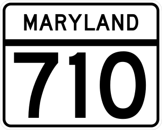
Maryland Route 710 is a state highway in the U.S. state of Maryland. Known as Ordnance Road, the state highway runs 2.16 miles (3.48 km) from MD 2 in Glen Burnie east to MD 173 in Brooklyn Park at the city limits of Baltimore. MD 710 provides access to the Defense Logistics Agency Curtis Bay Depot, a unit of the General Services Administration. The state highway is named for the federal site's prior use as a U.S. Army Depot. MD 710 was constructed in the early 1940s and relocated for most of its length concurrent with the construction of MD 10 in the early 1970s.


