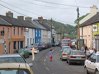
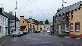
Union Hall, also Unionhall, is a small fishing village located in County Cork, Ireland, located on the west side of Glandore Harbour. Its nearest neighbour to the west is Castletownshend; to the east, Glandore village. It is approximately 10 kilometres south-east of Skibbereen. As of the 2016 census, 270 people were living in Union Hall.

Kinvara or Kinvarra is a sea port village in the southwest of County Galway, Ireland. It is located in the civil parish of Kinvarradoorus in the north of the barony of Kiltartan. Kinvarra is also an electoral division.

Millstreet is a town in north County Cork, Ireland, with a population of 1,555.

Darrara or Darrary is a rural townland near Clonakilty, County Cork in Ireland. The townland, of 1.4 km2 (0.54 sq mi), is home to Teagasc's Clonakilty Agricultural College and Sacred Heart Roman Catholic Church. Evidence of ancient settlement in the area include a restored Iron Age ringfort and a megalithic standing stone.

Tower, Ordnance Survey Ireland name Model Village, is a village within the administrative area of Cork city in Ireland. It is located to the northwest of the city, approximately 3 km from the town of Blarney on the R617 road. Together with Blarney, Tower is a satellite or dormitory town of Cork city. Tower is part of the Dáil constituency of Cork North-Central. As of the 2016 census of Ireland, the village had a population of 3,421.

Newcestown is a small village located 35 km from the city of Cork in the western part of County Cork, Ireland. It is a village with a church, a school, a pub and GAA club. Newcestown is part of the Dáil constituency of Cork North-West.

Durrus is a village and civil parish in West Cork in Ireland. It is situated ten kilometres (6 mi) from Bantry in County Cork, at the head of the Sheep's Head and the Mizen Head peninsulas.
Killoe is a rural community and parish in County Longford, Ireland, located approximately 6 miles north of Longford Town. It is home to Cairn Hill or Carn Clonhugh - the highest peak in County Longford.

Tullyallen is a village, civil parish and townland 6 km north-west of the town of Drogheda in County Louth, Ireland. It is in the historic Barony of Ferrard. It is located in the historical Boyne Valley, in the Catholic parish of Mellifont ; it is also close to Newgrange, Knowth and Dowth burial mounds, Monasterboice monastery, and to the Battle of the Boyne site.

Watergrasshill is a village in north east County Cork in Ireland. Watergrasshill is within the Cork North-Central Dáil constituency. Bypassed in 2003, the village is situated on the R639 road and accessible via junction 17 of the M8 motorway. The 2016 census recorded a population of 1,346.

Farran is a village in County Cork, Ireland, in the parish of Ovens. It lies on the southside of the River Lee. Farran is 12 miles (19 km) west from Cork City on the N22 road.
Drimoleague is a village on the R586 road at its junction with the R593 in County Cork, Ireland. It lies roughly halfway between the towns of Dunmanway and Bantry, within the civil parish of Dromdaleague. As of the 2016 census of Ireland, Drimoleague had 451 residents.

Glenville is a village and townland in County Cork, Ireland. It is situated approximately 20 km northeast of Cork city. Glenville is part of the Cork North-Central.

Dromina is a village and townland in County Cork, Ireland. It is situated in the civil parish of Shandrum, close to the village of Newtownshandrum. As of the 2016 census, Dromina had a population of 275 people, up from 207 as of the 1996 census.

Ballyvolane is a townland and suburb of Cork on the north side of the city, that borders Mayfield, White's Cross, Glenheights and Dublin Hill. The townland of Ballyvolane is in the civil parish of St. Anne's Shandon. Ballyvolane is within the Cork North-Central Dáil constituency.
Moycullen is a civil parish in the ancient barony of the same name. It is located in the western shore of Lough Corrib in County Galway, Ireland and is around 4 miles (6.4 km) north-west of the city of Galway on the road to Oughterard. The parish contains 27,294 statute acres. According to Lewis's survey of 1837, "The land is of very indifferent quality; and there is a large quantity of reclaimable waste and bog.". The parish gets its name from the church, now in ruins, that is situated around 1 mile (1.6 km) to the east of the village, in the townland of Moycullen itself.

Castlejordan is a village and townland in County Meath, Ireland. It is located in the south of the county, close to the border with County Offaly, to the south of Kinnegad. The townland of Castlejordan has an area of approximately 2.2 square kilometres (0.85 sq mi), and had a population of 85 people as of the 2011 census.
Ballyagran is a village and townland in County Limerick, Ireland. As of the 2016 census, the village had a population of 179 people. Ballyagran is also the name of a half-parish in the Roman Catholic Diocese of Limerick.

Courtbrack is a townland and village in County Cork, Ireland. It is located in the civil parish of Matehy close to the town of Blarney. The local Roman Catholic church is dedicated to Saint Joseph and was built c. 1840.

Saleen is a small village and census town in County Cork, Ireland. It is located in the civil parish of Garranekinnefeake, in the Cork County Council municipal district of East Cork. Saleen lies on the R630 regional road between Midleton and Whitegate.
