Churchtown, County Cork

Last updated • 3 min readFrom Wikipedia, The Free Encyclopedia

Churchtown
Brugh Thuinne
Village
Churchtown Village. - geograph.org.uk - 1552191.jpg
Statue in Churchtown, County Cork
Ireland adm location map.svg
Red pog.svg
Churchtown
Location in Ireland
Coordinates: 52°16′23″N8°43′46″W / 52.27306°N 8.72944°W / 52.27306; -8.72944
Country Ireland
Province Munster
County County Cork
Population
 (2016) [1]
598
Time zone UTC+0 (WET)
  Summer (DST) UTC-1 (IST (WEST))

Churchtown (Irish : Brugh Thuinne or Baile an Teampaill) [2] is a village, townland and civil parish in County Cork, Ireland. Churchtown, which had a population of 598 as of the 2016 census, is within the Cork North-West Dáil constituency.

Contents

Etymology

According to the Journal of the Ivernian Society, Churchtown is a translation of Baile an Teampuill, [3] the former ecclesiastical name of the parish which had replaced the non-ecclesiastical Brú Thuinne – the ‘royal house of the pasture lands’. The name of the parish, Brú Thuinne, has been the subject of much debate. Some scholars suggest that it is Brúgh, ‘a habitation’. Patrick Weston Joyce defines Brúgh as ‘a mansion’. Reverend Canon J.F. Lynch states: ‘Bruhenny is a diminutive form of Bruach, border or edge, and it is named Brochoyn and Bruchhane in the Pipe Roll of Cloyne.’ Others have identified the parish as ‘the marshy part of Orrery in County Cork’, leading to speculation that part of the name may have been derived from the genitive of the common word Tonn, meaning 'low-lying or pasture land'. [4]

History

St Colmcille's Catholic Church Church in Churchtown South - geograph.org.uk - 1385834.jpg
St Colmcille's Catholic Church

The area that now comprises the parish of Churchtown was settled at least 4,000 years ago. A Bronze Age axe head discovered in the parish is evidence of such settlement. Much of the village, which consisted primarily of thatched houses, was burned by the Whiteboys in January 1822 during an attack on the police barracks. Lord Egmont's agent, Sir Edward Tierney, commenced the rebuilding of Churchtown in 1825 and the work continued until its completion in 1849. The village was built in the form of a square, one side of which was named Egmont Row. The main street was George’s Street and that running west was named Kerry Lane. The double row of houses on the Buttevant Road was called Chapel Lane, while the road to the east leading to the main Cork–Limerick road was named Lodge Road (now Burton Road). [4]

Education

The first school in Churchtown was built from an endowment by Sir John Perceval in 1702. The dissolution of the school in 1720 was largely brought about by the reluctance of parents to ‘bind’ the children to the Master of the school rather than to tradesmen. A later grammar school at Burton was also a failure. The original Churchtown National School on Kerry Lane was built by Sir Edward Tierney and completed in 1847. Later the school was moved to another building and this building was turned into a community center. It is the only school in the parish. As of 2024, Churchtown National School (also known as Scoil Bhrugh Thuinne) had an enrollment of 123 girls and boys. [5]

Ecology

A wide variety of flora and fauna grow in the parish. Ballygrace and Stack's Bridge are considered areas of particular ecological value. Recorded varieties of trees common to the parish include: apple, crab apple, ash, alder, beech, cedar, chestnut, cypress, elm, fir, hazel, holly, larch, lime, monkey puzzle, oak, pear, pine, spruce, sycamore, willow and yew. Fauna includes the badger, fox, hare, shrew, red squirrel, stoat and bat. Birds include the goldcrest, sparrow hawk, kestrel and barn owl, as well as all other common songbirds.

Events

The Churchtown Carnival was a week-long annual fund-raising festival begun in the late 1940s under the guidance of Muintir na Tíre. The carnival was an important part of the town's culture and was still being held till the 1970s. The event was advertised in surrounding parishes and held at the community center. [4]

Notable people

The names of Barry O'Meara, Seán "Clárach" Mac Domhnaill and Vincent O'Brien are listed on a "Jockey on Horse" statue in the village centre. [4]

See also

Related Research Articles

<span class="mw-page-title-main">Ardfert</span> Village in County Kerry, Ireland

Ardfert is a village and civil parish in County Kerry, Ireland. Historically a religious centre, the economy of the locality is driven by agriculture and its position as a dormitory town, being only 8 km (5 mi) from Tralee. The population of the village was 749 at the 2016 census.

<span class="mw-page-title-main">Glanmire</span> Town near Cork city, Ireland

Glanmire is a suburban town 9 kilometres (5.6 mi) from Cork city centre, in the civil parish of Rathcooney, County Cork, Ireland. Glanmire is within the administrative area of Cork City Council and the Dáil constituency of Cork North-Central.

<span class="mw-page-title-main">Newcastle West</span> Town in County Limerick, Ireland

Newcastle West or simply Newcastle is a town in west County Limerick, Ireland. It is the largest town in the county, excluding Limerick city. It is also the county town, and sits on the River Arra which flows into the River Deel. Newcastle West is in the middle of a great bowl-shaped valley in West Limerick, known one time as the valley of the Wild Boar, apparently due to the abundance of this animal here when the area was thickly wooded. The crest of the town carries the image of a wild boar. The town is partly in the civil parish of Newcastle.

<span class="mw-page-title-main">Charleville, County Cork</span> Town in County Cork, Ireland

Charleville is a town in County Cork, Ireland. It lies in the Golden Vale, on a tributary of the River Maigue, near the border with County Limerick. Charleville is on the N20 road and is the second-largest town between Limerick and Cork, the largest being Mallow. The Roman Catholic parish of Charleville is within the Diocese of Cloyne. Significant industries in the town include Kerry Co-op and the construction and services sectors.

<span class="mw-page-title-main">Bruff</span> Town in Munster, Ireland

Bruff is a town in east County Limerick, in the midwest of Ireland, located on the old Limerick–Cork road (R512). The town lies on the Morning Star river, with two bridges in the town itself. The horseshoe lake of Lough Gur is nearby. The town is in a townland and civil parish of the same name.

<span class="mw-page-title-main">Churchtown, Dublin</span> Affluent suburb of Dublin, Ireland

Churchtown is a largely residential affluent suburb on the southside of Dublin, between Rathfarnham and Dundrum.

Ballyhea or Ballyhay is a townland and civil parish in north County Cork, Ireland. Located near to the County Limerick border, the village of Ballyhea lies on the main N20 Cork–Limerick road, 3.5 km south of Charleville. It lies approximately 110 m above sea level.

<span class="mw-page-title-main">Ballydesmond</span> Village in County Cork, Ireland

Ballydesmond, formerly Kingwilliamstown, is a rural village in County Cork, Ireland. It lies on the Blackwater River on the Cork-Kerry border. The Ballydesmond quarry is an area of geological interest, containing the best example of tundra forest polygons found in Ireland. It is located at the junction of the R577 and R578 regional roads.

<span class="mw-page-title-main">Ballyvourney</span> Village in County Cork, Ireland

Ballyvourney is a Gaeltacht village in southwest County Cork, Ireland. Ballyvourney is also a civil parish in the barony of Muskerry West, and an ecclesiastical parish in the Roman Catholic Diocese of Cloyne. The village is part of the Cork North-West Dáil Constituency.

<span class="mw-page-title-main">Douglas, Cork</span> Suburb in Cork city, Ireland

Douglas is a suburb, with a village core, in Cork city, Ireland. Douglas is also the name of the townland, Roman Catholic parish, Church of Ireland parish and civil parish in which it is contained.

<span class="mw-page-title-main">Ballinadee</span> Village in County Cork, Ireland

Ballinadee is a village in County Cork, Ireland. It lies in the parish of Courceys, approximately 12 km by road west of Kinsale and 9 km south east of Bandon. Ballinadee is on the banks of the River Pound, which flows into the River Bandon, and has a school, two churches and two pubs. The village is in a townland and civil parish of the same name.

Ballyphehane is a suburb in the south of Cork in Ireland. It is one of the oldest suburbs in Cork and was created as part of a post-World War II initiative to create a model community in Cork. Between 1948 and 1993, a total of 11 housing schemes totalling 1,316 dwellings were built by Cork Corporation, now known as Cork City Council. Many of the main roads in Ballyphehane are named after the executed leaders of the 1916 Rising.

<span class="mw-page-title-main">Glanworth</span> Village in County Cork, Ireland

Glanworth is a village on the R512 regional road in County Cork, Ireland. It lies approximately 8 kilometres (5 mi) northwest of the town of Fermoy and 40 km (25 mi) northeast of Cork city. As of 2022, Glanworth's population was 628.

<span class="mw-page-title-main">Paulstown</span> Village in County Kilkenny, Ireland

Paulstown is a small village in County Kilkenny in Ireland.

Currow is a rural village in County Kerry in south west Ireland, located approximately 12 km from Killarney and 18 km from Tralee. Currow is situated on the Brown Flesk River, a tributary of the River Maine.

Seán "Clárach" Mac Domhnaill or John Mac Donnell Claragh (1691–1754) was an Irish language poet in the first half of the 18th century.

<span class="mw-page-title-main">Old Parish</span> Village in County Waterford, Ireland

Old Parish is a village in west County Waterford, Ireland. It is part of the Gaeltacht in Waterford Gaeltacht na nDéise.

<span class="mw-page-title-main">Bruree</span> Village in County Limerick, Ireland

Bruree is a village in south-eastern County Limerick, Ireland, on the River Maigue. It takes its name from the nearby ancient royal fortress, the alternative name of which from the earliest times into the High Middle Ages was Dún Eochair Maigue or the "fortress on the brink of the maigue". Other very old spellings and names include Brugh Righ, and Brugh Ri. The village is in a townland and civil parish of the same name.

<span class="mw-page-title-main">Castletown, County Kerry</span> Townland in County Kerry, Ireland

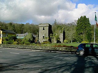
Castletown, is a townland of County Kerry, Ireland.

References

  1. "Census 2016 - Small Area Population Statistics (SAPMAP Area) - Settlements - Churchtown". Census 2016. Central Statistics Office.
  2. Placenames Database of Ireland
  3. "The history in the name Bruhenny". Journal of the Ivernian Society. 1913.
  4. 1 2 3 4 J. Hickey, Denis (2005). The Annals of Churchtown. Churchtown Village Renewal Trust.
  5. "Final a school - Scoil Bhrugh Thuinne". Department of Education. 23 August 2024. Retrieved 14 November 2024 via gov.ie.

52°16′23″N8°43′46″W / 52.27306°N 8.72944°W / 52.27306; -8.72944