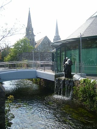
Clonakilty, sometimes shortened to Clon, is a town in County Cork, Ireland. The town is at the head of the tidal Clonakilty Bay. The rural hinterland is used mainly for dairy farming. The town's population was 4,946 at the 2022 census. The town is a tourism hub in West Cork, and was recognised as the "Best Town in Europe" in 2017, and "Best Place of the Year" in 2017 by the Royal Institute of the Architects of Ireland. Clonakilty is in the Dáil constituency of Cork South-West, which has three seats.

Carrigaline is a town and civil parish in County Cork, Ireland, situated on the River Owenabue. Located about 12 kilometres (7.5 mi) south of Cork city, and with a population of 18,239 people, it is one of the largest commuter towns in the county. The R611 regional road passes through the town, and it is just off the N28 national primary route to Ringaskiddy. Carrigaline grew rapidly in the late 20th century, from a village of a few hundred people into a thriving commuter town although some locals still refer to it as "the village". The town is one of the key gateways to west Cork, especially for those who arrive by ferry from France. Carrigaline is within the Cork South-Central Dáil constituency.
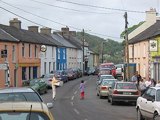
Union Hall, also Unionhall, is a small fishing village located in County Cork, Ireland, located on the west side of Glandore Harbour. Its nearest neighbour to the west is Castletownshend; to the east, Glandore village. It is approximately 10 kilometres south-east of Skibbereen. As of the 2016 census, 270 people were living in Union Hall.
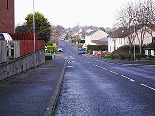
Carryduff is a small town and townland in County Down, Northern Ireland, about 10 kilometres (6.2 mi) south of Belfast city centre. It had a population of 7,173 people in the 2021 census. Most of the settlement lies within the townland of Carryduff, although part of it extends into the neighbouring townlands of Killynure and Mealough.
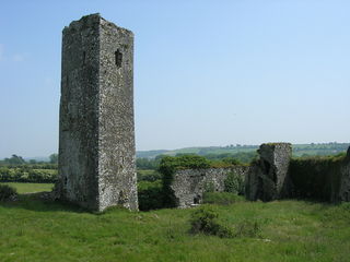
Ballincollig is a suburban town within the administrative area of Cork city in Ireland. It is located on the western side of Cork city, beside the River Lee on the R608 regional road. In 2016 it was the largest town in County Cork, at which time the Ballincollig Electoral Division had a population of 18,621 people. It is located beyond the green belt from the suburbs of Bishopstown and Wilton. Historically home to the Ballincollig Royal Gunpowder Mills which is now a Regional Park, the town has seen much growth in recent years as a satellite of Cork City. Ballincollig is within the Cork North-West Dáil constituency.

Monkstown is a village and parish in County Cork, Ireland, in the old barony of Kerrycurrihy. It lies 14 kilometres southeast of Cork city on the estuary of the River Lee, facing Great Island and looking onto Monkstown Bay. For census purposes, Monkstown is combined with the nearby town of Passage West, and the combined area has a population of approximately 5,800 residents. The parish of Monkstown includes the nearby villages of Shanbally and Ringaskiddy.

Ringaskiddy is a village in County Cork, Ireland. It is located on the western side of Cork Harbour, south of Cobh, and is 15 kilometres (9 mi) from Cork city, to which it is connected by the N28 road. The village is a port with passenger ferry, with two bi-weekly sailings to Roscoff in France. A ferry service to Swansea in Wales closed in 2012.

Moycullen is a Gaeltacht village in County Galway, Ireland, about 10 km (7 mi) northwest of Galway city. It is near Lough Corrib, on the N59 road to Oughterard and Clifden, in Connemara. Moycullen is now a satellite town of Galway with some residents commuting to the city for work, school, and business. Population increased 33.7% from the 2016 census, reaching 2,279 in 2022.
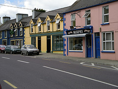
The twin villages of Ballineen and Enniskeane, or Enniskean, in County Cork in Ireland are 43 km (26.72 mi) southwest of Cork City, on the R586 road. The linear settlement lies on the River Bandon between Bandon and Dunmanway. The combined settlement is designated as a 'key village' by Cork County Council for planning purposes and, as of the 2016 census, had a population of 692 people.
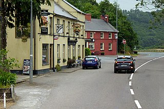
Belgooly (Irish: Béal Guala is a village in County Cork, Ireland, located 4.6 kilometres to the north-east of Kinsale. In 2022 it had a population of 823.

Rathmore is a small town in County Kerry, Ireland, lying immediately west of the border with County Cork. Rathmore is divided into two parts, one being the main commercial centre, and the other being the administrative centre where the schools and churches are located which is colloquially known as Rath Beg. It lies at the heart of the Sliabh Luachra area known for its traditional Irish music and culture. The local GAA club is Rathmore GAA. The SAG is in Rathmore and helps the elderly in the area. The town host the farmer's market every Saturday in the community centre.
Milford is a small village in County Cork, Ireland. It is in the townland of Kilbolane on regional road R515, close to the border with County Limerick. Milford is in the Dáil constituency of Cork North-West.
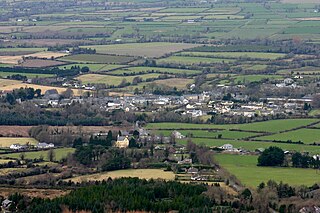
Clogheen is a village in County Tipperary, Ireland. The census of 2016 recorded the population at 478 people.

Glanworth is a village on the R512 regional road in County Cork, Ireland. It lies approximately 8 kilometres (5 mi) northwest of the town of Fermoy and 40 km (25 mi) northeast of Cork city. As of 2022, Glanworth's population was 628.
Lyre is a townland and small village in the civil parish of Clonmeen, barony of Duhallow, northwest County Cork, Ireland. It is approximately 3 km from the village of Nad. Lyre is within the Cork North-West Dáil constituency.

Moneygall is a village on the border of counties Offaly and Tipperary, in Ireland. It is situated on the R445 road between Dublin and Limerick. There were 374 people living in the village as of the 2022 census. Moneygall has a Catholic church, motorway service station, a car sales and repair centre, a national school, a Garda station and two pubs. The nearest Church of Ireland church, Borrisnafarney, is 2 km from the village beside the former Loughton Demesne.

Watergrasshill is a village in north east County Cork in Ireland. Watergrasshill is within the Cork North-Central Dáil constituency. Bypassed in 2003, the village is situated on the R639 road and accessible via junction 17 of the M8 motorway. It had a population of 1,840 at the 2022 census.

Tallow is a town, civil parish and townland in County Waterford, Ireland. Tallow is in the province of Munster near the border between County Cork and County Waterford and situated on a small hill just south of the River Bride.

Drinagh is a village in County Cork, Ireland. It lies on the R637 road between the towns of Dunmanway and Skibbereen. Drinagh is also close to Rosscarbery and Drimoleague.

Bweeng is a village located approximately 14 km (9 mi) south west of the town of Mallow, County Cork, Ireland on the R619 regional road. Bweeng is within the Dáil constituency of Cork North-West and the townlands of Beennamweel West, Beennamweel East, Shanavoher, Ballyboght and Glashaboy West in the civil parish of Kilshannig.


