
County Cork is the largest and the southernmost county of Ireland, named after the city of Cork, the state's second-largest city. It is in the province of Munster and the Southern Region. Its largest market towns are Mallow, Macroom, Midleton, and Skibbereen. As of 2022, the county had a population of 584,156, making it the third-most populous county in Ireland. Cork County Council is the local authority for the county, while Cork City Council governs the city of Cork and its environs. Notable Corkonians include Michael Collins, Jack Lynch, Roy Keane, Sonia O'Sullivan, Cillian Murphy and Graham Norton.

MacGillycuddy's Reeks is a sandstone and siltstone mountain range in the Iveragh Peninsula in County Kerry, Ireland. Stretching 19 kilometres, from the Gap of Dunloe in the east, to Glencar in the west, the Reeks is Ireland's highest mountain range, and includes most of the highest peaks and sharpest ridges in Ireland, and the only peaks on the island over 1,000 metres in height.

The Twelve Bens or Twelve Pins, also called the Benna Beola, is a mountain range of mostly sharp-peaked quartzite summits and ridges in the Connemara National Park in County Galway, in the west of Ireland. The widest definition of the range includes the Garraun Complex to the north as well as several isolated peaks to the west, and is designated a 16,163-hectare (39,940-acre) Special Area of Conservation.
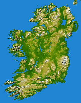
In these lists of mountains in Ireland, those within Northern Ireland, or on the Republic of Ireland – United Kingdom border, are marked with an asterisk, while the rest are within the Republic of Ireland. Where mountains are ranked by height, the definition of the topographical prominence used to classify the mountain, is noted. In British definitions, a height of 600 metres (1,969 ft) is required for a mountain, whereas in Ireland, a lower threshold of 500 metres (1,640 ft) is sometimes advocated.

Galtymore or Galteemore is a mountain in the province of Munster, Ireland. At 917.9 metres, it is one of Ireland's highest mountains, being the 12th-highest on the Arderin list, and 14th-highest on the Vandeleur-Lynam list. Galtymore has the 4th-highest topographic prominence of any peak in Ireland, which classifies Galtymore as a P600, or "major mountain". It is one of the 13 Irish Munros.

Kippure at 757 metres (2,484 ft), is the 56th-highest peak in Ireland on the Arderin scale, and the 72nd-highest peak on the Vandeleur-Lynam scale. Kippure is situated in the far northern sector of the Wicklow Mountains, where it lies on the border of counties Dublin and Wicklow in Ireland. Kippure is the County Top for Dublin, and its height and positioning over Dublin city have made its summit an important site for transmission masts, which are highly visible from a distance. Kippure's slopes feed into the Liffey Head Bog which forms the source of the River Liffey. The summit can be easily accessed from the east via a path that lies off the R115 road along the route to the Sally Gap.

The mountains and hills of the British Isles are categorised into various lists based on different combinations of elevation, prominence, and other criteria such as isolation. These lists are used for peak bagging, whereby hillwalkers attempt to reach all the summits on a given list, the oldest being the 282 Munros in Scotland, created in 1891.

Benbaun is a mountain in County Galway, Ireland. With a height of 729 metres (2,392 ft), it is the 72nd highest peak in Ireland on the Arderin scale, and the 88th highest peak on the Vandeleur-Lynam scale. Benbaun is situated at the centre of the core massif of the Twelve Bens mountain range in the Connemara National Park and is the tallest mountain of the Twelve Bens range, and the county top for Galway.
Knockboy is a 706-metre-high mountain on the border between counties Cork and Kerry in Ireland.

Mullaghcleevaun at 849 metres (2,785 ft), is the 15th–highest peak in Ireland on the Arderin scale, and the 20th–highest peak on the Vandeleur-Lynam scale. Mullaghcleevaun is in the central sector of the Wicklow Mountains range, in Wicklow, Ireland; it is the 2nd highest peak in Wicklow after Lugnaquilla. Mullaghcleevaun lies on the main "central spine" of the whole range that runs from Kippure in the north, to Lugnaquillia in the south; and in particular, it lies on the continuous "central boggy ridge" that runs from the Sally Gap to Tonelagee.

Purple Mountain at 832 metres (2,730 ft) high, is the 21st–highest peak in Ireland on the Arderin scale, and the 28th–highest according to the Vandeleur-Lynam scale. It is located in County Kerry, and is the highest point of the Purple Mountain Group.

Camaderry at 699 metres (2,293 ft), is the 90th-highest peak in Ireland on the Arderin scale, and the 112th-highest peak on the Vandeleur-Lynam scale. Camaderry is situated in the southern sector of the Wicklow Mountains range, and forms a broad horseshoe around the valley of Glendalough with the hydroelectric station at Turlough Hill 681 metres (2,234 ft), and the mountains of Conavalla 734 metres (2,408 ft), and Lugduff 652 metres (2,139 ft). Camaderry has a subsidiary summit, Camaderry South East Top 677 metres (2,221 ft), and both lie across the deep Wicklow Gap from Tonelagee 817 metres (2,680 ft), which sits on the "central spine" of the Wicklow range.
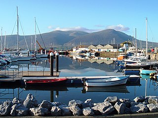
Slieve Mish Mountains, is a predominantly sandstone mountain range at the eastern end of the Dingle Peninsula in County Kerry, Ireland. Stretching 19 kilometres, from the first major peak of Barnanageehy outside of Tralee in the east, to Cnoc na Stuaice in near Central Dingle in the west, the range has over 17 material peaks, with the core of the mountain range based around the massif of its highest peak, Baurtregaum, and its deep glacial valleys of Derrymore Glen and Curraheen Glen.

Mangerton or Mangerton Mountain, at 838 metres (2,749 ft), is the 19th-highest peak in Ireland on the Arderin list, and the 26th–highest mountain according to the Vandeleur-Lynam list. Mangerton is the tallest mountain in the Mangerton Mountain Group, also called the Mangerton Mountains or the Mountains of East Kerry, a range that includes five other major mountains that have a height above 2,000 feet (610 m). Mangerton's western slopes lie within the Killarney National Park. On Mangerton's north-western face lies a deep corrie lake called the Devil's Punchbowl, which is a popular scenic destination for hill walkers; although the mountain is often overlooked by walkers due to the proximity of its more scenic and accessible neighbour, Torc Mountain. The far northern slopes of Mangerton was the site of an important 13th-century battle between the Mac Cárthaigh, and the FitzGeralds, known as the "Tooreencormick battle site".

The mountains and hills of England comprise very different kinds of terrain, from a mountain range which reaches almost 1,000 metres high, to several smaller areas of lower mountains, foothills and sea cliffs. Most of the major upland areas have been designated as Areas of Outstanding Natural Beauty (AONB) or national parks. The highest and most extensive areas are in the north and west, while the midlands, south-east and east of the country tend to be low-lying.

Table Mountain is a 702-metre (2,303 ft) peak in the southern section of the Wicklow Mountains range in Ireland. With a prominence of only 16 metres (52 ft), it is only listed in a few of the recognised categories of mountains in Ireland; it is the 110th–highest peak on the Vandeleur-Lynam Irish scale. Table Mountain is at the apex of a horseshoe-shaped "boggy" massif with its larger neighbours, Camenabologue 758 metres (2,487 ft) and Conavalla 734 metres (2,408 ft) that sit at the head of the Glenmalure valley; all three peaks lie close to the "central spine" of the range as it runs from Kippure in the north, to Lugnaquillia in the south. There is no recorded Irish language name for Table Mountain, and it has no connection with Table Mountain in Cape Town, South Africa.

Baurtregaum at 851 metres (2,792 ft), is the 13th–highest peak in Ireland on the Arderin scale, and the 18th–highest peak on the Vandeleur-Lynam scale. Baurtregaum is situated at the centre of the massif of the Slieve Mish Mountains on the Dingle Peninsula in County Kerry, Ireland. It is the tallest mountain of the Slieve Mish range, with a number of major subsidiary summits.

Gravale at 718 metres (2,356 ft), is the 79th–highest peak in Ireland on the Arderin scale, and the 98th–highest peak on the Vandeleur-Lynam scale. Gravale is in the middle sector of the Wicklow Mountains range, in County Wicklow, Ireland. Gravale sits on a north-east to south-west "boggy ridge" that forms the "central spine" of the whole range, which runs from the Sally Gap, to Carrigvore 682 metres (2,238 ft), to Gravale, and after a col to Duff Hill 720 metres (2,360 ft), which is part of the larger massif of Mullaghcleevaun 849 metres (2,785 ft).

War Hill at 686 metres (2,251 ft), is the 106th–highest peak in Ireland on the Arderin scale, and the 129th–highest peak on the Vandeleur-Lynam scale. War Hill is in the far northeastern section of the Wicklow Mountains, in County Wicklow, Ireland. Due to its remote setting, it is usually only accessed as part of a larger hill-walking route taking in other neighbouring peaks such as Djouce or Maulin. One of the few distinguishing landmarks in the area is the Coffin Stone that lies in the saddle between War Hill and Djouce, whose origin is uncertain.


