Caher Mountain (Cork)

Last updated
Caher Mountain
Cathair
Caher-mountain - geograph.org.uk - 271537.jpg
Very rough hillside and bog running up to the summit of Caher Mountain
Highest point
Elevation 338 m (1,109 ft) [1]
Prominence 143 m (469 ft) [1]
Coordinates 51°34′56″N9°44′32″W / 51.5822°N 9.7421°W / 51.5822; -9.7421 Coordinates: 51°34′56″N9°44′32″W / 51.5822°N 9.7421°W / 51.5822; -9.7421
Geography
Island of Ireland relief location map.png
Red triangle with thick white border.svg
Caher Mountain
Location in Ireland
Location County Cork, Ireland
Parent range Sheep's Head peninsula

Caher Mountain (Irish : Cathair = "stone ring-fort") is a hill, 338 metres high, with views of the Sheep's Head peninsula, roughly west of and above the village of Kilcrohane in County Cork, Ireland. [1]

Irish language Gaelic language spoken in Ireland and by Irish people

Irish is a Goidelic language of the Celtic languages family, itself a branch of the Indo-European language family. Irish originated in Ireland and was historically spoken by Irish people throughout Ireland. Irish is spoken as a first language in substantial areas of counties Galway, Kerry, Cork and Donegal, smaller areas of Waterford, Mayo and Meath, and a few other locations, and as a second language by a larger group of habitual but non-traditional speakers across the country.

Sheeps Head

Sheep's Head, also known as Muntervary, is the headland at the end of the Sheep's Head peninsula situated between Bantry Bay and Dunmanus Bay in County Cork, Ireland.

Kilcrohane Village in Munster, Ireland

Kilcrohane is a village in County Cork, Ireland. The last coastal village on the Sheep's Head Peninsula after Durrus and Ahakista. It lies under the 'Shadow of Seefin' and is also close to Caher Mountain. The village overlooks Dunmanus Bay.

Contents

Location

Caher Mountain is located approximately 15 km from the end of the Sheep's Head peninsula and around 4 km west of Kilcrohane. Its neighbouring summit is Seefin (345 m), some 5 km to the northeast. It is at grid reference V793380 and can be reached on an easy walk from a lay-by about 1.5 km above the village. [1]

Views

In clear weather there are views as far as Dursey Island and the Iveragh Peninsula from Caher Mountain. [1]

Dursey Island island

Dursey Island lies at the southwestern tip of the Beara Peninsula in the west of County Cork in Ireland. Dursey Island is 6.5 kilometres long and 1.5 kilometres wide. The island is separated from the mainland by a narrow stretch of water, Dursey Sound, which has a very strong tidal race, with the submerged Flag Rock close to the centre of the channel. The island has just six or so permanent residents, and is connected to the mainland by Ireland's only cable car. Dursey has no shops, pubs or restaurants. At one point there was a post office on the island; this has since closed.

Iveragh Peninsula Peninsula in County Kerry, Ireland

The Iveragh Peninsula is located in County Kerry in Ireland. It is the largest peninsula in southwestern Ireland. A mountain range, the MacGillycuddy's Reeks, lies in the centre of the peninsula. Carrauntoohil, its highest mountain, is also the highest peak in Ireland.

Related Research Articles

MacGillycuddys Reeks Mountain range in Kerry, Ireland

MacGillycuddy's Reeks is a sandstone and siltstone mountain range in County Kerry, Ireland. Stretching 19 kilometres, from the Gap of Dunloe in the east, to Glencar in the west, the Reeks is Ireland's highest mountain range, and includes most of the highest peaks and sharpest ridges in Ireland, and the only peaks on the island that are over 1,000 metres in height.

Dingle Peninsula peninsula in County Kerry, Munster; geonames ID = 2964779

The Dingle Peninsula is the northernmost of the major peninsulas in County Kerry. It ends beyond the town of Dingle at Dunmore Head, the westernmost point of Ireland and arguably Europe.

Carrauntoohil Highest mountain in Ireland

Carrauntoohil or Carrauntoohill is the highest mountain on the island of Ireland at 1,038.6 metres (3,407 ft). Located in County Kerry, Carrauntoohil is the central peak of the MacGillycuddy's Reeks, Ireland's highest mountain range.

Lists of mountains in Ireland Highest mountains in Ireland

These are lists of mountains and mountain ranges in Ireland. Those within Northern Ireland, or on the border, are marked with an asterisk, while the rest are within the Republic of Ireland. Where mountains are ranked by height, the definition of the "topographical prominence", used to classify the mountain, is noted. In British definitions, a height of 600 metres (1,969 ft) is required for a "mountain", whereas in Ireland, a lower threshold of 500 metres (1,640 ft) is sometimes advocated.

Inishturk island

Inishturk is an inhabited island of County Mayo, in Ireland.

Caher is an Anglicised form of the Irish language word cathair and may refer to: Caher

Ben of Howth mountain in Ireland

The Ben of Howth is a hilly area on Howth Head, adjacent to the 171 metre high Black Linn, the peninsula's highest point.

Ahakista Village in Munster, Ireland

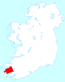
Ahakista is located approximately halfway along the Sheep's Head peninsula between Durrus and Kilcrohane in County Cork, Ireland. It is a wooded coastal village with a deep and sheltered harbour.

Seefin is the anglicisation of the Irish Suí Finn, meaning Finn's Seat, and may refer to the following places in Ireland:

Geokaun

Geokaun Mountain is the highest mountain on Valentia Island, County Kerry.

Mount Gabriel mountain in Ireland

Mount Gabriel is a mountain on the Mizen Peninsula situated immediately to the north of the town of Schull, in West Cork, Ireland.

Beenkeragh Mountain in Kerry, Ireland

Beenkeragh or Benkeeragh is the second-highest peak in Ireland, at 1,008.2 metres (3,308 ft), on both the Arderin and Vandeleur-Lynam lists. It is part of the MacGillycuddy's Reeks range in County Kerry. Beenkeragh also gives its name the infamous Beenkeragh Ridge, the narrow rocky arete between Beenkeragh and Carrauntoohil, Ireland's highest mountain.

Caher Mountain (Kerry) Mountain in Kerry, Ireland

Caher or Caher East Top at 1,000 metres (3,300 ft), is the third-highest peak in Ireland, on the Irish Arderin and Vandeleur-Lynam classifications. It is part of the MacGillycuddy's Reeks in County Kerry.

Caher West Top Mountain in Kerry, Ireland

Caher West Top at 973.4 metres (3,194 ft), is the fifth-highest peak in Ireland on the Irish Vandeleur-Lynam classification, and part of the MacGillycuddy's Reeks range. Caher West Top is the only Furth to have a prominence below 30 metres (98 ft).

Wild Atlantic Way Irish Tourism trail

The Wild Atlantic Way is a tourism trail on the west coast, and on parts of the north and south coasts, of Ireland. The 2,500 km driving route passes through nine counties and three provinces, stretching from County Donegal's Inishowen Peninsula in Ulster to Kinsale, County Cork, in Munster, on the Celtic Sea coast.

Killonaghan Parish in Munster, Ireland

Killonaghan or Killonahan is a civil parish in County Clare, Ireland. It covers a part of the Burren, a rugged area on the Atlantic coast, and contains the seaside village of Fanore.

R591 road (Ireland)

The R591 road is a regional road in Ireland. It is a road on the Mizen Peninsula in County Cork. Most of the road forms part of the Wild Atlantic Way.

Glanfahan

Glanfahan is a townland on the Dingle Peninsula, Ireland, notable for its large collection of clocháns, which form a National Monument.

References

  1. 1 2 3 4 5 Caher Mountain at mountainviews.ie. Accessed on 3 Feb 2013.