
County Cork is the largest and the southernmost county of Ireland, named after the city of Cork, the state's second-largest city. It is in the province of Munster and the Southern Region. Its largest market towns are Mallow, Macroom, Midleton, and Skibbereen. As of 2022, the county had a population of 584,156, making it the third-most populous county in Ireland. Cork County Council is the local authority for the county, while Cork City Council governs the city of Cork and its environs. Notable Corkonians include Michael Collins, Jack Lynch, Roy Keane, Sonia O'Sullivan, Cillian Murphy and Graham Norton.
BlackRock is a global investment management firm.
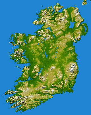
In these lists of mountains in Ireland, those within Northern Ireland, or on the Republic of Ireland – United Kingdom border, are marked with an asterisk, while the rest are within the Republic of Ireland. Where mountains are ranked by height, the definition of the topographical prominence used to classify the mountain, is noted. In British definitions, a height of 600 metres (1,969 ft) is required for a mountain, whereas in Ireland, a lower threshold of 500 metres (1,640 ft) is sometimes advocated.
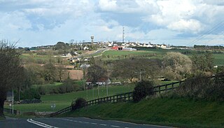
Kildorrery is a village in north County Cork, Ireland. It lies at the crossroads of the N73 road from Mallow to Mitchelstown and the R512 from Kilmallock to Fermoy. The village is in a townland and civil parish of the same name. Kildorrery is part of the Cork East Dáil constituency.
Kilfinnane or Kilfinane is a small market town in County Limerick, Ireland. The town's name comes from the Irish Cill (church) and Fhíonáin (Finnian), making its meaning "Church of Saint Finnian". Kilfinnane is located approximately 40 km southeast of Limerick, and approximately 70 km north-northwest of Cork. It had a population of 789 at the 2016 census.
Robert Dwyer Joyce (1836–1883) was an Irish poet, writer, and collector of traditional Irish music.

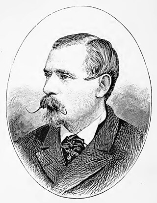
Patrick Weston "P. W." Joyce was an Irish historian, writer and music collector, known particularly for his research in Irish etymology and local place names of Ireland.

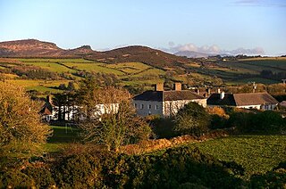
The Ballyhoura Mountains are in south-east County Limerick and north-east County Cork in central Munster, Ireland, running east and west for about 6 miles on the borders of both counties.

Mountain Rescue Ireland is the representative body for mountain rescue services on the island of Ireland. It has eleven member organisations - ten regional mountain rescue teams and one national canine search team (SARDA). Mountain Rescue Ireland (MRI) is a member of the International Commission for Alpine Rescue (IKAR-CISA).

Effin is a townland and civil parish in County Limerick, Ireland. It is on the R515 road, midway between Kilmallock and Charleville. The population of the parish is about 1,000. Effin is partly in the barony of Costlea, but chiefly in that of Coshma. The parish lies in the Golden Vale, Munster's rich dairyland, and intensive dairying is practised there. The Ballyhoura Mountains, which separate County Limerick from County Cork, are at the southern end of the parish.
Seefin is a mountain near the southern border of County Limerick, Ireland. At 528m it is the highest point and the second most northerly summit in the Ballyhoura Mountains and the 396th highest in Ireland. Latitude: 52.313847 Longitude: -8.522738.
Seefin is the anglicisation of the Irish Suí Finn, meaning Finn's Seat, and may refer to the following places in Ireland:

Ballylanders is a village in south County Limerick, Ireland. It is situated on the R513 Mitchelstown-Limerick regional road, being approximately 14 km (9 mi) from the former and 44 km (27 mi) from the latter. The 2016 census recorded a population of 308 people. The village is in a townland and civil parish of the same name.
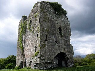
Castlepook or Castle Pook is a Norman style castle built in 1380 by the Synan family.
Bluebell Falls is an organic goat cheese company in County Cork, Ireland.
The Ballyhoura Way is a long-distance trail in Ireland. The trail is 89 kilometres long; it begins at St John's Bridge, near Kanturk, County Cork and ends at Limerick Junction, County Tipperary, and is typically completed in four days. It is designated as a National Waymarked Trail by the National Trails Office of the Irish Sports Council and is managed by Ballyhoura Fáilte. The trail was opened in April 1994 by President Mary Robinson.
The Multeen Way is a long-distance trail in County Tipperary, Ireland. It is 23 kilometres long and begins in Tipperary Town and ends in Upperchurch. It is typically completed in one day. It is designated as a National Waymarked Trail by the National Trails Office of the Irish Sports Council.
Fermoy is a historical barony in County Cork in Ireland. It is bordered by the baronies of Orrery and Kilmore to the north-west; Duhallow to the west; Barretts to the south-west; Barrymore to the south; Condons and Clangibbon to the east; and Coshlea, County Limerick to the north. It is bounded to the south by the Nagle Mountains and the valley of the Munster Blackwater. The Ballyhoura Mountains mark the northern boundary. A tributary of the Blackwater, the Awbeg has two branches in its upper stretches; one branch forms the northern boundary while the other near Buttevant, forms the western limit. To the east, lies another Blackwater tributary, the Funcheon. Anomalously, the namesake town of Fermoy is actually in the barony of Condons and Clangibbon. The town with the greatest population in the barony is Mallow.
Claidh Dubh, an Iron Age linear earthwork located in south-west Ireland.
Kilcolman Bog is a national nature reserve of approximately 74 acres (0.30 km2) in County Cork.

