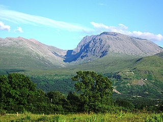
A Munro is defined as a mountain in Scotland with a height over 3,000 feet (914.4 m), and which is on the Scottish Mountaineering Club (SMC) official list of Munros; there is no explicit topographical prominence requirement. The best known Munro is Ben Nevis, the highest mountain in the British Isles at 4,413 feet (1,345 m).

In these lists of mountains in Ireland, those within Northern Ireland, or on the Republic of Ireland – United Kingdom border, are marked with an asterisk, while the rest are within the Republic of Ireland. Where mountains are ranked by height, the definition of the topographical prominence used to classify the mountain, is noted. In British definitions, a height of 600 metres (1,969 ft) is required for a mountain, whereas in Ireland, a lower threshold of 500 metres (1,640 ft) is sometimes advocated.

The mountains and hills of the British Isles are categorised into various lists based on different combinations of elevation, prominence, and other criteria such as isolation. These lists are used for peak bagging, whereby hillwalkers attempt to reach all the summits on a given list, the oldest being the 282 Munros in Scotland, created in 1891.

Knockmealdown is the highest peak of the Knockmealdown Range of mountains, located on the border between Co Tipperary and Co Waterford.

Knockboy is a 706-metre-high mountain on the border between counties Cork and Kerry in Ireland.

Barrclashcame is a 772 m (2,533 ft) mountain in County Mayo, Ireland.
Slieve Carr, also known as Slieve Cor or Corslieve, is a mountain with a height of 721 metres (2,365 ft) in County Mayo, Ireland. It is part of the Nephin Range and is beside Nephin Beg. On the summit is a burial cairn known as Laghtdauhybaun, from Leacht Dáithí Bháin, 'burial monument of white Dáithí'. This is believed to refer to Dathí, a king of Connacht in the 5th century.
Fauscoum, also known as Kilclooney Mountain, is a mountain in County Waterford, Ireland. It is the highest mountain of the Comeragh Mountain Range and the second highest mountain in County Waterford after Knockmealdown.

Ben Gorm is a 700 m high mountain in southwest County Mayo, Ireland, on the northern shore of Killary Harbour.
Maumtrasna is the highest peak in the Partry Mountains in south County Mayo, Ireland. The Srahnalong River runs southwest from the peak to the westernmost shore of Lough Mask. The townland of Maumtrasna is on the south bank of the Srahnalong. The townland was the location of the infamous Maumtrasna murders in 1882.

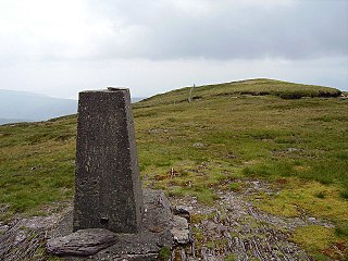
Arderin is a mountain on the border between Laois and Offaly in Ireland. With a height of 527 metres (1,729 ft) it is the highest point in the Slieve Bloom Mountains, and is both the highest point in County Laois and County Offaly.


