There are hundreds of peaks to be found on this peninsula, many of them unnamed. Much of the peninsula's coastline is encircled by mountains, and apart from the two large river valleys of the River Inny and river Ferta, most of the peninsula's land area is hilly or mountainous. As one travels from the sea in the west inland to the east, the terrain tends to become progressively more steep and mountainous, with the highest peaks being found far inland, close to the MacGillycuddy's Reeks. The highest mountain is Stumpa Dúloigh (784 m high), with the second tallest peak being Mullaghanattin (Mullach an Aitinn), 773 m high. Some of the more notable peaks include, from east to west: Boughil (Buachaill Finnleitheid), 639 m; Knocklomena (Cnoc an Mheannáin), 641 m; Broaghnabinnia (Bruach na Binne), 745 m; Knocknagantee, 676 m; Knockmoyle, 684 m; Meenteog, 715 m; Coomacarrea (An Tráigh), 772 m; Teermoyle Mountain, 760 m; Drung Hill, 640 m; Knocknadobar (Cnoc na dTobar), 690 m; and Coomcallee, 650 m.
Panoramic view from Stumpa Dúloigh across the peninsula.
MacGillycuddy's Reeks is a sandstone and siltstone mountain range in the Iveragh Peninsula in County Kerry, Ireland. Stretching 19 kilometres, from the Gap of Dunloe in the east, to Glencar in the west, the Reeks is Ireland's highest mountain range, and includes most of the highest peaks and sharpest ridges in Ireland, and the only peaks on the island over 1,000 metres in height.
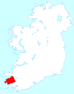
The Iveragh Peninsula is located in County Kerry in Ireland. It is the largest peninsula in southwestern Ireland. A mountain range, the MacGillycuddy's Reeks, lies in the centre of the peninsula. Carrauntoohil, its highest mountain, is also the highest peak in Ireland.
Carrauntoohil or Carrauntoohill is the highest mountain on the island of Ireland at 1,038.6 metres. It is on the Iveragh Peninsula in the Reeks District in County Kerry, close to the centre of Ireland's highest mountain range, MacGillycuddy's Reeks. Carrauntoohil is composed mainly of sandstone, whose glaciation produced distinctive features on the mountain such as the Eagle's Nest corrie and some deep gullies and sharp arêtes in its east and northeastern faces that are popular with rock and winter climbers.
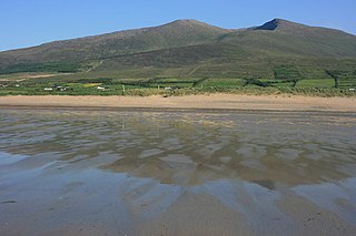
Mount Brandon or Brandon, at 952 metres (3,123 ft), is one of the ten highest peaks in Ireland, being the 8th–highest peak in Ireland on the Arderin list, and the 9th–highest on the Vandeleur-Lynam list. Brandon is the highest Irish mountain outside the MacGillycuddy's Reeks range and has the greatest prominence of any Irish peak except Carrauntoohil, Ireland's highest mountain.
Galtymore or Galteemore, is a mountain in the province of Munster, Ireland. At 917.9 metres (3,011 ft), it is one of Ireland's highest mountains, being the 12th-highest on the Arderin list, and 14th-highest on the Vandeleur-Lynam list. Galtymore has the 4th-highest topographic prominence of any peak in Ireland, which classifies Galtymore as a P600, or "major mountain". It is also one of the 13 Irish Munros.
The Gap of Dunloe, also recorded as Bearna an Choimín, is a narrow mountain pass running north-south in County Kerry, Ireland, that separates the MacGillycuddy's Reeks mountain range in the west, from the Purple Mountain Group range in the east. It is one of Kerry's most popular tourist destinations due to its scenery.
The Mountains of the Central Dingle Peninsula are the generic name given to the mountains that lie on the Dingle Peninsula between the Brandon Group of mountains in the west, and the Slieve Mish Mountains at the eastern end of the peninsula.
Slieve Mish Mountains, is a predominantly sandstone mountain range at the eastern end of the Dingle Peninsula in County Kerry, Ireland. Stretching 19 kilometres, from the first major peak of Barnanageehy outside of Tralee in the east, to Cnoc na Stuaice in near Central Dingle in the west, the range has over 17 material peaks, with the core of the mountain range based around the massif of its highest peak, Baurtregaum, and its deep glacial valleys of Derrymore Glen and Curraheen Glen.
Cnoc na Péiste, anglicised Knocknapeasta, at 988 metres (3,241 ft), is the fourth-highest peak in Ireland, on the Arderin and Vandeleur-Lynam lists. Cnoc na Péiste is part of the MacGillycuddy's Reeks range in County Kerry. It is one of only two 3,000 ft peaks in the Reeks with a prominence above the Marilyn threshold of 150 metres, and is the highest summit of the Eastern Reeks. In 1943, a USAAF plane crashed into the mountain, killing all five crew, and parts of the wreckage can still be seen in Lough Cummeenapeasta.
Knocknadobar at 690 metres (2,260 ft), is the 102nd–highest peak in Ireland on the Arderin scale, and the 123rd–highest peak in Ireland according to the Vandeleur-Lynam scale. Knocknadobar is one of the main mountains of the Iveragh Peninsula in County Kerry, Ireland, and has been one of the most important sites of pilgrimage in Ireland since medieval times.
Caher or Caher East Top at 1,000 metres (3,300 ft), is the third-highest peak in Ireland, on the Irish Arderin and Vandeleur-Lynam classifications. It is part of the MacGillycuddy's Reeks in County Kerry.
The Big Gun, at 939 metres (3,081 ft) high, is the ninth-highest peak in Ireland on the Arderin list, or the tenth-highest according to the Vandeleur-Lynam list. It is part of the MacGillycuddy's Reeks in County Kerry, and is also known as Lackagarrin or Foilnabreachaun.
Caher West Top at 973.4 metres (3,194 ft), is the fifth-highest peak in Ireland on the Irish Vandeleur-Lynam classification, and part of the MacGillycuddy's Reeks range. Caher West Top is the only Furth to have a prominence below 30 metres (98 ft).
Maolán Buí, also known by the name Bearna Rua, at 973 metres (3,192 ft) high, is the fifth-highest peak in Ireland on the Arderin list, or the sixth-highest peak in Ireland according to the Vandeleur-Lynam list. Maolán Buí is also known for its narrow north-west spur, called The Bone. It is part of the MacGillycuddy's Reeks in Kerry.
The Bones, at 957 metres (3,140 ft) high, is the seventh-highest peak in Ireland on the Arderin list, or the eighth-highest according to the Vandeleur-Lynam list. It is part of the MacGillycuddy's Reeks in County Kerry, and is a small sharp peak on the dramatic Beenkeragh Ridge, and is sometimes mistaken with The Bone, the north-east spur of Maolán Buí, which descends into the Hag's Glen.
Cnoc an Chuillinn, at 958 metres (3,143 ft), is the sixth-highest peak in Ireland on the Arderin list and the seventh-highest peak in Ireland on the Vandeleur-Lynam list. The name is sometimes incorrectly anglicised to Knockacullion, which is a name used for peaks and townlands in other parts of Ireland. Cnoc an Chuillinn is part of the MacGillycuddy's Reeks range in County Kerry.
Cruach Mhór, at 932 metres (3,058 ft) high, is the tenth-highest peak in Ireland on the Arderin list, and the eleventh-highest peak in Ireland according to the Vandeleur-Lynam list. A distinctive square grotto marks the summit. It is part of the MacGillycuddy's Reeks in County Kerry.
Brassel Mountain at 575 metres (1,886 ft), is the 261-st highest peak in Ireland, on the Arderin scale. It is part of the MacGillycuddy's Reeks range in County Kerry. Brassel Mountain is the south-east spur of the larger neighbouring peaks, Cnoc an Chuillinn 958 metres (3,143 ft), and Cnoc an Chuillinn East Top 926 metres (3,038 ft). Because of its positioning away from the main ridge of the Reeks, and away from the glens used to access the Reeks, Brassel is less frequently climbed, but can be used as an exit, or entry point to the main ridge.
Lough Acoose is a freshwater lake in the southwest of Ireland. It is located on the Iveragh Peninsula of County Kerry near the MacGillycuddy's Reeks mountains.
Cnoc na Toinne, at 845 metres (2,772 ft), is the 17th-highest peak in Ireland on the Arderin list, and the 23rd-highest peak in Ireland on the Vandeleur-Lynam list. It is part of the MacGillycuddy's Reeks range in County Kerry. Cnoc na Toinne lies between the Coomloughra Reeks and the Eastern Reeks, and is just above the col of the Devil's Ladder, a popular route for climbing Carrauntoohil, Ireland's highest mountain.
This page is based on this Wikipedia article Text is available under the CC BY-SA 4.0 license; additional terms may apply. Images, videos and audio are available under their respective licenses.