BBC Radio Derby is the BBC Local Radio station for the English county of Derbyshire, covering all but the northern tip of the county, and also serves eastern Staffordshire, mainly Uttoxeter and Burton upon Trent. The station broadcasts from its studios in Derby on 104.5, 95.3 and 96.0 (Buxton) FM and 1116 AM. It also transmits its programmes over the internet, and, as of 23 July 2014, broadcasts on DAB Digital Radio on the NOW Derbyshire DAB Multiplex.

BBC Radio Lancashire is the BBC Local Radio service for the county of Lancashire, in North West England. It began as BBC Radio Blackburn on 26 January 1971 on 96.4FM, then adding 854 kHz AM in 1972 and changing to its current name on 4 July 1981. It broadcasts from studios in Blackburn on 95.5, 103.9, 104.5 (Lancaster) FM and 855, 1557 AM, DAB, Freeview channel 720 and RealPlayer via the website.

hit105 is a commercial FM radio station broadcasting in Brisbane, Queensland, Australia, on a frequency of 105.3 MHz, and is part of Southern Cross Austereo's Hit Network. The station was previously branded as B105 following its conversion from AM to FM. This lasted until a co-branding as "Hit 105.3 B105", then as "Hit B105" and finally dropped the "B" reference to its present brand identity "hit105". The B had referred to Brisbane.
WUNC is the flagship National Public Radio member station for the Research Triangle area of North Carolina, broadcasting on the FM band at 91.5 MHz. Based in Chapel Hill and operated by the University of North Carolina at Chapel Hill, it airs NPR, American Public Media, Public Radio International, and BBC programming in an "all-news-and-information" format. On the weekends, the network broadcasts locally produced folk music programming; the longest-running continuously produced program offered by the station is Back Porch Music, a weekly folk and traditional music program.

Penobscot Knob, also Penobscot Mountain, is a summit located in the western fringe of the Poconos nearest to Mountain Top, Pennsylvania which in the Solomon Gap pass below it lies an important multi-modal transportation corridor. At one time before incorporation, Mountain Top and the saddle of the pass was known by the Amerindian name Penobscot. Penobscot Mountain forms part of the drainage divide between the Lehigh Valley & greater Delaware River drainage basin and the Wyoming and Susquehanna Valley, part of the Potomac River drainage basin. The pass formed between Penobscot and Haystack Mountain a few thousand feet to the West was one of the few places a railroad could be envisioned in the 1830s when the fuel crises in eastern cities demanded easier transportation to the Northern Anthracite Coal Fields, which ironically, came to be exploited by the company with a near monopoly in providing coal from the Southern Anthracite region, Lehigh Coal & Navigation Company, which had built both the Lehigh Canal, but also the nation's second railway, the Summit Hill & Mauch Chunk Railroad. The whole uplands north and west faces over look the Wyoming Valley from the southeastern corner near Hazleton towards and through the greater south Wilkes-Barre area. The southern and eastern slopes just give peeks into portions of the Poconos and wider views of the Lehigh Valley descending down to White Haven, for the Poconos technically are left-bank bounded by the Lehigh.

KUER-FM is a public radio station in Salt Lake City, Utah. Owned by the University of Utah, its studios are located in the Eccles Broadcast Center on the University of Utah campus, while its transmitter is located on Farnsworth Peak, after relocating from Mount Vision in the Oquirrh Mountains in 2011.

2RN is the trading name of RTÉ Transmission Network Ltd, a wholly owned subsidiary of Raidió Teilifís Éireann, formerly trading as RTÉNL, which runs Ireland's principal digital terrestrial television and radio broadcast networks. In December 2002 it became an incorporated company and subsidiary of RTÉ, it was previously a division within RTÉ. It operates 12 main TV and radio transmitter sites and many smaller relays and transposers, which carry television and/or radio. It also provides site hosting for mobile telephone operators, the emergency services, wireless broadband and other private mobile communications service providers.

Kippure is a granite mountain that straddles the county boundary from its peak in Wicklow into South Dublin. It is popular for hill walking and outdoor leisure activity owing to its proximity to Dublin city, with its fine views over Dublin Bay towards Howth Head. It has convenient access and easy terrain. At 757 metres, it is the 73rd highest in Ireland.

WRTP is a radio station broadcasting a Christian contemporary format. Licensed to Franklinton, North Carolina, United States, it serves the Raleigh/Durham area. The station is currently owned by Radio Training Network, with studios on Falls of Neuse Road in north Raleigh. Its transmitter is located near Warrenton.

Mullaghanish is a 649 m high mountain in the Derrynasaggart range, located just northeast of Ballyvourney in County Cork, Ireland.
KABX-FM is an adult contemporary formatted radio station in Merced, California. KABX is owned and operated by Mapleton Communications LLC. Its studios are in Merced and its transmitter is southwest of Mount Bullion. KABX can be heard in large areas of central California from approximately Modesto, to south of Fresno. It sometimes can be heard as far north as the Eastern portions of the Bay Area.
WMIT is a non-profit FM radio station licensed to Black Mountain, North Carolina. WMIT is a listener-supported ministry of the Billy Graham Evangelistic Association. It airs a mix of Contemporary Christian music with some Christian talk and teaching programs, including national religious leaders Jim Daly, John MacArthur, David Jeremiah, Chuck Swindoll and Charles Stanley. Studios and offices are on Porters Cove Road in Asheville. WMIT's tower rises 180 feet (55 m) above 6,557-foot (1,999 m) Clingman's Peak.

The Derrynasaggart Mountains are a mountain range in counties Cork and Kerry, Ireland. They are situated from mid-Cork to Kerry, and can be seen on the N22 road in the Kerry direction. They are also viewable from towns like Clondrohid, Macroom and Ballyvourney

West Mountain is a mountain in Utah, United States that is located 15.35 miles (25 km) southwest of the city of Provo, and 4.7 miles (8 km) west of the community of Benjamin. It is home to a radio station tower for KTCE, an FM station licensed to Payson and operating on 92.1 MHz. The mountain is also home to various FM radio translators and an observatory used by students from Brigham Young University (BYU). It can be accessed from a main road that starts near Benjamin. A small census designated place east of the mountain is known as West Mountain as well.

Humpy Peak is a peak located in the Uinta Mountain Range in northern Utah. It is approximately 27.56 miles (44 km) south of Evanston, Wyoming and 21.29 miles (34 km) east of Coalville, Utah. The summit has an elevation of 10,875 feet (3,315 m).

The Maghera transmission site is situated on a 400m high mountain located in the north of County Clare, Ireland. It is home to one of 2RN's network of radio and television transmitters.

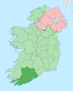
Divis transmitting station is the main high-power UHF and BBC National FM/DAB station that serves County Antrim and parts of County Down.
Spur Hill transmitter
This broadcast transmission site is located to the south of the city of Cork, Ireland, just north west of Cork airport, it has a cable-stayed mast 60m tall on an elevation of 137m ASL. The transmitter was initially opened in 1965 as a VHF relay of the main Mullaghanish television transmitter in County Cork. Later, FM radio transmitters were also added providing a relay of the national radio channels, and more recently, digital radio broadcasting (DAB) was started from the site. On its conversion to UHF television transmission in 1996, it became the main transmitter serving Cork city, carrying the four Irish analogue channels, RTÉ One (Ch53), RTÉ Two (Ch57), TV3 (Ch60), and TG4 (Ch63) at an effective radiated power of 20 kW. On 24 October 2012 all analogue television transmission ended in Ireland, and the station now provides the Irish DTT service Saorview to Cork city and environs. It is owned and operated by 2RN, a subsidiary of the Irish national broadcaster RTÉ.
Due to the difficult terrain of Cork City, and the lack of a single high point with citywide coverage, Cork City is home to a number of transmitters that cover the city.