
In these lists of mountains in Ireland, those within Northern Ireland, or on the Republic of Ireland – United Kingdom border, are marked with an asterisk, while the rest are within the Republic of Ireland. Where mountains are ranked by height, the definition of the topographical prominence used to classify the mountain, is noted. In British definitions, a height of 600 metres (1,969 ft) is required for a mountain, whereas in Ireland, a lower threshold of 500 metres (1,640 ft) is sometimes advocated.

Slieve Donard is the highest mountain in Northern Ireland and the wider province of Ulster, with a height of 850 metres (2,790 ft). The highest of the Mourne Mountains, it is near the town of Newcastle on the eastern coast of County Down, overlooking the Irish Sea. It is also the highest mountain in the northern half of Ireland, and 7th highest on the island.

Galtymore or Galteemore, is a mountain in the province of Munster, Ireland. At 917.9 metres (3,011 ft), it is one of Ireland's highest mountains, being the 12th-highest on the Arderin list, and 14th-highest on the Vandeleur-Lynam list. Galtymore has the 4th-highest topographic prominence of any peak in Ireland, which classifies Galtymore as a P600, or "major mountain". It is also one of the 13 Irish Munros.

Scotland is the most mountainous country in the United Kingdom. Scotland's mountain ranges can be divided, in a roughly north to south direction, into: the Scottish Highlands and the Central Belt and Southern Uplands in the Scottish Lowlands. The highlands contains the country's main mountain ranges, but many hills and mountains are to be found south of these as well. The highlands includes Britain's loftiest peaks, the Munros, the highest being Ben Nevis at 1,344.53 m. The below lists are not exhaustive; there are countless subranges throughout the country.

The mountains and hills of the British Isles are categorised into various lists based on different combinations of elevation, prominence, and other criteria such as isolation. These lists are used for peak bagging, whereby hillwalkers attempt to reach all the summits on a given list, the oldest being the 282 Munros in Scotland, created in 1891.

Mount Leinster is a 794-metre-high (2,605 ft) mountain in the Republic of Ireland. It straddles the border between Counties Carlow and Wexford, in the province of Leinster. It is the fifth-highest mountain in Leinster after Lugnaquilla 925 metres (3,035 ft), Mullaghcleevaun 849 metres (2,785 ft), Tonelagee 817 metres (2,680 ft), and Cloghernagh 800 metres (2,600 ft), and the highest of the Blackstairs Mountains. A 2RN transmission site tops the peak with a mast height of 122 metres (400 ft).

Knockmealdown is the highest peak of the Knockmealdown Range of mountains, located on the border between Co Tipperary and Co Waterford.
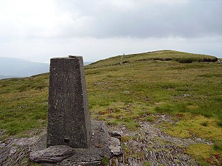
Knockboy is a 706-metre-high mountain on the border between counties Cork and Kerry in Ireland.

Barrclashcame is a 772 m (2,533 ft) mountain in County Mayo, Ireland.

Fauscoum, also known as Kilclooney Mountain, is a mountain in County Waterford, Ireland. It is the highest mountain of the Comeragh Mountain Range and the second highest mountain in County Waterford after Knockmealdown.
Keeper Hill or Slievekimalta is a mountain with a height of 694 metres (2,277 ft) in the Silvermine Mountains of County Tipperary, Ireland. Traditionally, it was deemed to be part of the Slieve Felim Mountains.

Cupidstown Hill, at 379 metres (1,243 ft), is the highest point in County Kildare, Ireland, and lies on the fringes of the Wicklow Mountains, 11.6 kilometres (7.2 mi) east of Naas.

Arderin is a mountain on the border between Laois and Offaly in Ireland. With a height of 527 metres (1,729 ft) it is the highest point in the Slieve Bloom Mountains, and is both the highest point in County Laois and County Offaly.

Beenoskee or Benoskee is a 826 m (2,710 ft) mountain on the Dingle Peninsula in Kerry, Ireland.


